
Optimal selection method for territorial sea base points

A base point, territorial sea technology, applied in the field of marine surveying and mapping, can solve problems such as low work efficiency

Active Publication Date: 2020-04-14
PLA DALIAN NAVAL ACADEMY
View PDF7 Cites 0 Cited by
  • Summary
  • Abstract
  • Description
  • Claims
  • Application Information

AI Technical Summary

Problems solved by technology

[0005] In order to solve the problem of low working efficiency of the traditional base point selection method, the present invention provides a method for optimal selection of territorial sea base points

Method used


Image

  • Optimal selection method for territorial sea base points
  • Optimal selection method for territorial sea base points
  • Optimal selection method for territorial sea base points

Examples


Embodiment Construction

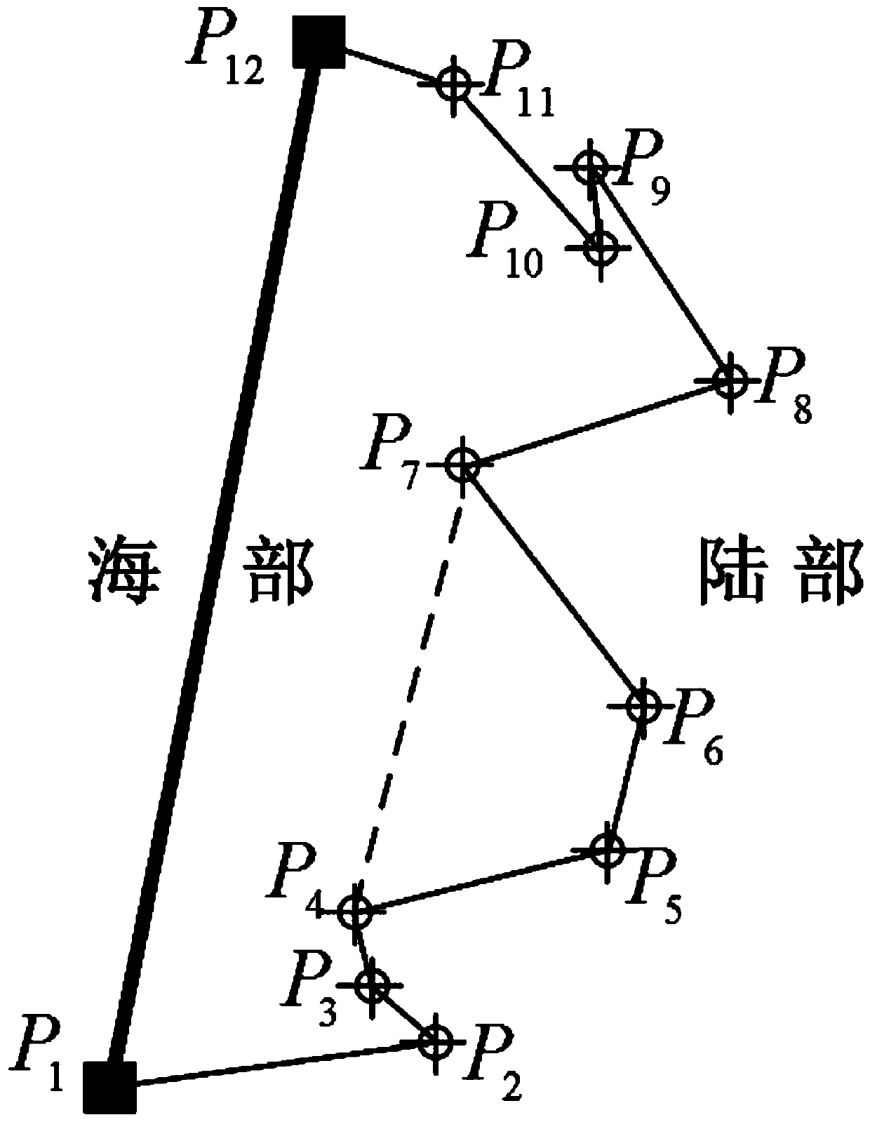
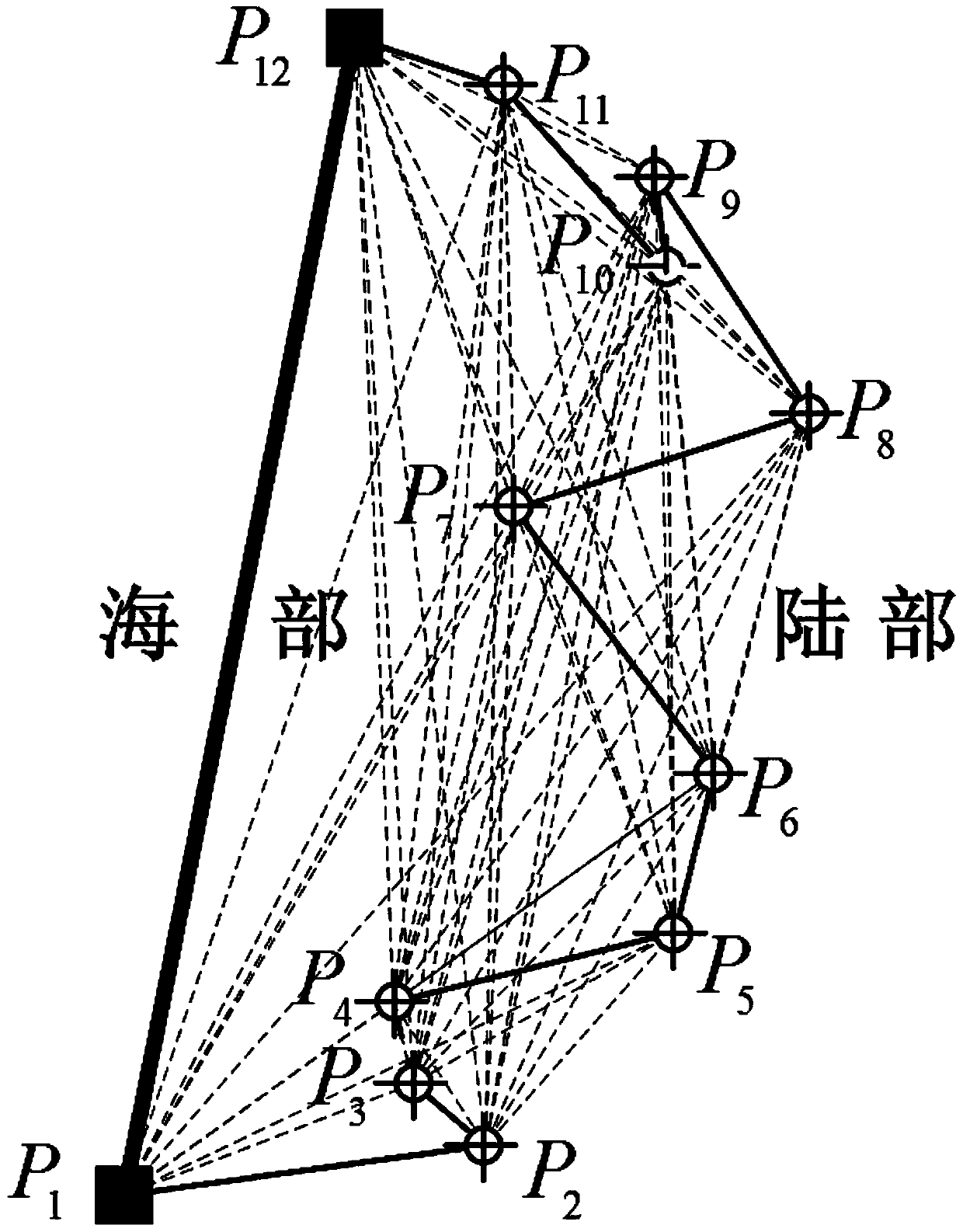
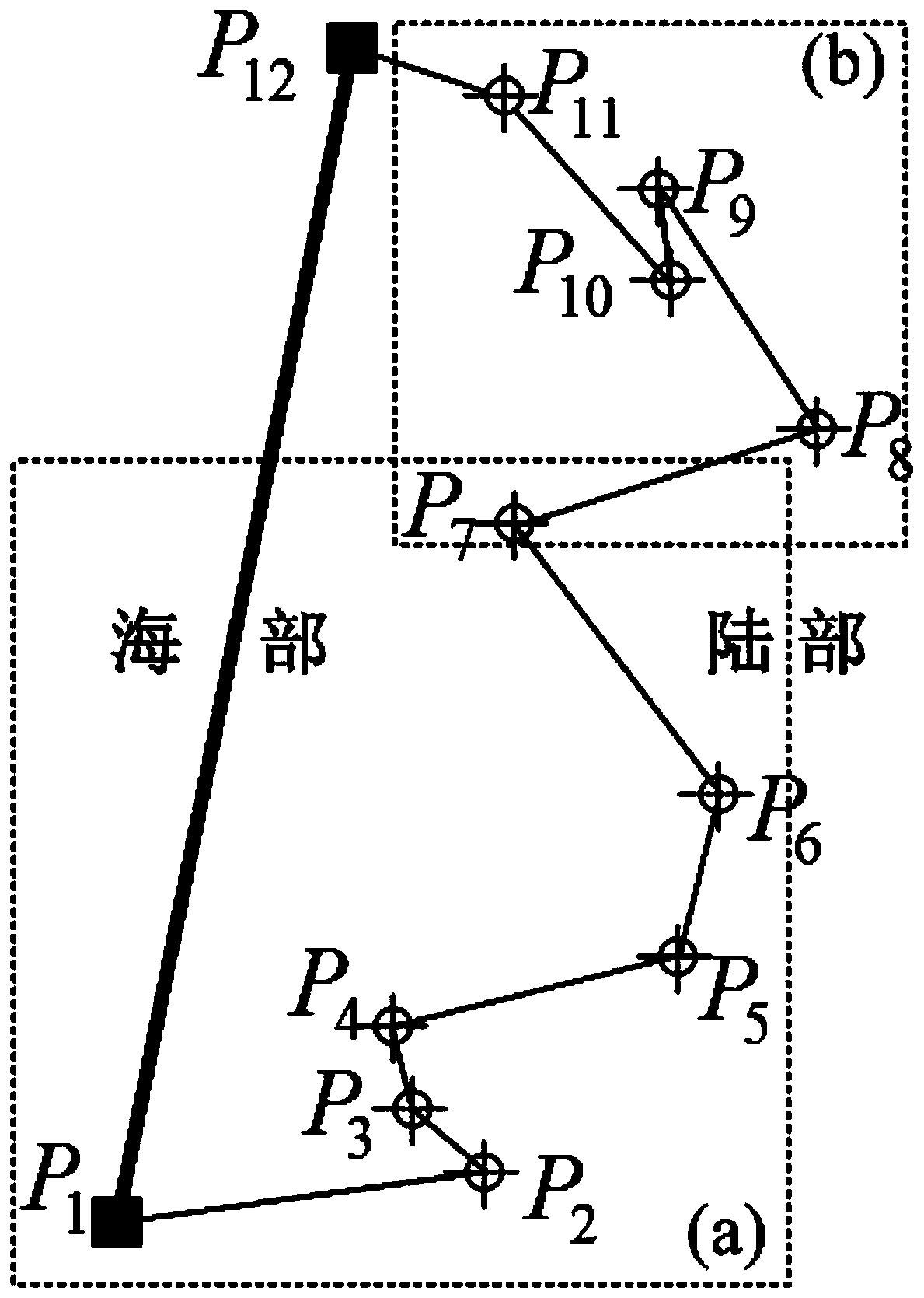
[0071] The method for optimally selecting territorial sea base points of the present invention has a process such as figure 1 As shown, first, by constructing the initial baseline map and the best possible baseline map in sequence, a large number of unreasonable candidate base point combinations are eliminated; then the "depth-first" search and area comparison strategy are used to obtain the optimal baseline path. 》The prescribed baseline is optimized and adjusted to determine the optimal base point selection plan.

[0072] Include the following definitions: figure 2 Shown, P 1 , P 2 ……P 11 , P 12 Is an ordered set of candidate base points, where: P 1 , P 12 Ideal base point determined by using convex hull construction technology; P 2 ……P 11 For P 1 And P 12 Alternative basis points between::

[0073] Such as figure 2 Shown, P 1 , P 2 ……P 11 , P 12 Is a set of ordered candidate base points, where P 1 , P 12 To adopt the ideal base point determined by convex hull construction tech...


PUM


Abstract

An optimal selection method for territorial sea base points comprises the following steps: firstly, taking two ideal base points as starting and ending points, connecting the ideal base points and allalternative base points between the ideal base points in different forms to form an alternative base line set, filtering out alternative base lines of which the lengths exceed a specified threshold value and which are not within a base line graph polygon, and constructing an initial base line graph; secondly, performing optimization judgment on the associated edge of each node in the initial baseline graph, filtering out the associated edge and the adjacent point of which the baseline polygon area cannot be minimum, and generating a possible optimal adjacent point set; and finally, searchingthe possible optimal baseline graph to obtain a possible optimal baseline path set, performing area calculation on a corresponding baseline polygon, and selecting an alternative base point combinationwith the smallest baseline polygon area to generate an optimal baseline path. According to the method, the problem of combined explosion possibly occurring when the alternative base points are inserted in the unreasonable baseline adjustment process is solved, and the base point optimization working efficiency is improved.

Description

Technical field [0001] The invention relates to the technical field of marine surveying and mapping. Background technique [0002] The territorial sea baseline is the starting line of the territorial sea, contiguous zone, exclusive economic zone, continental shelf, and outer continental shelf of coastal countries. It is the basis for maritime delimitation. Its determination methods mainly include normal baseline method, straight baseline method or a combination of the two baselines. law. Among them, the straight baseline is a broken line connected by a series of ordered territorial water base points (referred to as base points). Different schemes for the selection of base points in the territorial sea, that is, the number of base points selected and their spatial distribution of points, determine the difference in the composition of straight baselines and have an important impact on the results of maritime delimitation. Therefore, how to determine a reasonable base point of the...

Claims


Application Information

Patent Timeline
IPC IPC(8): G01C7/00
CPCG01C7/00
Inventor 董箭彭认灿李彬彬贾帅东张立华
Owner PLA DALIAN NAVAL ACADEMY
Learn More