Riverway type reservoir underwater terrain modeling method independent of measured data
A technology of underwater topography and reservoirs, applied in the field of hydrogeomorphology, can solve problems such as difficult to support large-scale global-scale research, limit the application of missing data areas, etc., and achieve the effect of simple implementation and good applicability
- Summary
- Abstract
- Description
- Claims
- Application Information
AI Technical Summary
Problems solved by technology
Method used
Image

Examples
Embodiment Construction
[0044] The specific embodiments of the present invention will be described in further detail below in conjunction with the drawings and embodiments. The following examples are used to illustrate the present invention, but not to limit the scope of the present invention.
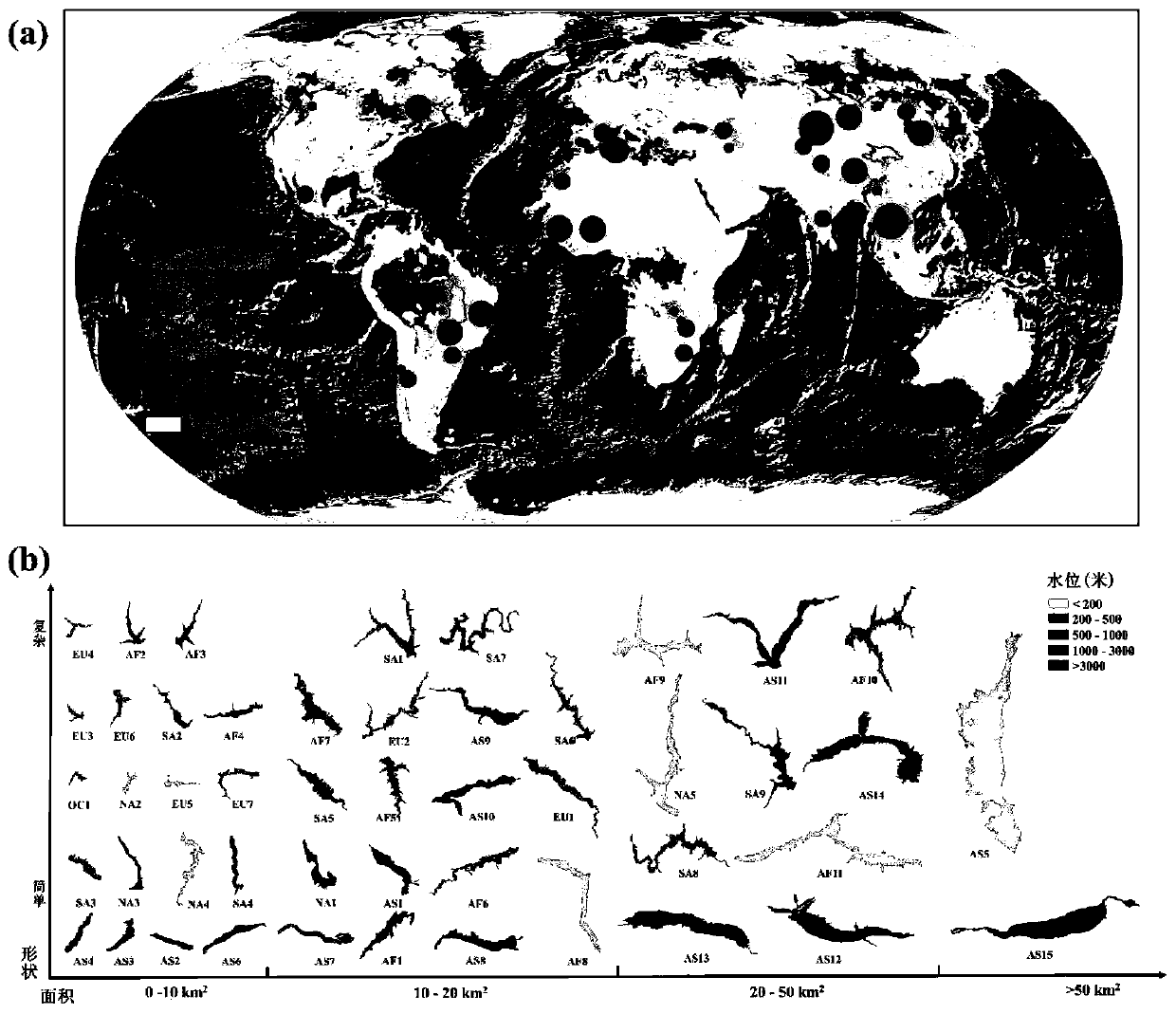
[0045] In the embodiment of this application, 48 reservoirs newly built after 2000 are randomly selected globally. The underwater topographic information of these reservoirs can be recorded by SRTMDEM data collected in February 2000, which is convenient for verification of algorithm accuracy. Such as figure 1 As shown, the selected reservoirs are distributed on all continents in the world, and their area, morphological complexity, and topography around the reservoir all show obvious differences and representativeness.
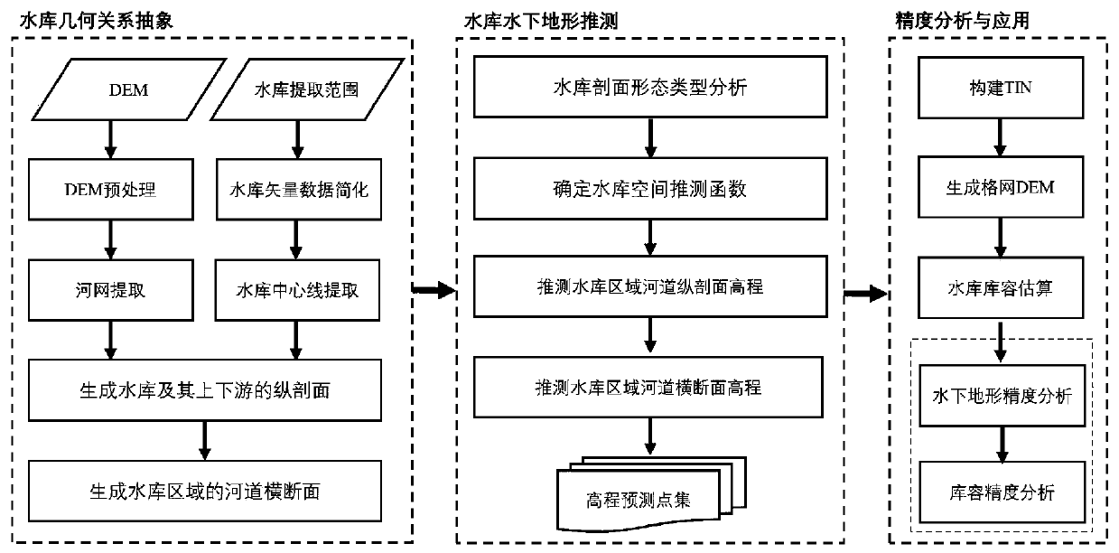
[0046] Such as figure 2 Shown is a flowchart of the embodiment, and this embodiment includes the following steps:
[0047] Step 1. Extract the runoff network and the centerline of the reservoir. T...
PUM
 Abstract
Description
Claims
Application Information
 - R&D Engineer
- R&D Manager
- IP Professional
- Industry Leading Data Capabilities
- Powerful AI technology
- Patent DNA Extraction
Browse by: Latest US Patents, China's latest patents, Technical Efficacy Thesaurus, Application Domain, Technology Topic.
© 2024 PatSnap. All rights reserved.Legal|Privacy policy|Modern Slavery Act Transparency Statement|Sitemap