

Map area determination method and device, equipment and storage medium
A technology for determining methods and regions, applied in the field of image processing, can solve the problems of multi-time, unable to guarantee the accuracy of drawing, and low accuracy.
- Summary
- Abstract
- Description
- Claims
- Application Information
AI Technical Summary
Problems solved by technology
Method used
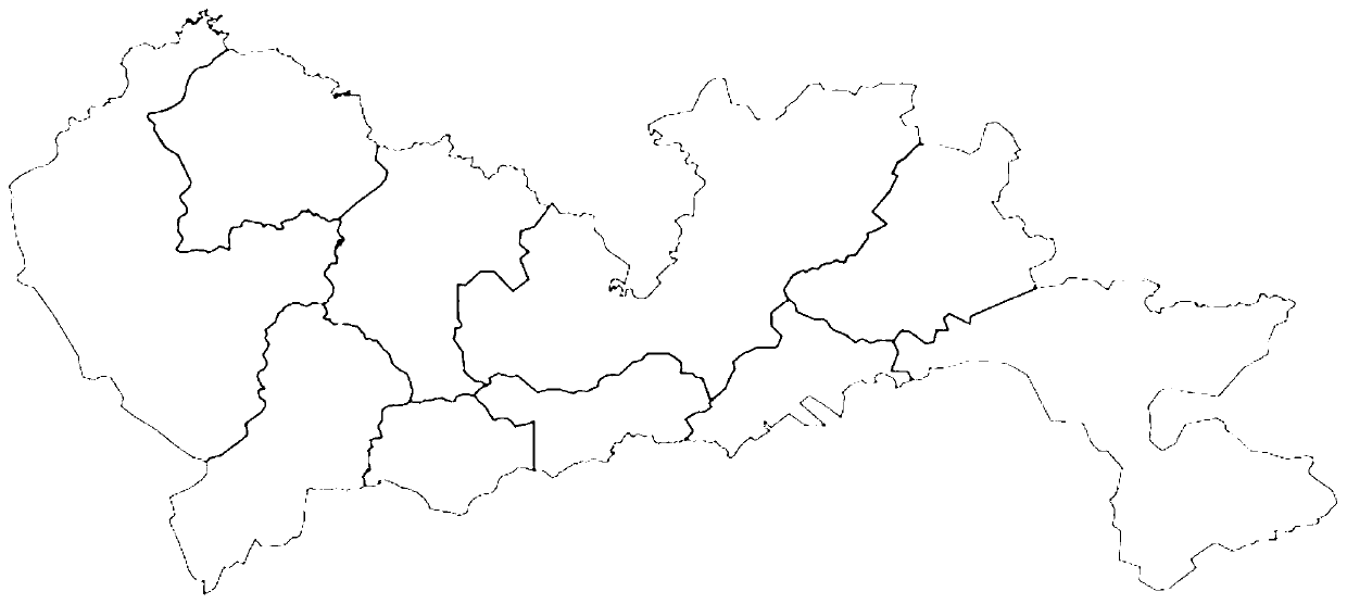
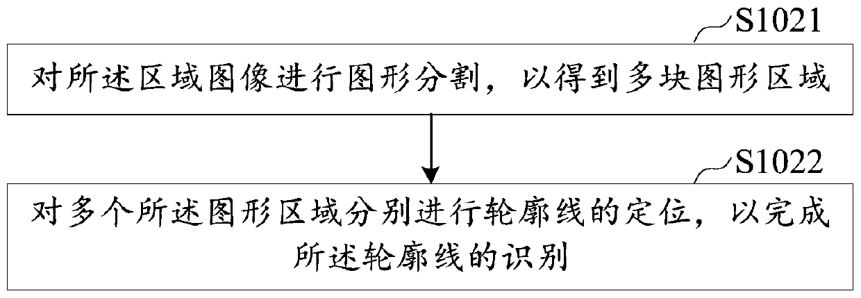
Image


Examples
Embodiment Construction
[0029] The following will clearly and completely describe the technical solutions in the embodiments of the present application with reference to the drawings in the embodiments of the present application. Obviously, the described embodiments are part of the embodiments of the present application, not all of them. Based on the embodiments in this application, all other embodiments obtained by persons of ordinary skill in the art without making creative efforts belong to the scope of protection of this application.
[0030] The flow charts shown in the drawings are just illustrations, and do not necessarily include all contents and operations / steps, nor must they be performed in the order described. For example, some operations / steps can be decomposed, combined or partly combined, so the actual order of execution may be changed according to the actual situation.
[0031] It should be understood that the terms used in the specification of this application are for the purpose of ...
PUM
 Abstract
Description
Claims
Application Information