Ship coordinate correction method, system and device based on AIS and storage medium
A technology of ships and coordinates, applied in ship traffic control, traffic control systems, instruments, etc., can solve unfavorable maritime management and other problems, and achieve an effect that is beneficial to maritime management
- Summary
- Abstract
- Description
- Claims
- Application Information
AI Technical Summary
Problems solved by technology
Method used
Image
Examples
Embodiment Construction
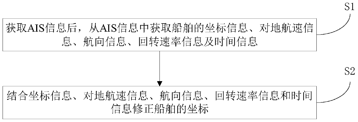
[0042] like figure 1 As shown, the present embodiment provides a method for correcting ship coordinates based on AIS, comprising the following steps:
[0043] S1. After obtaining the AIS information, obtain the ship's coordinate information, speed over ground information, heading information, slew rate information and time information from the AIS information;
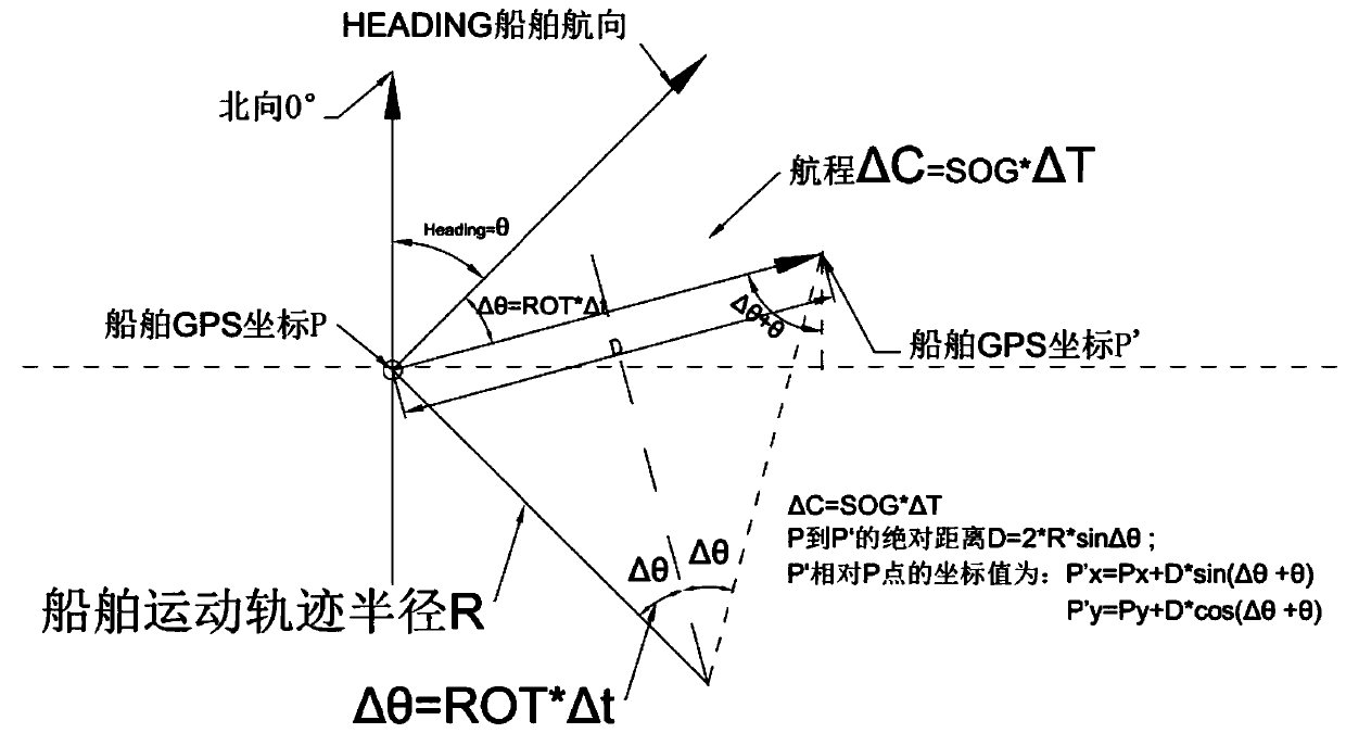
[0044] The AIS information is sent by the AIS equipment on the ship, and the AIS information specifically includes information such as the ship's identification code, ship name, position, course, ship speed, time, tonnage, etc. Therefore, the coordinate information of the ship can be obtained from the AIS information , Ground speed information, heading information, slew rate information and time information. The coordinate information is the position cheating information at the moment when the AIS equipment on the ship sends the AIS information, and the coordinate information can be satellite positioning coordinate in...
PUM
 Abstract
Description
Claims
Application Information
 - R&D
- Intellectual Property
- Life Sciences
- Materials
- Tech Scout
- Unparalleled Data Quality
- Higher Quality Content
- 60% Fewer Hallucinations
Browse by: Latest US Patents, China's latest patents, Technical Efficacy Thesaurus, Application Domain, Technology Topic, Popular Technical Reports.
© 2025 PatSnap. All rights reserved.Legal|Privacy policy|Modern Slavery Act Transparency Statement|Sitemap|About US| Contact US: help@patsnap.com


