Map road data storage method and device and positioning point matching method and device

A technology of road data and map data, applied in the field of maps, can solve the problems of inability to know the overall road latitude and longitude, inaccurate matching results, and long delay in positioning matching, so as to reduce the amount of data downloads, reduce the deviation of matching results, and improve the accuracy. Effect

Active Publication Date: 2020-08-04
ALIBABA GRP HLDG LTD
View PDF5 Cites 5 Cited by
  • Summary
  • Abstract
  • Description
  • Claims
  • Application Information

AI Technical Summary

Problems solved by technology

On the one hand, the downloaded data volume of all the tile data of the entire road is relatively large, and the download speed is slow, resulting in a relatively long delay in positioning matching; on the other hand, if all the tiles of the entire road are not downloaded, it cannot Knowing the latitude and longitude of the overall road and other data will further lead to inability to match positioning or inaccurate matching results

Method used


Image

  • Map road data storage method and device and positioning point matching method and device
  • Map road data storage method and device and positioning point matching method and device
  • Map road data storage method and device and positioning point matching method and device

Examples


Embodiment 1

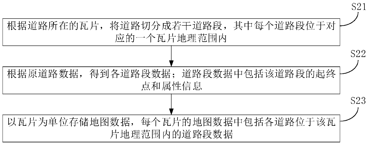
[0070] Embodiment 1 of the present invention provides a method for storing map road data, the process of which is as follows figure 2 shown, including the following steps:

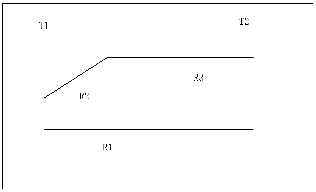
[0071] Step S21: According to the tile where the road is located, divide the road into several road segments; wherein each road segment is located within the geographical range of a corresponding tile.

[0072] When a road is located in more than one tile geographic range, the road is divided according to the tile geographic range spanned by the road, and the road is divided into several road segments. Each divided road segment will no longer span multiple The geographic range of the tile, but only within the geographic range of a tile, so that when performing road matching, the road data of the tile can be obtained according to the tile where the anchor point is located to perform positioning matching.

[0073] When a road is only within the geographical range of one tile, it can be regarded as a specia...

Embodiment 2

[0106] A positioning point matching method provided in Embodiment 2 of the present invention, the process of which is as follows Image 6 shown, including the following steps:

[0107] Step S61: Determine the current tile where the anchor point is located.

[0108] The current location of the user or the vehicle can be obtained from a global positioning system (Global Positioning System, GPS), and a preliminary positioning point can be obtained. At this time, the obtained positioning point may deviate from the road. For example, the user is walking on the road, but the actually acquired current location is at a building next to the road. For another example, the vehicle is driving on the road, but the actually obtained current position is on the isolation belt, green belt, etc. near the road. In addition, other methods may also be used to obtain the current location of the user or the vehicle to obtain a preliminary positioning point.

[0109] After obtaining the anchor poi...


PUM


Abstract

The invention discloses a map road data storage method and device and a positioning point matching method and device. The method comprises the steps: cutting a road into a plurality of road sections according to tiles where the road is located, wherein each road section is located in a corresponding tile geographic range; according to the original road data of the road, obtaining data of each roadsection, wherein the road section data comprises starting and ending points and attribute information of the road section; storing map data by taking tiles as units, wherein the map data of each tilecomprises road segment data of each road in the geographical range of the tile. According to the invention, the organization and storage granularity of the road data can be finer, the data downloading amount in the application process is reduced, and the operation delay caused by data downloading is reduced.

Description

technical field [0001] The present invention relates to the technical field of maps, in particular to a method and device for storing map road data, and a method and device for matching positioning points. Background technique [0002] At present, the storage and downloading of map data is usually in the form of grid-divided tiles. When it is necessary to store and download map data, it can be stored and downloaded in units of tiles. When a road in the map is relatively long, it may span multiple different tiles. Therefore, to obtain the complete data of a road, it is necessary to download and query the data of multiple tiles, which causes great inconvenience to the reading and updating of road data. [0003] Map matching is a positioning technology commonly used in positioning and navigation. It improves the positioning effect by matching positioning points to candidate roads. In the prior art, when matching an anchor point to a candidate road, it is generally necessary t...

Claims


Application Information

Patent Timeline
Patent Type & Authority Applications(China)
IPC IPC(8): G06F16/29G01C21/30
CPCG01C21/30
Inventor 夏双荣
Owner ALIBABA GRP HLDG LTD
Why Eureka
Try Eureka