Karst region territorial space development suitability evaluation method and system
A technology of space development and evaluation method, which is applied in the field of land space planning, can solve problems such as unclear logic, emphasis on nature from a single perspective, and weak interpretation of element interaction, so as to achieve the effect of precise landing
- Summary
- Abstract
- Description
- Claims
- Application Information
AI Technical Summary
Problems solved by technology
Method used
Image
Examples
Embodiment 1
[0038] Embodiment 1 of the present invention proposes a method for evaluating the suitability of national land space development in karst areas, including:
[0039] (1) Establishment of indicator system
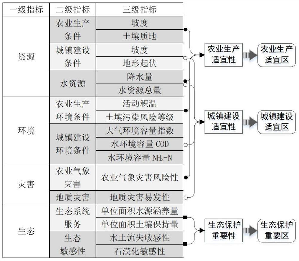
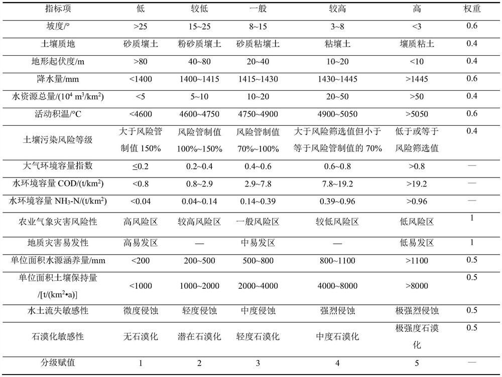
[0040] Such as figure 1 As shown, according to the resource development conditions, environmental capacity, ecosystem service capacity and the degree of impact on land construction and development in karst areas, an evaluation index system for land space development suitability in karst areas is established; among them, the first-level indicators include: resources, environment, disasters and Ecology; each first-level indicator includes multiple second-level indicators, among which resources include: agricultural production conditions, urban construction conditions and water resources; environment includes: agricultural production environmental conditions and urban construction environmental conditions; disasters include: agricultural meteorological disasters and Geological ...
PUM
 Abstract
Description
Claims
Application Information
 - R&D
- Intellectual Property
- Life Sciences
- Materials
- Tech Scout
- Unparalleled Data Quality
- Higher Quality Content
- 60% Fewer Hallucinations
Browse by: Latest US Patents, China's latest patents, Technical Efficacy Thesaurus, Application Domain, Technology Topic, Popular Technical Reports.
© 2025 PatSnap. All rights reserved.Legal|Privacy policy|Modern Slavery Act Transparency Statement|Sitemap|About US| Contact US: help@patsnap.com


