
High-rise building settlement monitoring result three-dimensional positioning method based on high-resolution INSAR

A high-resolution, settlement monitoring technology, applied in the directions of height/horizontal measurement, measuring devices, surveying and navigation, etc., can solve the problems of top-bottom inversion, failure to reflect the advantages of high-resolution SAR monitoring settlement results, and affect the three-dimensional information of high-rise buildings Expression and other problems to achieve the effect of solving geometric distortion

Active Publication Date: 2021-01-29
北京四象爱数科技有限公司
View PDF10 Cites 4 Cited by
  • Summary
  • Abstract
  • Description
  • Claims
  • Application Information

AI Technical Summary

Problems solved by technology

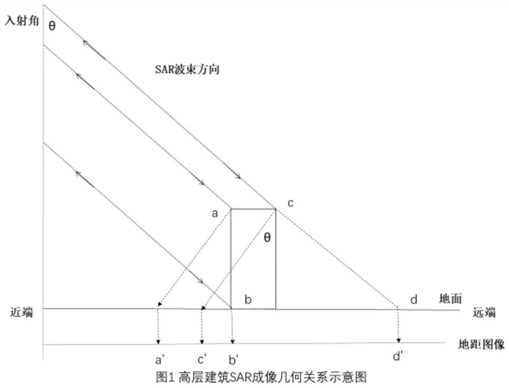
[0007] However, the PS point deformation monitoring results obtained by the commonly used INSAR deformation monitoring and processing software (such as SNAP, SARscape, GAMMA software, etc.) are all based on the two-dimensional plane. Geometry distortion such as bottom inversion not only affects the expression of 3D information of high-rise buildings in IDI, but also fails to reflect the advantages of high-resolution SAR monitoring settlement results

Method used

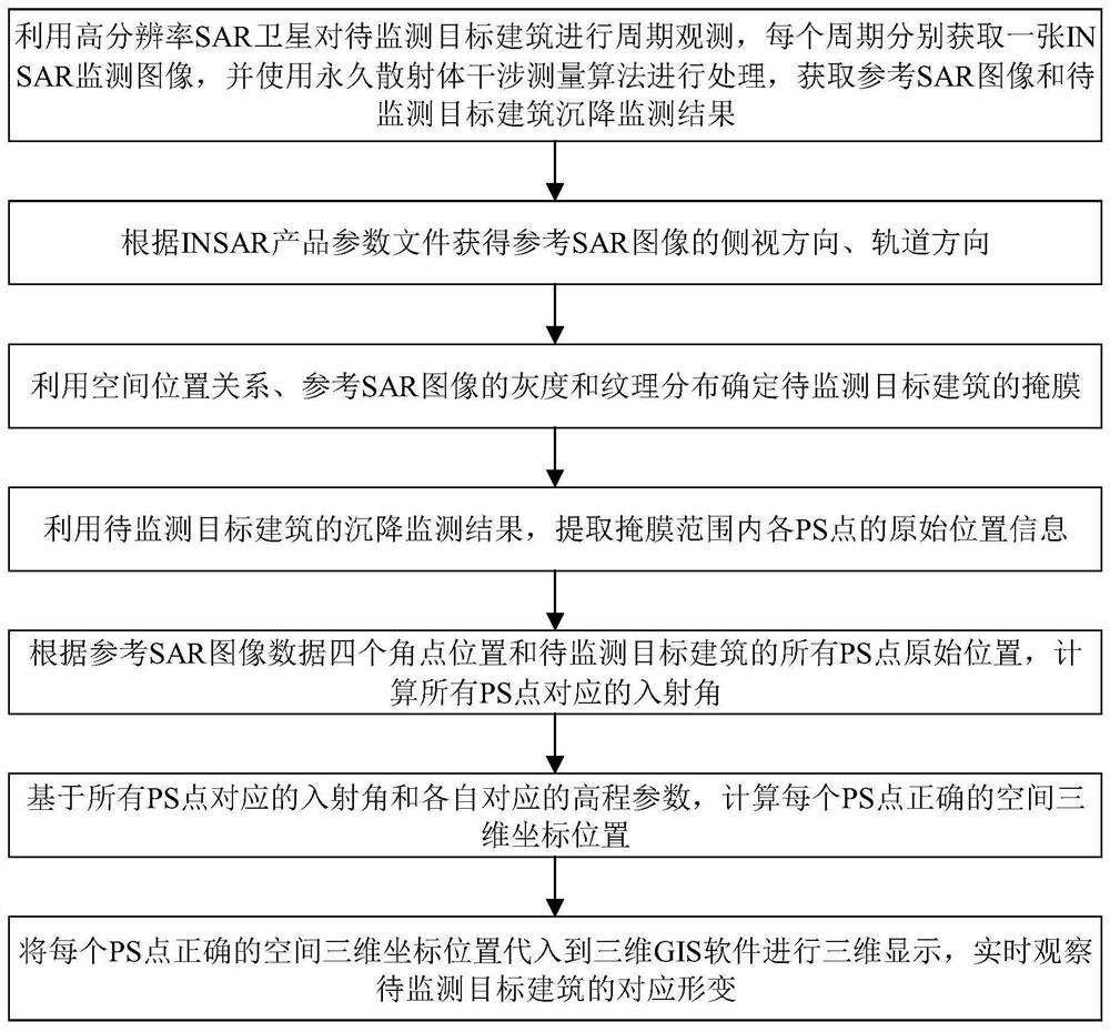

Image

  • High-rise building settlement monitoring result three-dimensional positioning method based on high-resolution INSAR
  • High-rise building settlement monitoring result three-dimensional positioning method based on high-resolution INSAR
  • High-rise building settlement monitoring result three-dimensional positioning method based on high-resolution INSAR

Examples


Embodiment

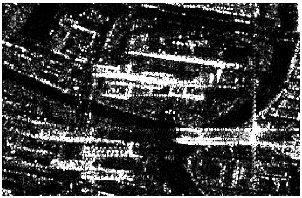
[0086] Taking the settlement monitoring results of urban high-rise buildings in Ningbo City, Zhejiang Province as an example, the three-dimensional positioning method based on the high-resolution INSAR settlement monitoring results provided by the present invention will be described below.

[0087] The settlement monitoring of urban high-rise buildings in Ningbo City, Zhejiang Province uses the German TerraSAR satellite data. The time span is from June 2016 to December 2017. The imaging mode is the right side view of the strip mode, the orbit is the orbit mode, and the spatial resolution is 3 meters, the central incident angle of the SAR radar wave is 37.26°. The 30-meter resolution SRTM DEM provided by NASA was used as the reference DEM in the data interferometry process. The permanent scatterer interferometry processing of the time series adopts the permanent scatterer interferometry method. After removing the topographic phase and flat phase of the interferogram, a high-coh...


PUM


Abstract

The invention discloses a high-rise building settlement monitoring result three-dimensional positioning method based on a high-resolution INSAR, and belongs to the technical field of INSAR data application processing and building safety monitoring. The method comprises the following steps: firstly, periodically observing a to-be-monitored target building by utilizing a high-resolution SAR satellite, respectively acquiring an SAR monitoring image in each period, acquiring a reference SAR image and a settlement monitoring result of the to-be-monitored target building, and further acquiring a side view direction and an orbit direction of the reference SAR image; secondly, determining a mask of the to-be-monitored target building by utilizing the spatial position relationship and referring tothe gray scale and texture distribution of the SAR image, extracting original position information of each PS point in the range of the mask, calculating incident angles corresponding to all PS points, and calculating a correct spatial three-dimensional coordinate position of each PS point in combination with respective corresponding elevation parameters; and finally, substituting the spatial three-dimensional coordinate position into three-dimensional GIS software, and observing a corresponding deformation result of the to-be-monitored target building in real time. According to the invention,the transformation of the deformation monitoring result from two dimensions to three dimensions is realized.

Description

technical field [0001] The invention belongs to the technical field of INSAR (Interferometry Synthetic Aperture Radar, Interferometric Synthetic Aperture Radar) data application processing and building safety monitoring, and specifically relates to a high-resolution INSAR-based three-dimensional positioning method for high-rise building settlement monitoring results. Background technique [0002] With the rapid development of economic construction and the rapid development of urban modernization, a large number of high-rise buildings have been newly built in large and medium cities. At present, housing construction is the most important property and life guarantee for individuals and families, and its quality and safety are related to the vital interests of the people. However, in recent years, building collapses have occurred frequently in various parts of our country, causing serious casualties and economic losses. In order to ensure the safety of the building, it is nece...

Claims


Application Information

Patent Timeline
IPC IPC(8): G01C5/00G01S13/90
CPCG01C5/00G01S13/9021G01S13/9041
Inventor 俞雷郗晓菲张薇姚勇航赵路明康曼
Owner 北京四象爱数科技有限公司
Learn More