Terrain prediction method and device of slope, radar, unmanned aerial vehicle and operation control method

A prediction method and technology of prediction device, applied in the field of unmanned aerial vehicles, can solve the problems of slow terrain following response, flight safety threats, etc.

Pending Publication Date: 2021-02-12
SZ DJI TECH CO LTD
View PDF5 Cites 3 Cited by
  • Summary
  • Abstract
  • Description
  • Claims
  • Application Information

AI Technical Summary

Problems solved by technology

[0003] However, by detecting the height difference between the UAV and the ground directly below, and then adjusting the flight height, this method is a kind of post-feedback, and the response of terrain following is slow. Security poses a huge threat

Method used


Image

  • Terrain prediction method and device of slope, radar, unmanned aerial vehicle and operation control method
  • Terrain prediction method and device of slope, radar, unmanned aerial vehicle and operation control method
  • Terrain prediction method and device of slope, radar, unmanned aerial vehicle and operation control method

Examples


Embodiment Construction

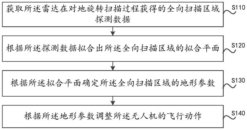
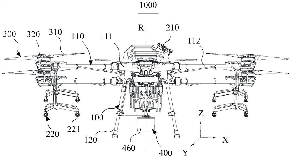
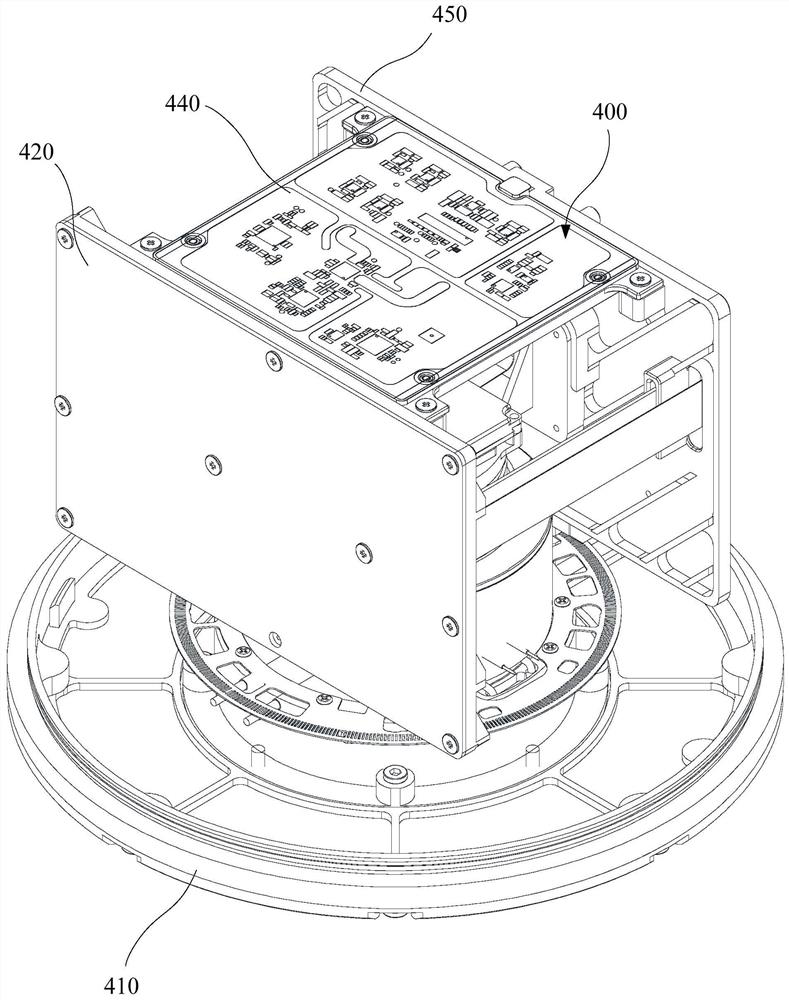
[0049] The following will clearly and completely describe the technical solutions in the embodiments of this specification with reference to the drawings in the embodiments of this specification. Obviously, the described embodiments are part of the embodiments of this specification, not all of them. Based on the embodiments in this specification, all other embodiments obtained by persons of ordinary skill in the art without creative efforts fall within the protection scope of this specification.

[0050] The flow charts shown in the drawings are just illustrations, and do not necessarily include all contents and operations / steps, nor must they be performed in the order described. For example, some operations / steps can be decomposed, combined or partly combined, so the actual order of execution may be changed according to the actual situation.

[0051] Some implementations of this specification will be described in detail below with reference to the accompanying drawings. In t...


PUM


Abstract

A terrain prediction method and device of a slope, a radar, an unmanned aerial vehicle and an operation control method are provided. The unmanned aerial vehicle is equipped with the radar. The methodincludes: acquiring the omnidirectional scanning area detection data obtained by the radar during the ground rotation scanning process (S110); fitting the fitting plane of the omnidirectional scanningarea according to the detection data (S120); determining the terrain parameters of the omnidirectional scanning area according to the fitting plane (S130); and adjusting the flight motion of the unmanned aerial vehicle according to the terrain parameters ( S140).

Description

technical field [0001] This description relates to the technical field of unmanned aerial vehicles, and in particular to a slope terrain prediction method, device, radar, unmanned aerial vehicle and operation control method. Background technique [0002] In some operation scenarios, drones need to fly over some uneven terrain, such as ground with slopes. For example, in the process of mountain operations, the UAV can detect the vertical distance relative to the ground directly below and maintain a certain height difference with the ground directly below, so as to realize ground-like flight such as terrain following. [0003] However, by detecting the height difference between the UAV and the ground directly below, and then adjusting the flight height, this method is a kind of post-feedback, and the response of terrain following is slow. Security poses a huge threat. Contents of the invention [0004] Based on this, this specification provides a slope terrain prediction m...

Claims


Application Information

Patent Timeline
Patent Type & Authority Applications(China)
IPC IPC(8): G05D1/10
CPCG05D1/101
Inventor 祝煌剑王春明胡文鑫
Owner SZ DJI TECH CO LTD
Why Eureka
Try Eureka