

Ground marking fusion method and system based on road structure, server and medium
A technology of road structure and fusion method, applied in the direction of map/plan/chart, instrument, character and pattern recognition, etc., can solve the problem of error, automatic driving vehicle entering the wrong lane, etc., and achieve the effect of good position accuracy
- Summary
- Abstract
- Description
- Claims
- Application Information
AI Technical Summary
Problems solved by technology
Method used
Image

Examples
Embodiment Construction
[0024] In order to make the object, technical solution and advantages of the present invention clearer, the present invention will be further described in detail below in conjunction with the accompanying drawings and embodiments. It should be understood that the specific embodiments described here are only used to explain the present invention, not to limit the present invention.
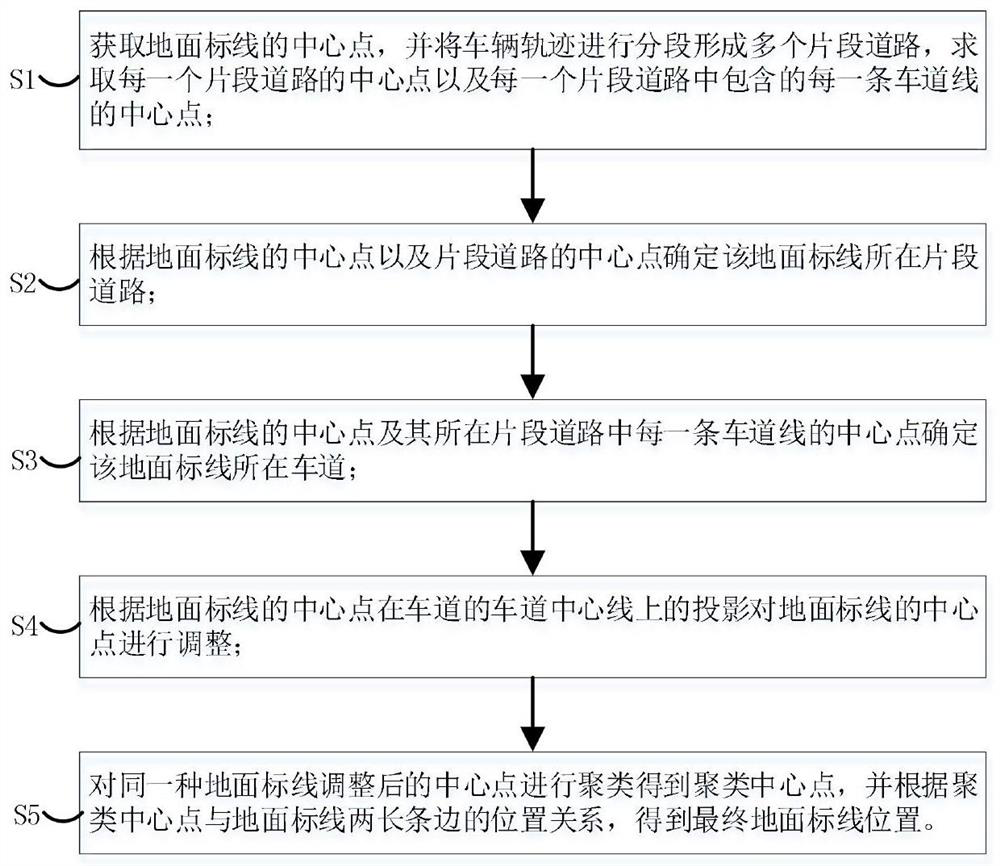
[0025] Such as figure 1 As shown, the embodiment of the present invention provides a kind of ground marking fusion method based on road structure, and it comprises the following steps:
[0026] S1. Obtain the center point of the ground marking, segment the vehicle trajectory into multiple segment roads, and obtain the center point of each segment road and the center point of each lane line included in each segment road.
[0027] Specifically, the collected ground marking data is a rectangular frame represented by four points. Let the four vertices be marked as A, B, C, and D. Assume that AB is the...
PUM
 Abstract
Description
Claims
Application Information