Geographic information data generation method and device, map presentation method and device, storage medium and computing equipment

A technology of geographic information data and geography, which is applied in the field of maps, can solve the problems of cumbersome representation of geographic information, and achieve the effects of fast data transmission, refined and simplified representation, and less storage space

Pending Publication Date: 2021-04-16
上海智感博士物联网有限公司
View PDF0 Cites 0 Cited by
  • Summary
  • Abstract
  • Description
  • Claims
  • Application Information

AI Technical Summary

Problems solved by technology

[0004] However, when using latitude and longitude to represent a specific space, at least four latitude and longitude coordinates are required to define a specific range, especially when expressing high-precision geographic information requires more latitude and longitude coordinate information, resulting in cumbersome representation of geographic information

Method used


Image

  • Geographic information data generation method and device, map presentation method and device, storage medium and computing equipment
  • Geographic information data generation method and device, map presentation method and device, storage medium and computing equipment
  • Geographic information data generation method and device, map presentation method and device, storage medium and computing equipment

Examples


Embodiment Construction

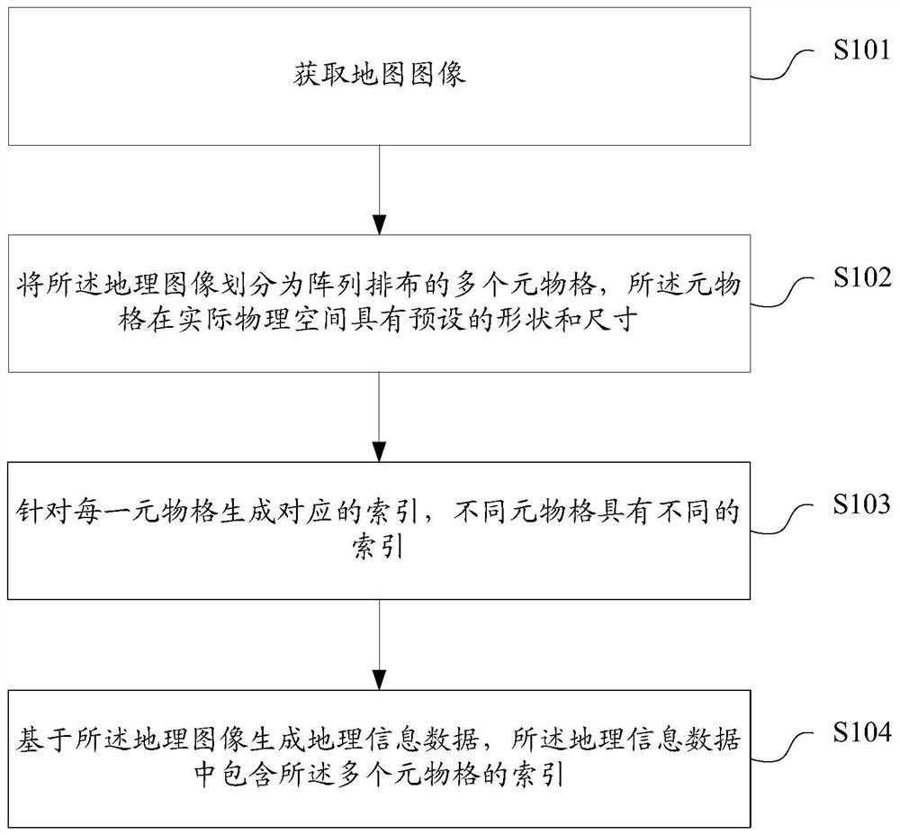
[0029] As mentioned in the background technology, when using latitude and longitude to represent a specific space in the prior art, at least four latitude and longitude coordinates are required to define a specific range, especially when expressing high-precision ground information requires more latitude and longitude coordinate information, This leads to cumbersome representation of geographic information.

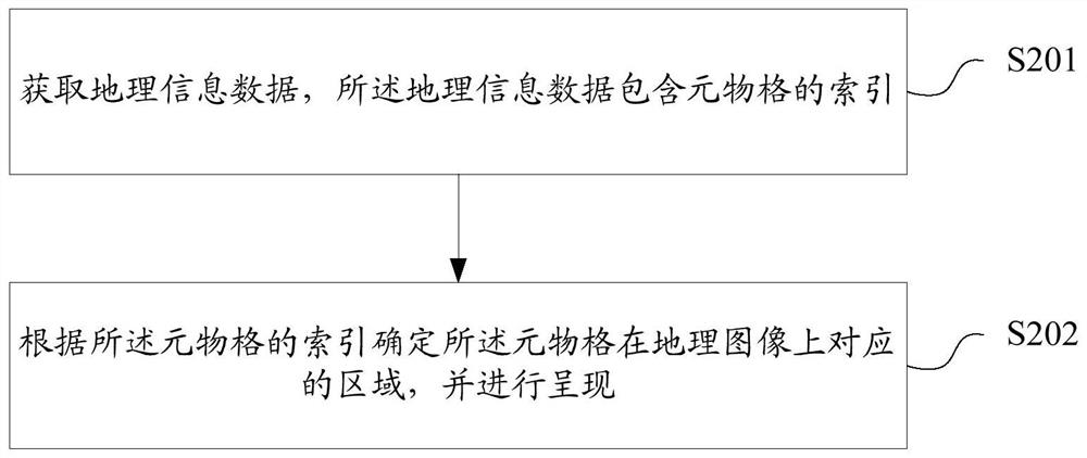
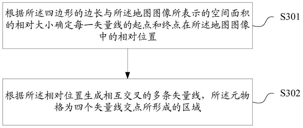
[0030] The technical solution of the present invention divides the geographical image according to the unit of the area with an absolute scale, so that the meta-grid obtained after the division can represent a specific area in the actual physical space; compared with the prior art that uses latitude and longitude coordinates to represent In the technical solution of the present invention, the use of meta-grids to represent specific areas can make the representation of specific areas more refined and simplified, and can easily represent higher-precision geographic data.

...


PUM


Abstract

The invention discloses a geographic information data generation method and device, a map presentation method and device, a storage medium and computing equipment. The geographic information data generation method comprises the steps of obtaining a geographic image; dividing the geographic image into a plurality of element grids arranged in an array, wherein the element grids have preset shapes and sizes in an actual physical space; generating a corresponding index for each meta-grid, wherein different meta-grids have different indexes; and generating geographic information data based on the geographic image, wherein the geographic information data comprises indexes of the plurality of meta-grids. According to the technical scheme, the convenience of geographic information representation can be improved.

Description

technical field [0001] The present invention relates to the field of map technology, in particular to a method and device for generating geographic information data, map presentation, a storage medium, and a computing device. Background technique [0002] In geographic information technology, latitude and longitude are the most commonly used representations for spatial positioning of geographic information. The combination of longitude and latitude forms a coordinate system, called a geographic coordinate system, which uses a three-dimensional spherical surface to A spherical coordinate system that defines space on Earth and that can indicate any location on Earth. Latitude and longitude are auxiliary lines assumed by humans for the convenience of measurement, and are defined as the trajectory formed by a point on the earth's surface as the earth rotates. Any one of the parallels is circular and parallel to each other. The length of the latitude is the cosine of the circum...

Claims


Application Information

Patent Timeline
Patent Type & Authority Applications(China)
IPC IPC(8): G06F16/29G06F16/22G09B29/00
Inventor 邵怡蕾
Owner 上海智感博士物联网有限公司
Why Eureka
Try Eureka