Auxiliary device capable of improving surveying and mapping precision of remote sensing image

An auxiliary device and remote sensing image technology, applied in the direction of camera devices, etc., can solve problems such as easy to be contaminated with dust, unclear pictures, and decreased shooting accuracy

Active Publication Date: 2021-05-07
WEIFANG ENG VOCATIONAL COLLEGE
View PDF14 Cites 5 Cited by
  • Summary
  • Abstract
  • Description
  • Claims
  • Application Information

AI Technical Summary

Problems solved by technology

[0003] When the existing UAVs carry cameras in the air, due to the fast air flow and wind speed, the dust mixed in the air flow is easy to contaminate the camera when it blows over the camera. After the camera continues to move in the air, especially the downward When moving, the camera lens is direct

Method used


Image

  • Auxiliary device capable of improving surveying and mapping precision of remote sensing image
  • Auxiliary device capable of improving surveying and mapping precision of remote sensing image
  • Auxiliary device capable of improving surveying and mapping precision of remote sensing image

Examples


Embodiment Construction

[0028] The technical solutions in the embodiments of the present invention will be clearly and completely described below in conjunction with the embodiments of the present invention. Apparently, the described embodiments are only some of the embodiments of the present invention, not all of them. Based on the embodiments of the present invention, all other embodiments obtained by persons of ordinary skill in the art without creative efforts fall within the protection scope of the present invention.

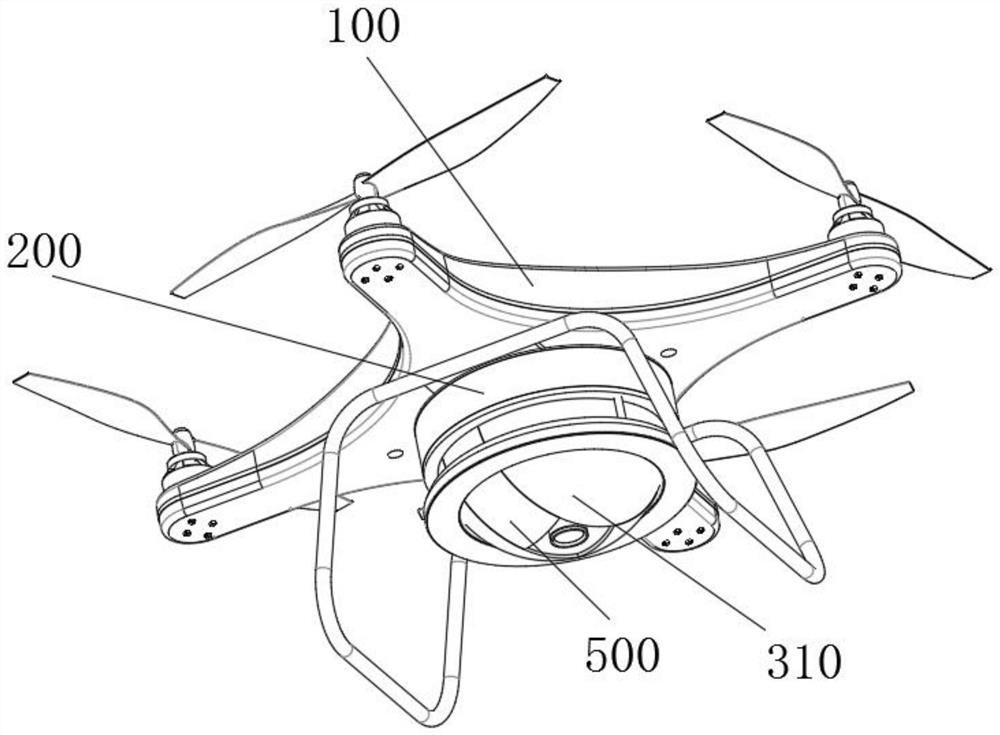
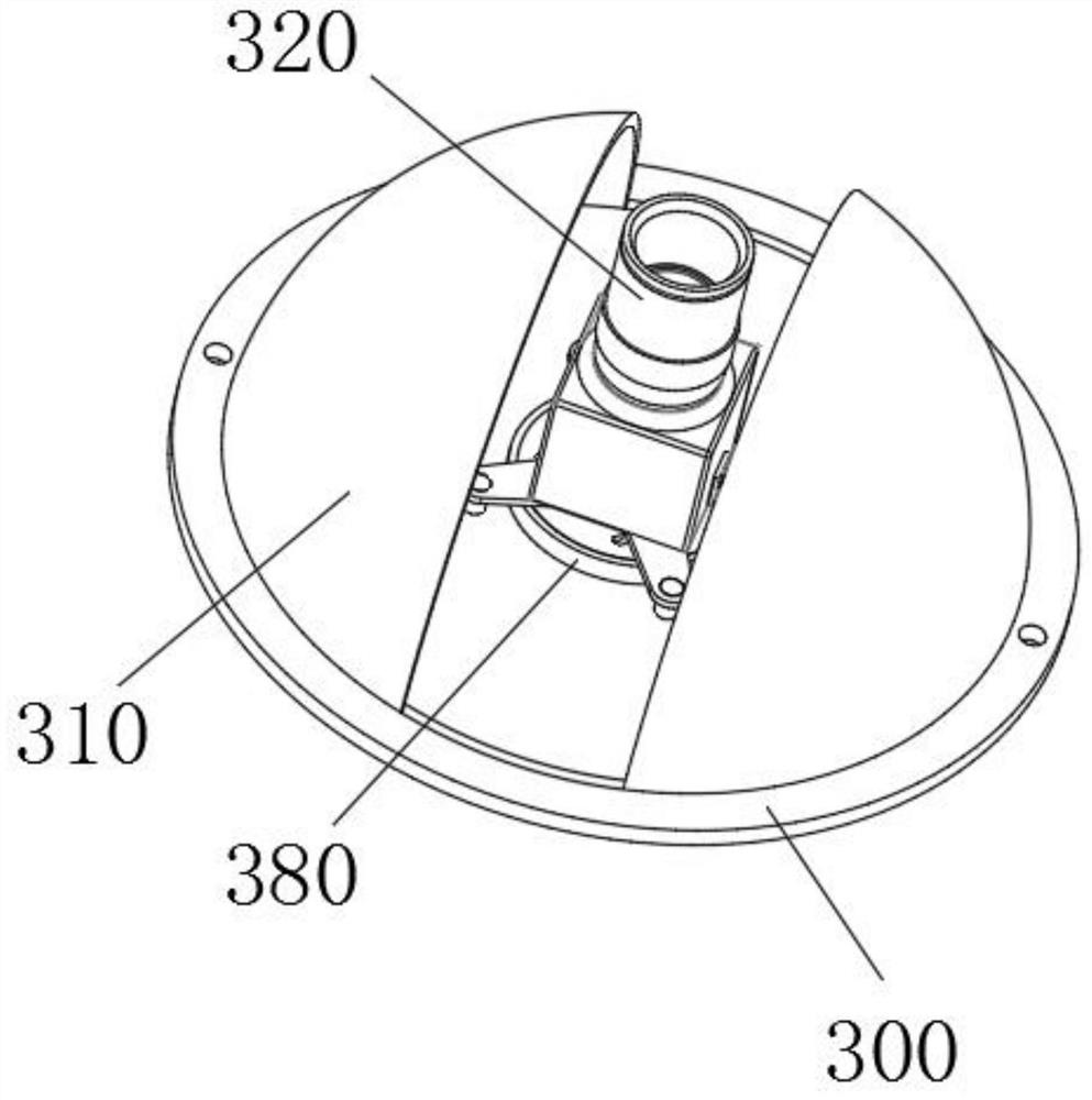
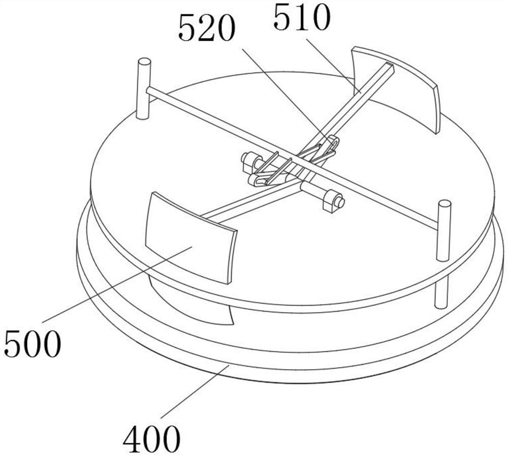
[0029] see Figure 1-7 As shown, an auxiliary device that can increase the accuracy of remote sensing image surveying and mapping includes an unmanned aerial vehicle 100, the bottom of the unmanned aerial vehicle 100 is fixedly connected with a fixed shell 200, the bottom of the fixed shell 200 is fixedly connected with a bottom plate 300, and the bottom surface of the bottom plate 300 is A surveying and mapping camera 320 is installed at the center of the base plate, which is con...


PUM


Abstract

The invention relates to the technical field of remote sensing surveying and mapping auxiliary devices, in particular to an auxiliary device capable of improving remote sensing image surveying and mapping precision, which comprises an unmanned aerial vehicle, the bottom end of the unmanned aerial vehicle is fixedly connected with a fixed shell, the bottom end of the fixed shell is fixedly connected with a bottom plate, and a surveying and mapping camera is mounted at the center of the bottom surface of the bottom plate. According to the unmanned aerial vehicle, through the arrangement of the bottom plate and the spherical shell, the spherical shell protects the surveying and mapping camera, the surveying and mapping camera is prevented from being blown by transverse airflow, dust is effectively prevented from entering the surveying and mapping camera, meanwhile, wind resistance is reduced, and the unmanned aerial vehicle can be conveniently kept stable in the air; and through arrangement of the two protective plates, an annular plate and a driving rod, when the unmanned aerial vehicle drives the surveying and mapping camera to descend, the two protection plates are automatically closed under wind pressure to shield the surveying and mapping camera and prevent dust from entering a lens of the surveying and mapping camera, and when the unmanned aerial vehicle hovers in the air to prepare for shooting, the two protection plates are automatically opened towards the two sides to expose the lens of the surveying and mapping camera, and shooting is convenient.

Description

technical field [0001] The invention relates to the technical field of auxiliary devices for remote sensing surveying and mapping, in particular to an auxiliary device capable of increasing the accuracy of remote sensing image surveying and mapping. Background technique [0002] Remote sensing mapping is a technology that uses various sensors and cameras on the ground, aviation, and aerospace platforms to draw topographic maps or other thematic maps on the ground surface. UAVs have greatly improved the efficiency of field topographic data collection, and real-world models directly display plots and attachments, making cadastral measurement and management more convenient. [0003] When the existing UAVs carry cameras in the air, due to the fast air flow and wind speed, the dust mixed in the air flow is easy to contaminate the camera when it blows over the camera. After the camera continues to move in the air, especially the downward When moving, the camera lens is directly i...

Claims


Application Information

Patent Timeline
IPC IPC(8): G01C11/02
CPCG01C11/02
Inventor 单晓丽王媛媛董明宇王翠李丽
Owner WEIFANG ENG VOCATIONAL COLLEGE
Why Eureka
Try Eureka