System and method for dynamically constructing regional natural disaster risk cloud atlas

A technology of risk cloud map and natural disasters, applied in the field of risk monitoring systems, can solve the problems of slow data speed, untimely, time-consuming and labor-intensive, etc., and achieve the effect of reducing huge losses and improving prevention and control capabilities.

Pending Publication Date: 2021-06-11
成都鼎安华智慧物联网股份有限公司
View PDF4 Cites 5 Cited by
  • Summary
  • Abstract
  • Description
  • Claims
  • Application Information

AI Technical Summary

Problems solved by technology

[0003] In order to grasp the risk distribution of natural disasters, the traditional method adopts artificial ground census, which is not only slow in obtaining data, but also time-consuming and laborious, and the census results obtained are single, untimely, and inaccurate

Method used


Image

  • System and method for dynamically constructing regional natural disaster risk cloud atlas
  • System and method for dynamically constructing regional natural disaster risk cloud atlas
  • System and method for dynamically constructing regional natural disaster risk cloud atlas

Examples


Embodiment Construction

[0025] The present invention will be further described below in conjunction with accompanying drawing:

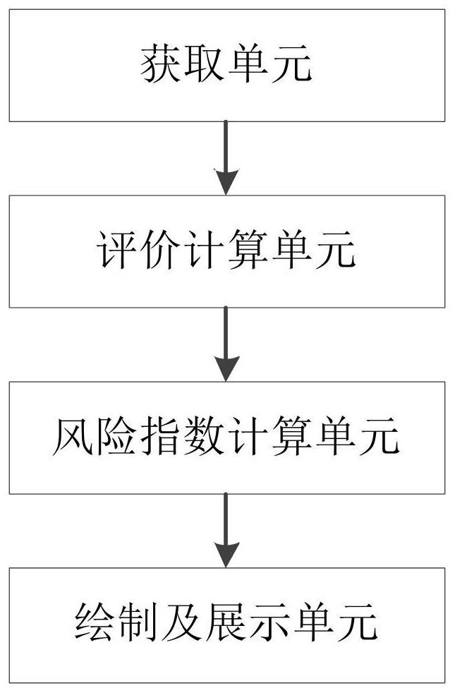
[0026] as attached figure 1 Shown, a kind of system of the present invention dynamically constructs regional natural disaster risk cloud map, comprises:

[0027] The acquisition unit is used to acquire the environmental data of the target area and standardize the data;

[0028] The evaluation calculation unit determines the evaluation indicators and impact factors according to the environmental data;

[0029] The risk index calculation unit is used to calculate the regional risk index according to the evaluation indicators and impact factors;

[0030] A drawing and display unit for drawing a risk cloud map based on the regional risk index;

[0031] The acquisition unit, evaluation calculation unit, risk index calculation unit, drawing and display unit are connected in sequence.

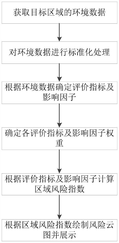
[0032] as attached figure 2 As shown, a method for dynamically constructing a regional na...


PUM


Abstract

The invention discloses a system and a method for dynamically constructing a regional natural disaster risk cloud picture. The method comprises the following steps: acquiring environmental data of a target region; performing standardization processing on the environment data; determining evaluation indexes and influence factors according to the environment data; determining each evaluation index and influence factor weight; calculating a regional risk index according to the evaluation index and the influence factor; and drawing and displaying a risk cloud picture according to the regional risk index. According to the invention, the original simple defense of natural disasters is changed into comprehensive management of risks, the prevention and control capability of the natural disasters is greatly improved, and the huge loss of the disasters to the country and people is reduced.

Description

technical field [0001] The invention relates to the technical field of risk monitoring systems, in particular to a system and method for dynamically constructing a regional natural disaster risk cloud map. Background technique [0002] my country's natural disasters present four characteristics: various types of disasters, wide distribution areas, high frequency of occurrence, and heavy losses, which affect social stability and economic and social development. How to improve comprehensive disaster risk assessment capabilities and natural disaster prevention and control capabilities, provide information-based decision-making support for disaster prevention, disaster reduction, and disaster relief, more comprehensively grasp disaster situations, and fully understand the natural dynamics of disasters. is very necessary. [0003] In order to understand the distribution of natural disaster risks, the traditional method uses manual ground census, which is not only slow in obtaini...

Claims


Application Information

Patent Timeline
Patent Type & Authority Applications(China)
IPC IPC(8): G06Q10/06G06Q50/26
CPCG06Q10/0635G06Q10/06393G06Q50/26
Inventor 罗超廖长明敬志坚庄永忠
Owner 成都鼎安华智慧物联网股份有限公司
Why Eureka
Try Eureka