

Digital earth model construction method and device
A digital earth and construction method technology, applied in 3D modeling, image data processing, instruments, etc., can solve problems such as difficulty in meeting the needs of digital earth, difficulty in expressing deep earth information, lack of models, etc.
- Summary
- Abstract
- Description
- Claims
- Application Information
AI Technical Summary
Problems solved by technology
Method used
Image

Examples
Embodiment Construction
[0047] In order to better understand the purpose, technical solution and technical effect of the present invention, the present invention will be further explained below in conjunction with the accompanying drawings and embodiments. At the same time, it is stated that the embodiments described below are only used to explain the present invention, and are not intended to limit the present invention.
[0048] An embodiment of the present invention provides a method for constructing a digital earth model.
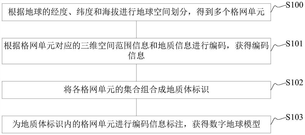
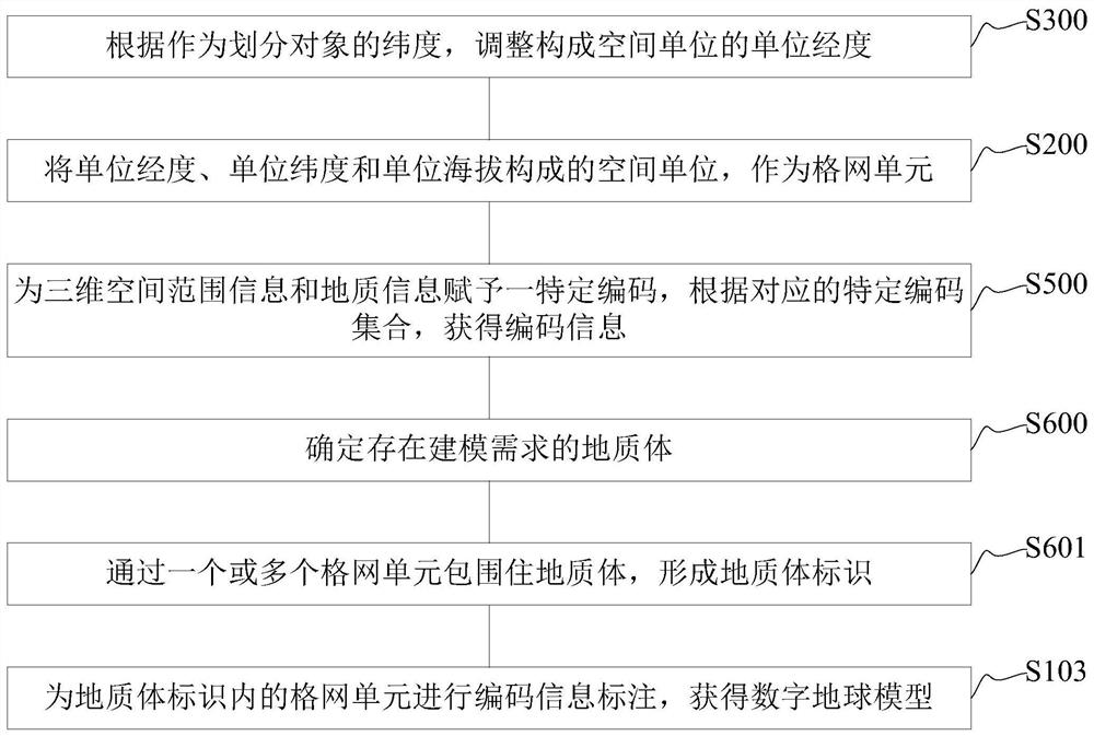
[0049] figure 1 It is a flowchart of a method for constructing a digital earth model in an embodiment, such as figure 1 As shown, a method for constructing a digital earth model in an embodiment includes steps S100 to S103:
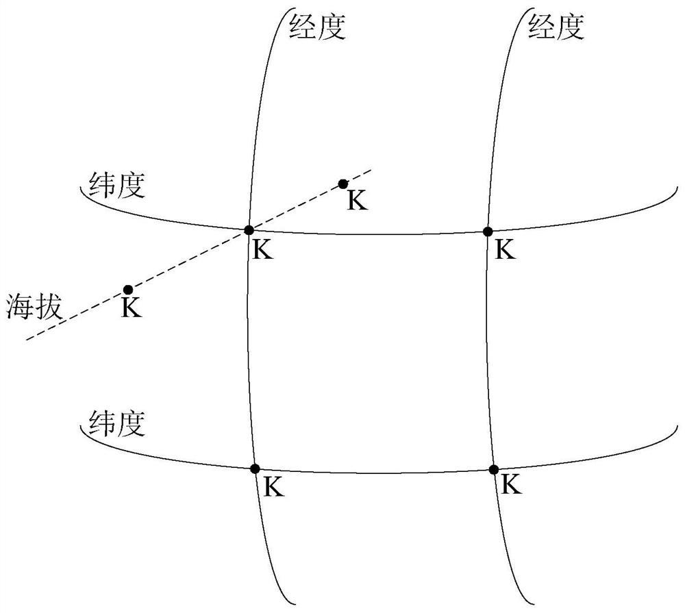
[0050]S100, dividing the earth space according to the longitude, latitude and altitude of the earth to obtain multiple grid units;
[0051] Among them, the space is divided according to the physical topological properties of the earth. Since the topol...
PUM
 Abstract
Description
Claims
Application Information