Real-time monitoring and information push method for multi-source satellite image data reception
A satellite image and information push technology, applied in still image data retrieval, still image data indexing, image communication, etc., can solve problems such as low degree of automation, inability to receive satellite images, time lag, and low efficiency
- Summary
- Abstract
- Description
- Claims
- Application Information
AI Technical Summary
Problems solved by technology
Method used
Image
Examples
Embodiment Construction
[0055] The specific implementation manner and working principle of the present invention will be further described in detail below in conjunction with the accompanying drawings.
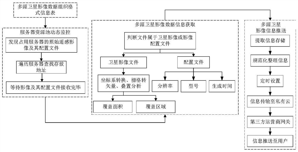
[0056] like figure 1 As shown, a multi-source satellite image data receiving real-time monitoring and information push method, the specific steps are as follows:
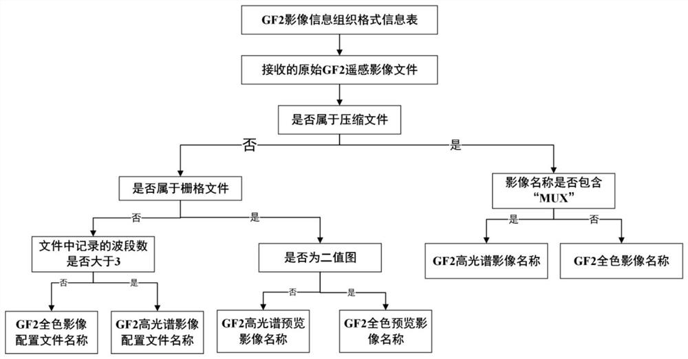
[0057] Step 1. According to the existing remote sensing satellite image data organization and storage format at home and abroad, establish a multi-source satellite image data organization format information table. The content of the information table mainly includes hyperspectral image name, hyperspectral image preview name, hyperspectral image configuration file name , panchromatic image name, panchromatic image preview name, panchromatic image profile name;
[0058] In this embodiment, the GF2 (Gaofen No. 2) image is taken as an example. The GF2 image includes hyperspectral and panchromatic image data. Each type of data includes an imag...
PUM
 Abstract
Description
Claims
Application Information
 - R&D
- Intellectual Property
- Life Sciences
- Materials
- Tech Scout
- Unparalleled Data Quality
- Higher Quality Content
- 60% Fewer Hallucinations
Browse by: Latest US Patents, China's latest patents, Technical Efficacy Thesaurus, Application Domain, Technology Topic, Popular Technical Reports.
© 2025 PatSnap. All rights reserved.Legal|Privacy policy|Modern Slavery Act Transparency Statement|Sitemap|About US| Contact US: help@patsnap.com


