Land information display system and method
A technology for displaying system and map information, applied in geographic information databases, image data processing, structured data retrieval, etc., and can solve problems such as low accuracy, insufficient samples, and time lag
- Summary
- Abstract
- Description
- Claims
- Application Information
AI Technical Summary
Problems solved by technology
Method used
Image
Examples
Embodiment Construction
[0066] The following is further described in detail through specific implementation methods:
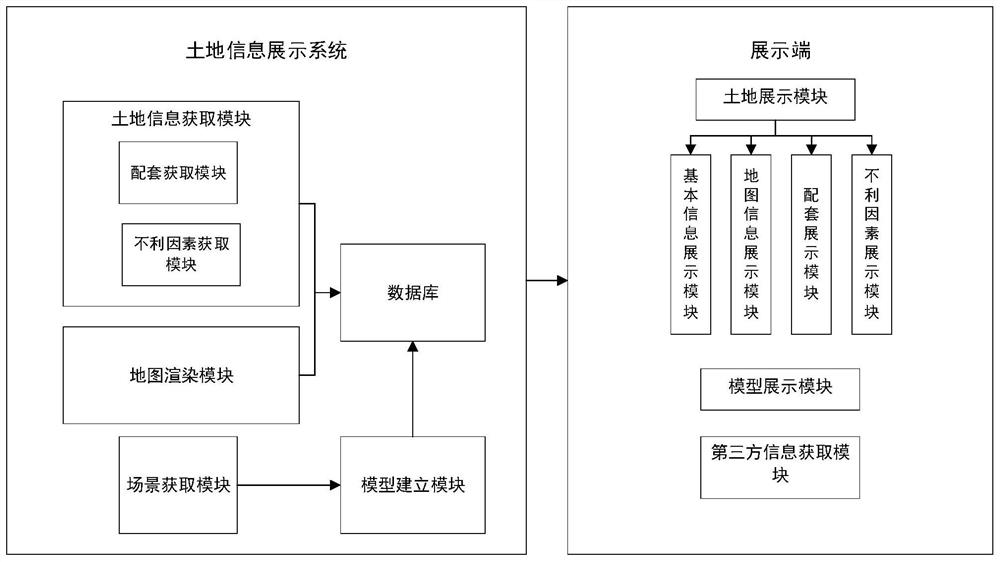
[0067] The embodiment is basically as attached figure 1 Shown:
[0068] It includes a server and a display terminal. The server includes a land information acquisition module, a map rendering module, a scene acquisition module, a model building module and a database. The display side includes a model land display module and a model display module.
[0069] The land information acquisition module acquires various information about the land for sale in the city through big data, and stores the collected land information in the database. The map rendering module uses GIS technology to render information labels on the map, and the information labels include information on the land for sale. Geographic location, land outline and area control plan, the map includes one or more of city planning map, city standard map, and satellite map. In this embodiment, the map includes city standard m...
PUM
 Abstract
Description
Claims
Application Information
 - R&D
- Intellectual Property
- Life Sciences
- Materials
- Tech Scout
- Unparalleled Data Quality
- Higher Quality Content
- 60% Fewer Hallucinations
Browse by: Latest US Patents, China's latest patents, Technical Efficacy Thesaurus, Application Domain, Technology Topic, Popular Technical Reports.
© 2025 PatSnap. All rights reserved.Legal|Privacy policy|Modern Slavery Act Transparency Statement|Sitemap|About US| Contact US: help@patsnap.com

