Navigation plotting device and using method
A plotting and square technology, applied in the field of nautical plotting devices and nautical plotting, can solve the problems of low mapping efficiency, storage difficulty, inconvenience, etc., and achieve the effect of easy equipment storage, easy hand-held carrying, and small footprint.
- Summary
- Abstract
- Description
- Claims
- Application Information
AI Technical Summary
Problems solved by technology
Method used
Image
Examples
Embodiment 1
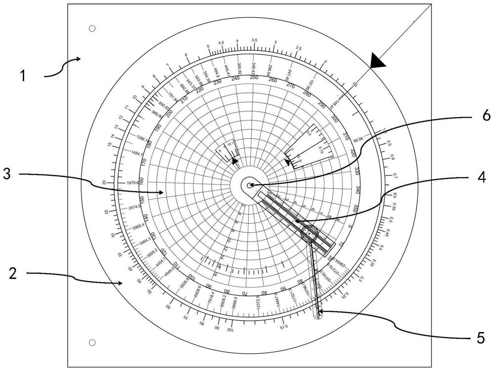
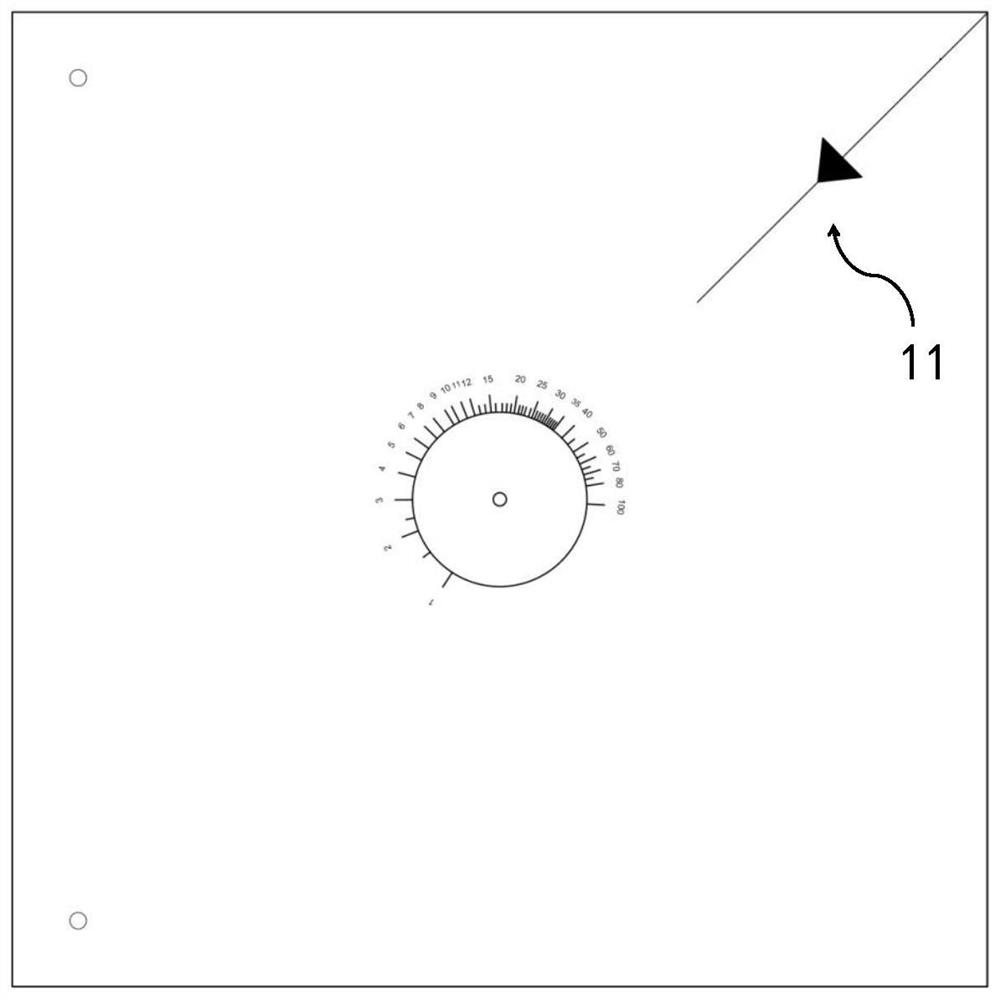
[0067] In the navigation plotting device provided by this embodiment, the upper right corner of the bottom square panel is marked with a mileage reading indicator arrow along 45° to the center of the square, and a speed scale (knot) in logarithmic form is marked with a radius of 26.5mm relative to the center of the square, The speed scale is 100 and the logarithmic base is 2 (all scales in this slide rule are in base 2).
[0068] The movable turntable in the middle layer is made of transparent material. From the outside to the inside, the mileage (nautical miles, the range is 1000, all the conversion coefficients of this slide rule are 36, and the radius is 110mm), pressure (Pascal, the range is 29694×10 3 , radius is 107mm), time (hour, range is 1000, radius is 72mm), pressure (Pascal, range is 1200, radius is 49mm), time (minutes, range is 1000, radius is 39mm) marked with 5 circle logarithms Form scale.
[0069]The upper plotting turntable 3 marks the centrifugal ray auxil...
Embodiment 2
[0072] For the legend problem: the true heading of the ship is 000°, the speed in the fog is 9 knots, the true bearing and distance of the incoming ship measured by the radar are as follows: 0800 045°7.0′; 0805 045°6.0′; 0810 045°5.0′, using the above navigation plotting The device solves the following problems through manual plotting and drawing:
[0073] (1) In order to allow the incoming ship to pass at the shortest distance of 2.0 nautical miles from the port side of the ship, the new course is scheduled to change to the starboard at 0815;
[0074] (2) If it is scheduled to change direction when it is 4.5 nautical miles away from the incoming ship, the new course that allows other ships to pass at the shortest distance of 2.0 nautical miles from the port side of the own ship.
[0075] Among the above numbers, the first number combination, in the description of "abcd", the first two numbers ab means hour, the last two numbers cd means minute, 0800 means 8:00, and the second...
Embodiment 3
[0082] Adopt the navigation plotting device disclosed by the present invention to carry out navigation depth conversion, such as Figure 15 As shown, the mileage indicator arrow on the square bottom plate is aligned with the current pressure value, and the upper plotting dial is rotated to align the speed indicator line with 1. At this time, the time / depth indicator line is the corresponding depth value.
[0083] It can be seen that, utilizing the navigation plotting device of the present invention, the functions of various navigation plotting tools such as the current navigation set square, ruler, protractor, compasses, parallel ruler, T-square, and square can be completed, and because the navigation plotting device of the present invention Components are assembled and integrated, the relative movement relationship is fixed, and the plotting accuracy is faster, more convenient, and more accurate than independent tool combinations.
PUM
 Abstract
Description
Claims
Application Information
 - R&D
- Intellectual Property
- Life Sciences
- Materials
- Tech Scout
- Unparalleled Data Quality
- Higher Quality Content
- 60% Fewer Hallucinations
Browse by: Latest US Patents, China's latest patents, Technical Efficacy Thesaurus, Application Domain, Technology Topic, Popular Technical Reports.
© 2025 PatSnap. All rights reserved.Legal|Privacy policy|Modern Slavery Act Transparency Statement|Sitemap|About US| Contact US: help@patsnap.com


