Dam body three-dimensional deformation monitoring-oriented combined observation method with two ground-based radars

A ground-based radar and three-dimensional deformation technology, which is applied in the field of surveying and mapping, can solve the problems of difficult and practical display of the monitoring target displacement situation, and the inability of a single ground-based radar to accurately calculate the three-dimensional displacement information of the target, so as to achieve easy application and practicability Strong and lower professional threshold

CN113740844APending Publication Date: 2021-12-03雷添杰
0 Cites 9 Cited by

Patent Information

Authority / Receiving Office
CN · China
Patent Type
Applications(China)
Current Assignee / Owner
Publication Date
2021-12-03

Smart Images

  • Figure 1
    Figure 1
  • Figure 2
    Figure 2
  • Figure 3
    Figure 3
Patent Text Reader

Abstract

The invention discloses a dam body three-dimensional deformation monitoring-oriented combined observation method with two ground-based radars. The method comprises the following steps of S1, generating a three-dimensional model; S2, constructing a ground-based radar system; s3, obtaining radar data; s4, fusing the radar data and the three-dimensional model to obtain a fused model; and S5, monitoring the measured target based on the fused model. A three-dimensional model of a key target in a monitoring area is constructed by using a point cloud data set of the monitoring area acquired by a ground three-dimensional laser scanner and an unmanned aerial vehicle oblique photogrammetry technology. Different from an existing calculation result in abstract expression forms of numbers, characters, images and the like, after the three-dimensional model is constructed and used, a result calculated according to data acquired by the ground-based radar can be displayed in front of a user in a more intuitive manner, the professional threshold of interpreting the calculation result is reduced, so that the method can be accepted and applied by vast demanders more easily, and the practicability is higher.
Need to check novelty before this filing date? Find Prior Art

Description

technical field

[0001] The invention relates to the field of surveying and mapping, in particular to a joint observation method of two ground-based radars for three-dimensional deformation monitoring of a dam body. Background technique

[0002] my country's geological structure is complex and the topography fluctuates greatly, so geological disasters such as landslides, collapses, and mud-rock flows are extremely prone to occur. In addition, human production and living activities can easily induce landslide disasters. The instability or sliding of a large number of rock and soil slopes is not uncommon, which has brought serious harm and loss to engineering construction and people's lives and property. Therefore, by monitoring the target displacement data with advanced technology, the three-dimensional displacement information of the target can be obtained by accurate calculation, so as to reflect the real displacement of the target, and alarm the deformation information exce...

Examples

Embodiment Construction

[0055] The specific embodiments of the present invention are described below so that those skilled in the art can understand the present invention, but it should be clear that the present invention is not limited to the scope of the specific embodiments. For those of ordinary skill in the art, as long as various changes Within the spirit and scope of the present invention defined and determined by the appended claims, these changes are obvious, and all inventions and creations using the concept of the present invention are included in the protection list.

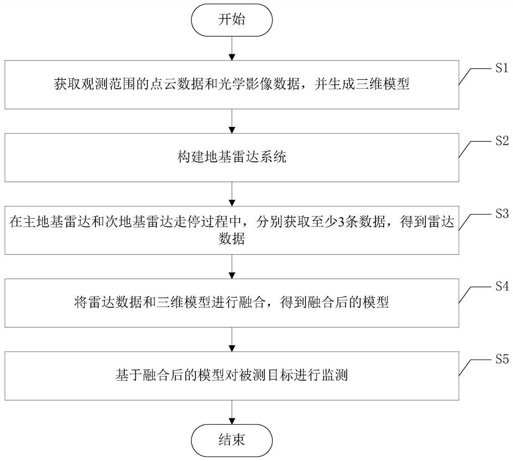
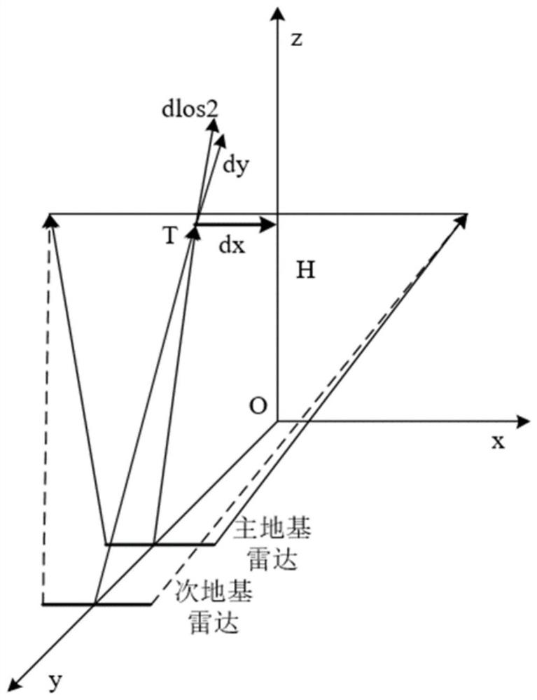
[0056] Such as figure 1 with figure 2 As shown, the joint observation method of two ground-based radars for three-dimensional deformation monitoring of the dam includes the following steps:

[0057] S1. Obtain point cloud data and optical image data in the observation range, and generate a three-dimensional model;

[0058] S2. Construct the ground-based radar system: place the main ground-based radar at the monitoring st...