
GNSS deformation monitoring method and system

A deformation, double-difference observation equation technology, applied in the field of satellite navigation, can solve the problem that the multi-path effect has no spatial correlation, cannot adopt the differential mode, and can not be eliminated.

Pending Publication Date: 2021-12-07
QIANXUN SPATIAL INTELLIGENCE INC
View PDF0 Cites 0 Cited by
  • Summary
  • Abstract
  • Description
  • Claims
  • Application Information

AI Technical Summary

Problems solved by technology

However, the multipath effects related to the site environment are not spatially correlated, cannot be eliminated by differential mode, and cannot be separated by linear model estimation

Method used


Image

  • GNSS deformation monitoring method and system
  • GNSS deformation monitoring method and system
  • GNSS deformation monitoring method and system

Examples


Embodiment Construction

[0073] There are two existing GNSS deformation monitoring solutions as follows. One is to build a new GNSS deformation monitoring reference station: install a monitoring base station on the measured point of the building structure, and set up a reference station in a relatively non-settling area near the building structure, and transmit the data of the monitoring base station and the reference station through a wireless or wired transmission system to The service system performs analysis and calculation to obtain deformation information. The second is to receive the enhanced signal at the monitoring point: the receiver receives the satellite message signal and the low-orbit satellite navigation and positioning auxiliary enhanced system signal or the navigation positioning and deformation monitoring and positioning auxiliary enhanced system signal at the monitoring point, such as the VRS signal in NRTK, for analysis and calculation Get deformation information.

[0074] The abo...


PUM


Abstract

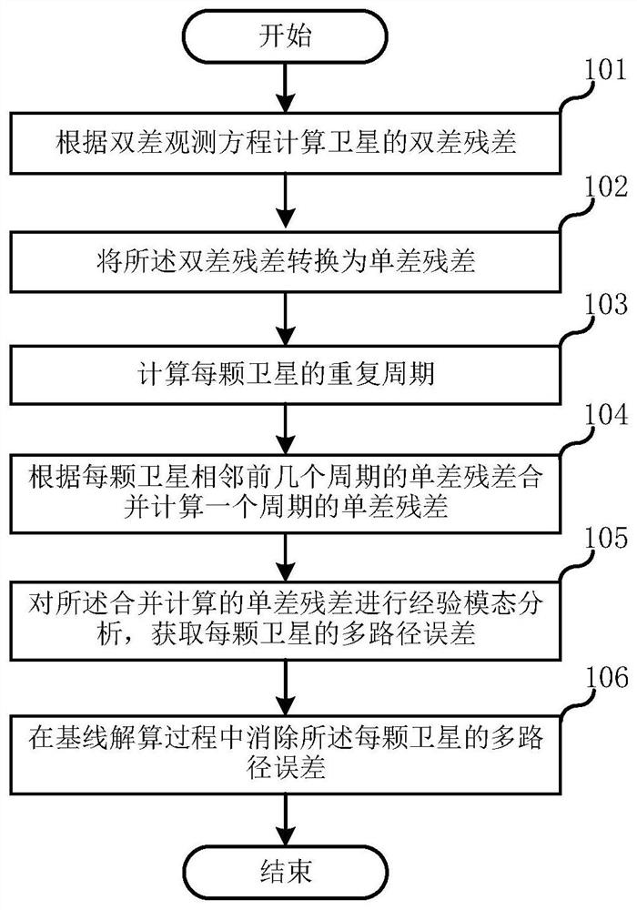
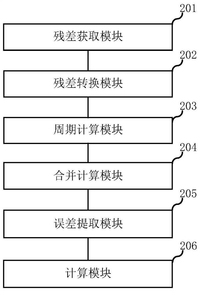
The invention discloses a GNSS deformation monitoring method and system. The method comprises the following steps: calculating a double-difference residual error of a satellite according to a double-difference observation equation; converting the double-difference residual error into a single-difference residual error; calculating a repetition period of each satellite; calculating the single-difference residual error of one period according to the single-difference residual error combination of the adjacent previous several periods of each satellite; carrying out empirical mode analysis on the single-difference residual error obtained by merging calculation to obtain a multi-path error of each satellite; and eliminating the multi-path error of each satellite in the baseline resolving process.

Description

technical field [0001] This specification generally relates to the technical field of satellite navigation, and in particular relates to a GNSS deformation monitoring method and system. Background technique [0002] At present, GNSS-based monitoring schemes use monitoring station data and reference station data (or virtual VRS data) to form a baseline, and perform baseline calculation to obtain the coordinate information of monitoring points, so as to determine whether the structure is deformed. First of all, the satellite data received on the ground not only contains useful information such as the receiver position, but also includes random observation errors and various systematic errors. Among them, systematic errors, such as ionospheric errors, tropospheric errors, orbital errors, satellite clock errors, and receiver clock errors, can be eliminated or greatly weakened through dual-frequency observations, double-difference observations, and accurate model corrections. Ho...

Claims


Application Information

Patent Timeline
IPC IPC(8): G01S19/39G01S19/44G01S19/40
CPCG01S19/39G01S19/44G01S19/40
Inventor 陈玉林余伟
Owner QIANXUN SPATIAL INTELLIGENCE INC
Learn More