
Multi-attitude all-terrain geographic information surveying and mapping instrument

A geographic information and mapping instrument technology, applied in the field of geographic surveying and mapping, can solve problems such as long adjustment time, reduced data accuracy, and large adjustment errors, and achieve the effects of increasing adjustment speed, reducing friction, and reducing smoothness

Active Publication Date: 2022-02-22
山东瑞鑫地理信息工程有限公司
View PDF9 Cites 1 Cited by
  • Summary
  • Abstract
  • Description
  • Claims
  • Application Information

AI Technical Summary

Problems solved by technology

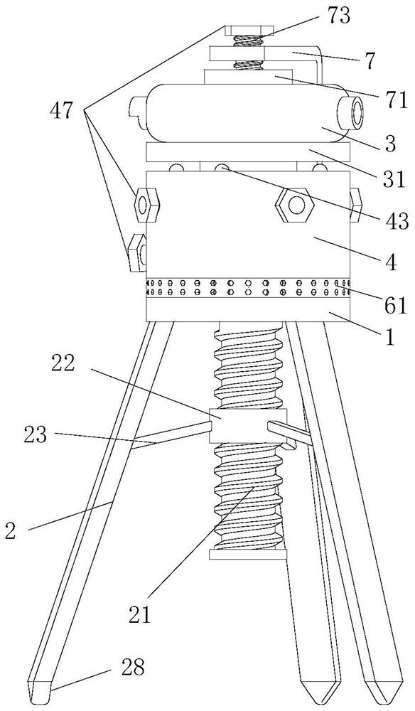
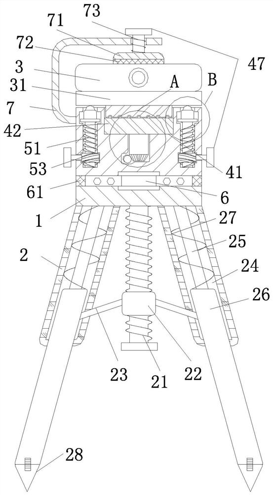
[0004] In order to make up for the deficiencies of the existing technology and solve the problems of reduced data accuracy and long adjustment time due to the excessive adjustment error of each azimuth of the surveying instrument during the micro-adjustment of the approach, the present invention proposes a multi-attitude all-terrain Geographic Information Mapping Instrument

Method used


Image

  • Multi-attitude all-terrain geographic information surveying and mapping instrument
  • Multi-attitude all-terrain geographic information surveying and mapping instrument
  • Multi-attitude all-terrain geographic information surveying and mapping instrument

Examples


Embodiment approach

[0034] As an embodiment of the present invention, a ball 54 is movably installed on the upper surface of the adjustment frame 52;

[0035] During work, since the lower surface of the adjustment frame 52 and the mounting base 31 are in contact with each other, turning the turntable 42 during angle adjustment causes friction between the mounting base 31 and the adjusting frame 52, reducing the smoothness of adjustment, and at the same time, under long-term use There will be deep grooves at the bottom of the mounting base 31, which seriously affects the use of the surveying instrument; adding balls 54 on the adjustment frame 52, when performing rotation adjustment, the balls 54 promote the rotation of the mounting base 31, reducing the mounting base 31 and the adjustment frame 52 friction, improve the speed of adjustment, and at the same time improve the efficiency of the surveying instrument.

[0036] As an embodiment of the present invention, the center position of the lower su...


PUM


Abstract

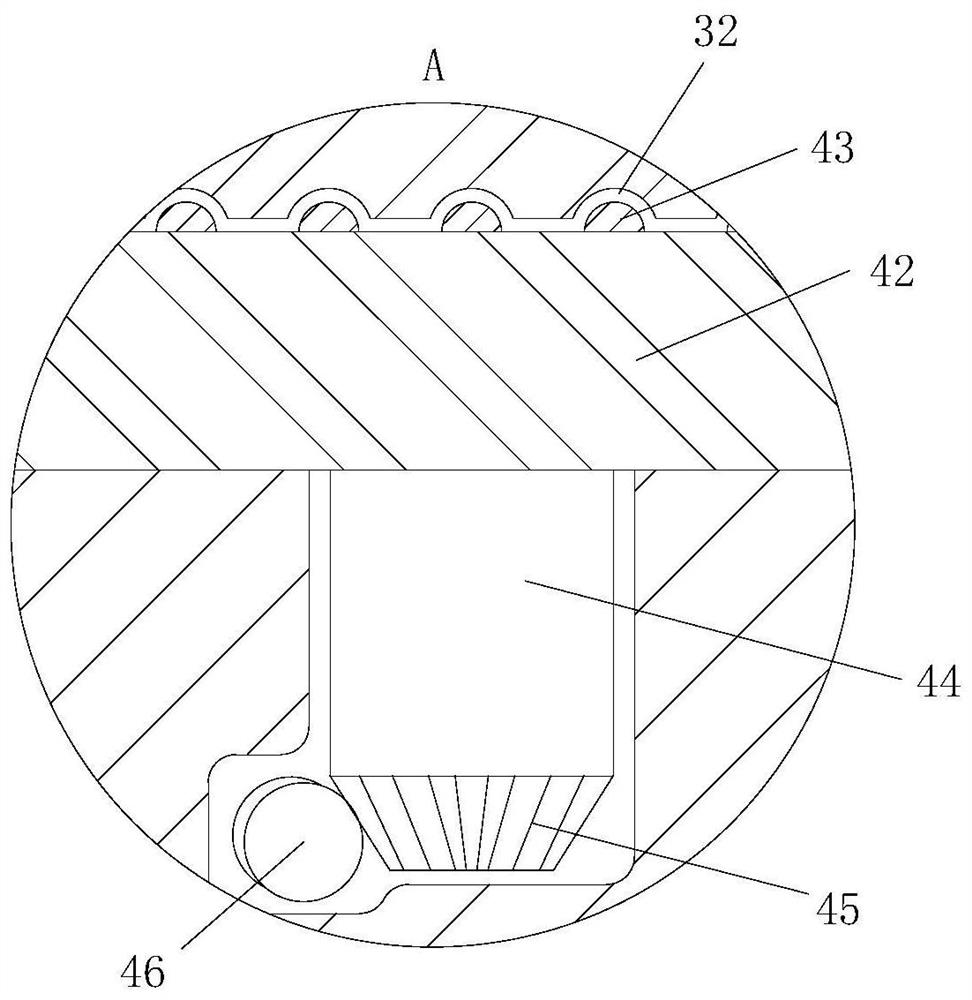
The invention belongs to the field of geographic surveying and mapping, and particularly relates to a multi-attitude all-terrain geographic information surveying and mapping instrument, which comprises a base, a tripod and a surveying and mapping instrument body, the lower surface of the surveying and mapping instrument body is fixedly connected with a mounting seat, the lower surface of the mounting seat is provided with ball grooves which are uniformly distributed in a circular ring shape, and the upper surface of the base is rotatably connected with an adjusting seat; a fixing groove is formed in the center of the upper surface of the adjusting seat, a rotating disc is movably installed in the fixing groove, magnetic beads in one-to-one correspondence with the ball grooves are fixedly installed on the upper surface of the rotating disc, a rotating shaft is welded to the lower surface of the rotating disc, a turbine rod is rotationally connected into the adjusting seat, and a movable groove flush with the upper surface of the adjusting seat is formed in the adjusting seat. A screw rod is installed inside the movable groove, the top of the screw rod is fixedly connected with an adjustment frame, and a column gear is installed in the inner part of the adjustment seat. According to the surveying and mapping instrument, the structure is simple, the micro adjustment of the surveying and mapping instrument can be assisted, the adjustment time of the surveying and mapping instrument is shortened, and meanwhile the accuracy of measured data is improved.

Description

technical field [0001] The invention belongs to the field of geographical surveying and mapping, in particular to a multi-position and all-terrain geographic information surveying and mapping instrument. Background technique [0002] Surveying and mapping refers to the measurement, collection and drawing of the shape, size, spatial position and attributes of natural geographical elements or surface artificial facilities, etc.; measuring instruments are mainly used for measuring instruments on construction sites, and benchmarks and horizontal planes are required for measurement The measurement accuracy can only be guaranteed vertically. When entering the geographic surveying and mapping operation, first perform horizontal calibration, and then carry out the geographic surveying and mapping operation. When performing the operation, a micro-adjustment is required to ensure that the data is within a measurement range, but when performing a micro-adjustment Excessive adjustment o...

Claims


Application Information

Patent Timeline
IPC IPC(8): F16M11/08F16M11/18F16M11/34F16F15/08
CPCF16M11/08F16M11/18F16M11/34F16F15/08Y02A90/30
Inventor 刘薇薇刘银屏
Owner 山东瑞鑫地理信息工程有限公司
Learn More