A visual navigation method for indoor satellite platform

A satellite platform and visual navigation technology, applied in the field of satellite navigation, can solve the problems of difficult speed operation, high cost, large amount of calculation, etc., and achieve the effect of improving matching speed, small amount of calculation, and high correct matching rate

Active Publication Date: 2022-04-19
PLA PEOPLES LIBERATION ARMY OF CHINA STRATEGIC SUPPORT FORCE AEROSPACE ENG UNIV
View PDF0 Cites 0 Cited by
  • Summary
  • Abstract
  • Description
  • Claims
  • Application Information

AI Technical Summary

Problems solved by technology

[0003] The purpose of the present invention is to avoid the deficiencies in the prior art and provide a visual navigation method for an indoor satellite platform, which solves the problem that the existing indoor satellite platform has a large amount of calculation, high cost and difficulty in running at a high speed. question

Method used


Image

  • A visual navigation method for indoor satellite platform
  • A visual navigation method for indoor satellite platform
  • A visual navigation method for indoor satellite platform

Examples


Embodiment Construction

[0047] In order to enable those skilled in the art to better understand the technical solution of the present invention, the present invention will be described in further detail below in conjunction with the accompanying drawings and specific embodiments. And the features in the embodiments can be combined with each other.

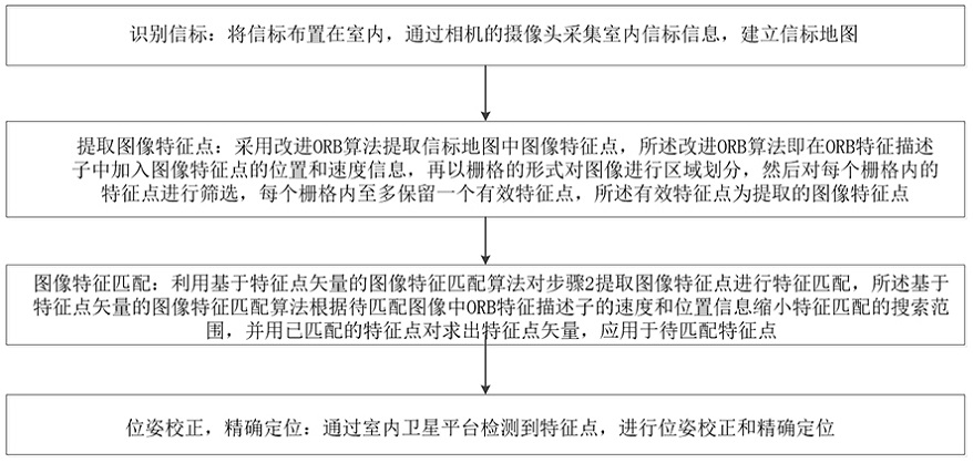
[0048] Such as figure 1 As shown, a visual navigation method for an indoor satellite platform provided by an embodiment of the present invention, the following steps:

[0049] Step 1, identify the beacon: arrange the beacon indoors, collect indoor beacon information through the camera of the camera, and build a beacon map; preferably, the camera is a Kinect camera;

[0050] Preferably, the specific process of the above steps is as follows:

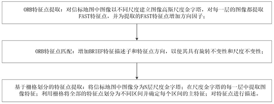
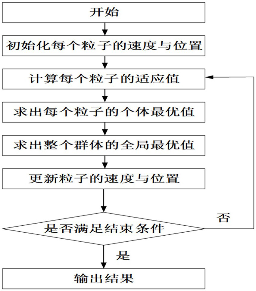
[0051] Step 11, arrange the beacons indoors, and control the indoor satellite platform to walk along the preset planning path, the preset planning path includes a straight line path and a right-angle path, and the i...


PUM


Abstract

The invention discloses a visual navigation method for an indoor satellite platform, comprising the following steps: step 1, identifying beacons: arranging the beacons indoors, collecting indoor beacon information through a camera, and establishing a beacon map; step 2, Extract image feature points: use the improved ORB algorithm to extract image feature points in the beacon map; step 3, image feature matching: use the image feature matching algorithm based on feature point vectors to match features; step 4, pose correction, precise positioning: The feature points are detected through the indoor satellite platform, and the pose correction and precise positioning are performed. The invention has the advantages of small amount of calculation and high speed operation of the satellite platform.

Description

technical field [0001] The invention belongs to the technical field of satellite navigation, and in particular relates to a visual navigation method for an indoor satellite platform. Background technique [0002] At present, indoor visual navigation mostly adopts the method of pasting two-dimensional codes on the ground. Long-term use will cause damage to the two-dimensional codes, which need to be replaced regularly, and the cost is high; and the widely used algorithms such as SIFT, SURF and ORB have a large amount of calculation. The disadvantages are that the satellite platform is difficult to run at a higher speed and so on. Contents of the invention [0003] The purpose of the present invention is to avoid the deficiencies in the prior art and provide a visual navigation method for an indoor satellite platform, which solves the problem that the existing indoor satellite platform has a large amount of calculation, high cost and difficulty in running at a high speed. q...

Claims


Application Information

Patent Timeline
Patent Type & Authority Patents(China)
IPC IPC(8): G01C21/20G01C21/00
CPCG01C21/206G01C21/383
Inventor 夏鲁瑞王刚陈雪旗杨帆李森卢妍马剑
Owner PLA PEOPLES LIBERATION ARMY OF CHINA STRATEGIC SUPPORT FORCE AEROSPACE ENG UNIV
Why Eureka
Try Eureka