DOM manufacturing method based on color point cloud

A production method and color point technology, applied in the field of surveying and mapping, can solve problems such as inaccurate color information and easy error reporting, and achieve the effects of improving work efficiency, improving utilization efficiency, and saving costs

Pending Publication Date: 2022-04-08
CHINA RAILWAY ERYUAN ENG GRP CO LTD
View PDF7 Cites 0 Cited by
  • Summary
  • Abstract
  • Description
  • Claims
  • Application Information

AI Technical Summary

Problems solved by technology

Then, when performing the operation of step B3, if the points processed in step B2 do not exist inside the grid, the nearest neighbor interpolation method is used, which is easy to report an error and the obtained color information is not accurate

Method used


Image

  • DOM manufacturing method based on color point cloud
  • DOM manufacturing method based on color point cloud
  • DOM manufacturing method based on color point cloud

Examples


Embodiment Construction

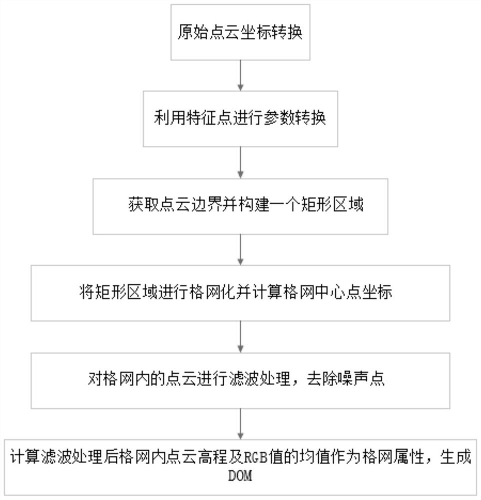
[0027] The present invention will be further described below in conjunction with the accompanying drawings and embodiments.

[0028] DOM production method based on color point cloud, including steps,

[0029] S1. Transform the coordinate system of the original point cloud data into the independent coordinate system of the project, determine the scope of the DOM to be made, and construct a rectangular area covering the point cloud data.

[0030] Get the X, Y maximum and minimum values ​​of the converted point cloud coordinates, respectively X MAX 、X MIN , Y MAX and Y MIN , to get the X MAX 、X MIN , Y MAX and Y MIN Constructs a bounding rectangular region that completely covers the point cloud data.

[0031] S2. Grid the rectangular area constructed in step S1, so that the length and width of each grid are equal to the resolution of the DOM to be generated.

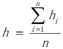
[0032] The size of the grid is determined according to the resolution of the DOM to be generated. The grid is a...


PUM


Abstract

The invention provides a DOM (Document Object Model) making method based on color point cloud, which can obtain relatively accurate color information. Comprising the following steps: S1, determining a range of a DOM to be made, and constructing an external rectangular region covering point cloud data; s2, performing gridding on the rectangular region in the step S1, so that the length value and the width value of each grid are equal to the resolution value of the DOM to be generated; s3, calculating the plane coordinate of the center point of each grid; s4, RGB values of all point clouds in the rectangular area are obtained, and the RGB values of the point clouds included in each grid are averaged; calculating the elevation of the central point of each grid; and generating raster data to obtain a DOM file. While the utilization efficiency of the LiDAR point cloud data is improved, the cost is effectively saved, and the working efficiency is improved.

Description

technical field [0001] The invention relates to the technical field of surveying and mapping, in particular to a method for making a DOM based on color point clouds. Background technique [0002] Point cloud data is usually obtained by laser LiDAR scanning. The 3D laser point cloud is essentially a set of 3D coordinate values ​​and attribute information, including attribute information such as spatial position and RGB color value. DOM (Digital Orthophoto Map) is the abbreviation of digital orthophoto map, which is a raster image map containing coordinate information. At present, the method of obtaining DOM is mainly to make use of digital remote sensing images and aerial photo images for digital differential correction. [0003] The patent document with application number 201710970058.2 discloses a three-dimensional surface modeling method based on laser point cloud data. Mainly use the point cloud color information to construct the surface DOM, use high-density point clo...

Claims


Application Information

Patent Timeline
Patent Type & Authority Applications(China)
IPC IPC(8): G06T17/05G06T17/20
Inventor 梅熙林春峰刘凯李芋均陈红兵宋益桥赵兵郜珂郭刚
Owner CHINA RAILWAY ERYUAN ENG GRP CO LTD
Why Eureka
Try Eureka