Data processing system and method based on multiple geographical visualization platforms
A data processing system and geographic technology, applied in the field of data processing, can solve problems affecting work efficiency, waste of resources, incompatibility, etc., and achieve the effects of improving work efficiency, reducing waste of resources, and improving comprehensiveness and accuracy
- Summary
- Abstract
- Description
- Claims
- Application Information
AI Technical Summary
Problems solved by technology
Method used
Image
Examples
Embodiment 1
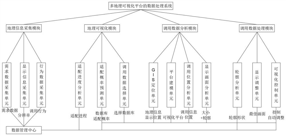
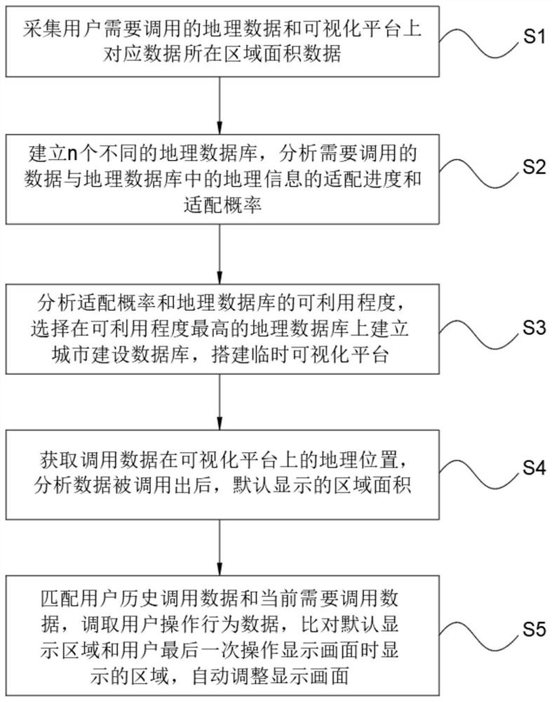
[0056] Embodiment 1: Use the demand data collection unit to collect the data sets that different users need to call as B={B1, B2, B3}={512, 64, 256}, use the display information collection unit to collect the corresponding data on the visualization platform The area set of the area is S={S1, S2, S3}={48, 6, 24}, and the data set of a random database among the 3 geographic databases is B'={B1', B2', B3' }={516, 68, 258}, the data in the corresponding database is divided into 3 areas, and the area of each area is set as s = {s1, s2, s3} = {160, 40, 80}, the obtained There are 2 geographic databases that have been adapted to the existing geographic information, and the current adaptation progress is M / n=2 / 3, according to the formula Obtain the adaptation probability set of the data that a random user needs to call and all the regional data in a random geographical database that has been adapted as P={P1, P2, P3}={0.89, 0.7, 0.44}, and set the adaptation probability threshold f...
PUM
 Abstract
Description
Claims
Application Information
 - R&D
- Intellectual Property
- Life Sciences
- Materials
- Tech Scout
- Unparalleled Data Quality
- Higher Quality Content
- 60% Fewer Hallucinations
Browse by: Latest US Patents, China's latest patents, Technical Efficacy Thesaurus, Application Domain, Technology Topic, Popular Technical Reports.
© 2025 PatSnap. All rights reserved.Legal|Privacy policy|Modern Slavery Act Transparency Statement|Sitemap|About US| Contact US: help@patsnap.com


