
Viewpoint correlated error measuring method for generating landform grid

A technology of error measurement and grid generation, applied in image data processing, 3D modeling, instruments, etc., can solve the problems of increased number of triangles, overestimation of triangle screen projection errors, low storage efficiency, etc., and improve the quality of picture display , uniform triangular mesh, and high storage efficiency

Inactive Publication Date: 2006-03-22
ZHEJIANG UNIV
View PDF0 Cites 0 Cited by
  • Summary
  • Abstract
  • Description
  • Claims
  • Application Information

AI Technical Summary

Problems solved by technology

Due to the need to ensure that the error of the child node does not exceed the error of the parent node, the screen projection error of the triangle will be overestimated, increasing the number of triangles
At the same time, this method needs to store the error of the object space and the radius of the enclosing sphere on each vertex, and the storage efficiency is not high.

Method used

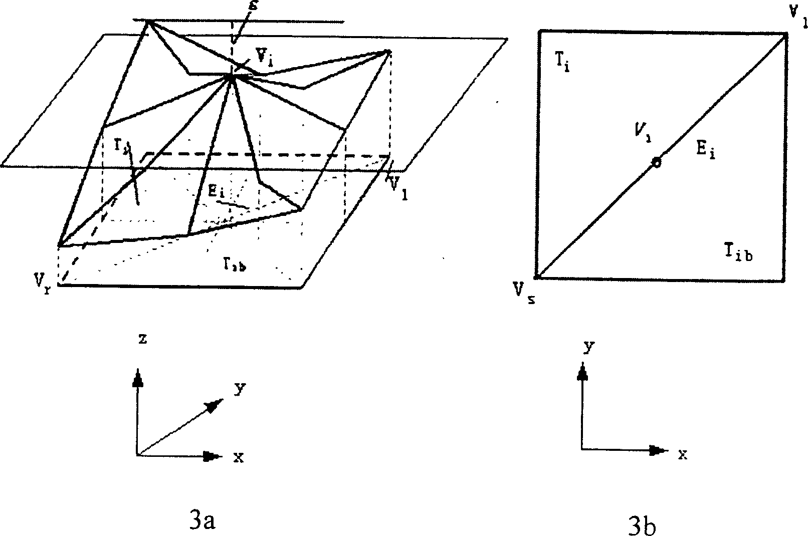

Image

  • Viewpoint correlated error measuring method for generating landform grid
  • Viewpoint correlated error measuring method for generating landform grid
  • Viewpoint correlated error measuring method for generating landform grid

Examples


Embodiment Construction

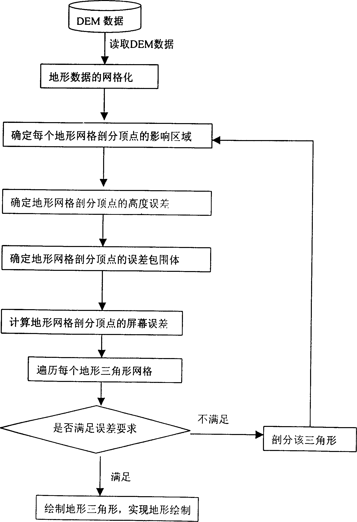
[0031] A viewpoint-related error measurement method for terrain grid generation of the present invention, such as figure 1 As shown, it includes four steps: (1) determine the area of ​​influence of each terrain meshing vertex; (2) determine the height error of each terrain meshing vertex; (3) determine the height error of each terrain meshing vertex; (4) In the screen space, any viewpoint is given, and the screen error of each terrain mesh division vertex is calculated. Process such as figure 1 Represented: at first the system reads the original terrain data, i.e. DEM data, triangularizes the original terrain, then uses the four steps of the present invention to measure each terrain triangle error, and then traverses each terrain triangle, if the triangle Meet the error requirements, draw the triangle, if the error requirements are not met, subdivide the triangle, and then use the four steps of the present invention to measure the triangle error until the error requirements a...


PUM


Abstract

The invention discloses a viewpoint-related error measuring method for terrain mesh generation, including four steps: determining the influenced area of each meshing top; determining the height error of each meshing top; determining the error enveloper of each meshing top; giving an arbitrary viewpoint in the screen space, to calculate the screen error of each meshing top. Its efficiency is high, and at the same time, only need store an additional height error data, the storage efficiency is very high, meeting the real-time drawing requirements. And the error estimation is accurater, and it generates less triangles on the same screen error condition. It introduces the screen projection area difference, which makes the generated triangle evener so as to improve the quality of the picture drawn by large-scale real-time terrain meshes.

Description

technical field [0001] The present invention relates to general image data processing or generation, and in particular to a viewpoint-related error measurement method for terrain grid generation. Background technique [0002] In the real-time visualization of large-scale terrain, the original terrain data is usually expressed as terrain regular grid height field (DEM), and the number of grid sampling points is usually (2 n +1)×(2 n +1). When n is very large, if the adjacent sampling points are formed into a triangular grid (the grid is called the original terrain grid), then the number of triangles is very large. Due to the limitation of hardware conditions (such as the calculation speed of the processor, the graphics card rendering speed, etc.), the realization of real-time virtual roaming of the terrain is very difficult. Accurate real-time terrain roaming is impossible for large-scale terrain data. Therefore, it is necessary to simplify the displayed terrain during re...

Claims


Application Information

Patent Timeline
Patent Type & Authority Patents(China)
IPC IPC(8): G06T17/50G06T17/05
Inventor 华炜陆艳青周栋鲍虎军
Owner ZHEJIANG UNIV
Learn More