Real time measuring method of forest fire field
A real-time measurement and forest fire technology, applied in the field of forest fire monitoring, can solve problems such as inability to accurately and timely report forest fire conditions, and achieve the effect of simple, fast, and high-accuracy measurement methods.
- Summary
- Abstract
- Description
- Claims
- Application Information
AI Technical Summary
Problems solved by technology
Method used
Image
Examples
Embodiment Construction
[0024] The real-time measurement method of the forest fire scene is different from the existing method, and has been greatly improved, specifically:
[0025] The ground patrol consists of 3-5 people, equipped with 2 electronic theodolites and 2 GPS receivers. The GPS receivers can realize fast positioning, and the electronic theodolites are mainly used to measure angles.
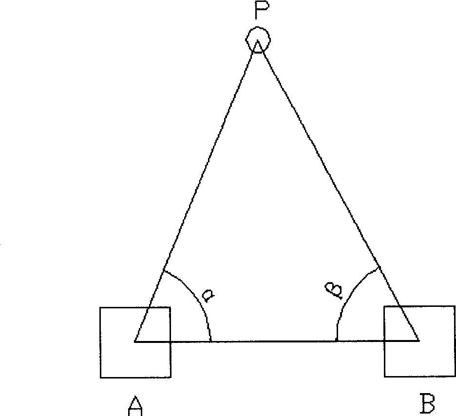
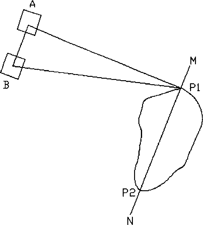
[0026] When a forest fire is found, it can realize the rapid and ready positioning of the fire point of the forest fire: such as figure 1 As shown, first use the GPS receiver to locate the two points A and B, and measure the coordinates (X A , Y A ) and (X B , Y B ), then set up the electronic theodolite at two points A and B, and measure the horizontal angles α and β; by the formula X P = X A ctgβ ...
PUM
 Abstract
Description
Claims
Application Information
 - R&D
- Intellectual Property
- Life Sciences
- Materials
- Tech Scout
- Unparalleled Data Quality
- Higher Quality Content
- 60% Fewer Hallucinations
Browse by: Latest US Patents, China's latest patents, Technical Efficacy Thesaurus, Application Domain, Technology Topic, Popular Technical Reports.
© 2025 PatSnap. All rights reserved.Legal|Privacy policy|Modern Slavery Act Transparency Statement|Sitemap|About US| Contact US: help@patsnap.com


