Mobile map display device, map display system and map display method

A technology for displaying equipment and maps, which can be used in maps/plans/charts, sub-office equipment, radio wave measurement systems, etc., and can solve problems such as the difficulty in realizing user map display and the lack of equipment for measuring azimuths in mobile phones.

Inactive Publication Date: 2011-10-12
KYOCERA CORP
View PDF6 Cites 0 Cited by
  • Summary
  • Abstract
  • Description
  • Claims
  • Application Information

AI Technical Summary

Problems solved by technology

[0005] Initially, mobile cellular phones equipped with a map information display processing function lacked a device for measuring azimuth, so it was difficult to realize a map display that is easy for users to understand, such as a heading up display (displaying a rotating map, so that the forward direction points to the top of the screen)

Method used


Image

  • Mobile map display device, map display system and map display method
  • Mobile map display device, map display system and map display method
  • Mobile map display device, map display system and map display method

Examples


Embodiment Construction

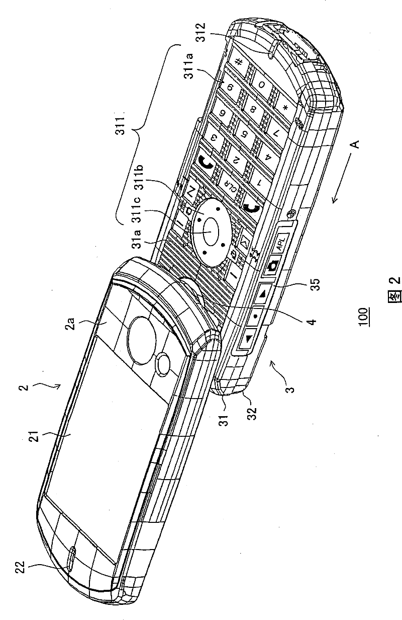
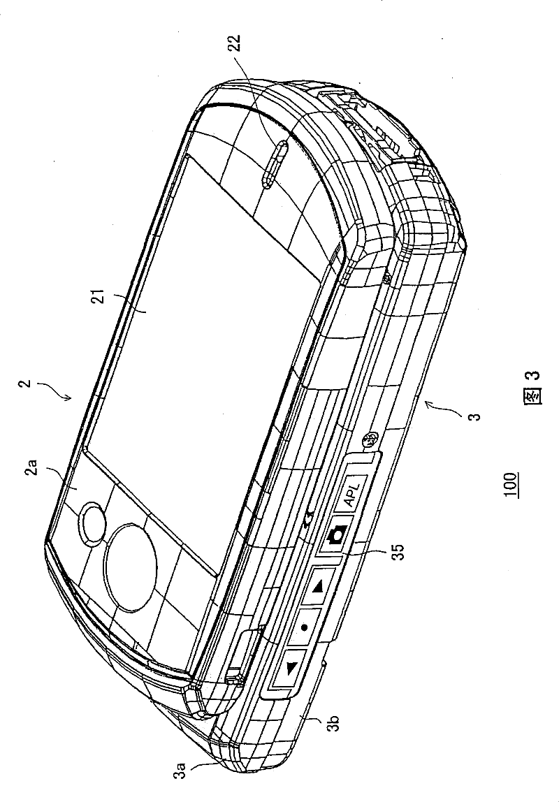
[0058] When the present invention is applied to a multifunctional type movable, portable cellular phone (hereinafter referred to as "mobile cellular phone") having a map information display processing function and an image capture function and capable of displaying map information in consideration of the orientation, the following will be explained with reference to the drawings. the embodiment.

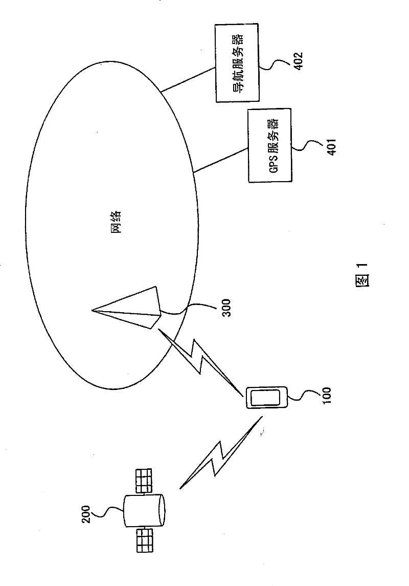
[0059] figure 1 is a block diagram showing a configuration example of a system for acquiring geographic location and map information in cellular phone 100 according to an embodiment of the present invention.

[0060] The cellular phone 100 receives GPS signals transmitted from three or more GPS satellites 200 orbiting the earth in known orbits. Then, the cellular phone 100 transmits information on the received GPS signal from the base station 300 to the GPS server system 401 (as an example of the spot finding device of the present invention) through the communication network, and ac...


PUM


Abstract

A mobile map display device has a terrestrial magnetism sensor for measuring terrestrial magnetism, a display section, and a control section capable of calculating a geographical bearing based on the value measured by the terrestrial magnetism sensor and having first display processing and second processing where, when the control section obtains a map and makes it displayed on the display section, the first display processing causes the map to be displayed in a direction associated with the calculated bearing and the second display processing causes the map to be displayed in a manner fixed in a predetermined bearing. In displaying the map, upon detecting deterioration in the accuracy of the terrestrial magnetism sensor, the control section causes the map to be displayed by the second display processing.

Description

technical field [0001] The invention relates to a mobile communication device, such as a mobile phone, provided with a geomagnetic sensor for measuring a geographical position, and a method for calibrating the geomagnetic sensor. Background technique [0002] Usually, a device is needed to confirm the geographic location of the current location and provide directions to the destination location through a map. As an apparatus meeting such a demand, a car navigation system is known (for example, Patent Document 1, Patent Document 2, and Patent Document 3). [0003] In general, a car navigation system calculates the geographic position of a current location by receiving and processing signals transmitted from a plurality of GPS (Global Positioning System) satellites (hereinafter referred to as "GPS signals"), from a storage unit (DVD , hard disk, etc.) read out the map data about the current location environment and display it on the display. In addition, by using a vehicle s...

Claims


Application Information

Patent Timeline
Patent Type & Authority Patents(China)
IPC IPC(8): G01C21/00G01C17/28G08G1/005G09B29/10H04M1/00G09B29/00G01S19/14G01S19/24G09G5/00G09G5/36H04W4/02
Inventor 桶屋成生
Owner KYOCERA CORP
Why Eureka
Try Eureka