System for positioning a terrestrial user

A user and ground technology, applied in satellite radio beacon positioning system, positioning, radio relay system, etc., can solve problems such as high cost

Inactive Publication Date: 2013-06-12
ASTRIUM GMBH
View PDF1 Cites 0 Cited by
  • Summary
  • Abstract
  • Description
  • Claims
  • Application Information

AI Technical Summary

Problems solved by technology

[0004] It goes without saying that the manufacture, deployment, use and operation of such management satellites in high orbits presents considerable costs, so that it is advantageous to limit the number of said management satellites

Method used


Image

  • System for positioning a terrestrial user
  • System for positioning a terrestrial user
  • System for positioning a terrestrial user

Examples


Embodiment Construction

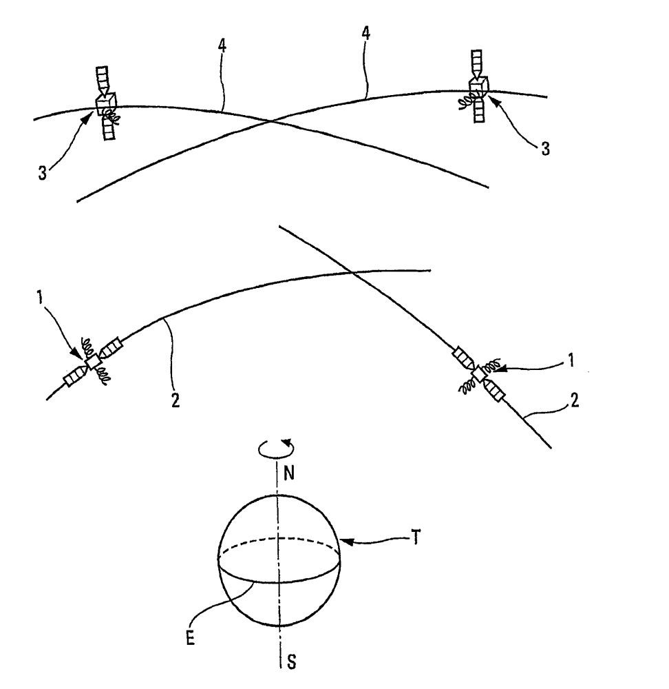
[0025] exist figure 1 Known satellite-based positioning systems presented schematically and in part in , include:

[0026] a navigation satellite 1 placed in a medium-altitude orbit 2 (approximately 25,000 km) around the Earth T; and

[0027] A management satellite 3 placed in a high orbit 4 around the earth T (approximately 45000 km).

[0028] Said management satellite 3 is able to at least partly manage the navigation satellite 2 through monitoring centers and ground communication stations (not represented), for example (but not exclusively) in the French The way described in patent application no. 07 03562.

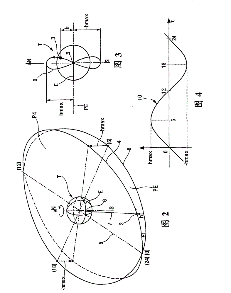
[0029] figure 2 , 3 and 4 (intended to clarify the ensuing Figure 5 , 6 and 7) relate to a single administrative satellite 3 placed in a high orbit 4. In this case (see figure 2 ), the high orbit 4 is geosynchronous and its plane P4 is inclined with respect to the plane PE of the equator E by an angle of inclination i. The intersection of the planes P4 and ...


PUM


Abstract

Disclosed is a system for positioning a terrestrial user. The system includes navigation satellites placed in medium altitude orbits, management satellites placed in high orbits, able to manage the navigation satellites and communicate with the Earth. The management satellites can include a set of at least three management satellites each placed in a high orbit, having a plane that is inclined with respect to the plane of the terrestrial equator and cuts the equator along a diametral straight intersection line with respect to the Earth. Two external diametral straight intersection lines can form an angle of longitude of at least 90 degrees.

Description

technical field [0001] The present invention relates to a satellite based system for locating terrestrial users located on earth, at sea or in terrestrial orbit. Background technique [0002] Satellite-based positioning systems are known comprising constellations of navigation satellites placed in medium-altitude orbits (approximately 25000 km) around the Earth. These navigation satellites and their orbits are generally referred to in the art as "MEO satellites" and "MEO orbits" (Medium Earth Orbit), respectively. The navigation satellites are evenly distributed in several orbital planes, so that at any point on the earth, the user can see several navigation satellites, that is to say with them (at least three, but at least four if the user wishes to know his altitude ) lies in the line and deduces from it his own ground coordinates. Furthermore, at least one terrestrial monitoring center cooperating with communication stations distributed over the Earth's surface is provi...

Claims


Application Information

Patent Timeline
Patent Type & Authority Patents(China)
IPC IPC(8): H04B7/19G01S5/14B64G1/10G01S19/02
CPCB64G1/242B64G1/1014B64G1/1085H04B7/19G01S19/02
Inventor R·莱内
Owner ASTRIUM GMBH
Why Eureka
Try Eureka