
High accuracy remote coordinate machine

a remote coordinate machine, high-accuracy technology, applied in the direction of machine control, process and machine control, using reradiation, etc., can solve the problems of systematic undervaluation of fuel assets, non-uniform expansion of storage tanks located in environments subject to high average temperatures, and difficult to accurately measure expansion

Active Publication Date: 2019-07-02
SAUDI ARABIAN OIL CO
View PDF20 Cites 2 Cited by
  • Summary
  • Abstract
  • Description
  • Claims
  • Application Information

AI Technical Summary

Benefits of technology

The present invention offers a faster and more efficient way to calibrate large structures like storage tanks. This method allows for the mapping of the entire surface of a structure in a short time without the need for point set registration. It also provides a higher accuracy and a better understanding of large structures' shape and dimensions. Overall, the invention is a highly effective tool for creating a detailed three-dimensional map of large structures.

Problems solved by technology

However, storage tanks located in environments subject to high average temperatures tend to expand non-uniformly.
The expansions are often difficult to measure accurately and can have an appreciable effect on the total volume.
Inaccurate fuel level readings can lead to systematic undervaluation of fuel assets and consequent loss of revenue during custodial transfers.
However, commonly-used calibration techniques typically take an unduly long time to perform, e.g., 3 to 8 hours per tank.
These lengthy techniques cause considerable disruption to the operation of the tanks, which can be scheduled for product transfers almost continuously.

Method used


Image

  • High accuracy remote coordinate machine
  • High accuracy remote coordinate machine
  • High accuracy remote coordinate machine

Examples


Embodiment Construction

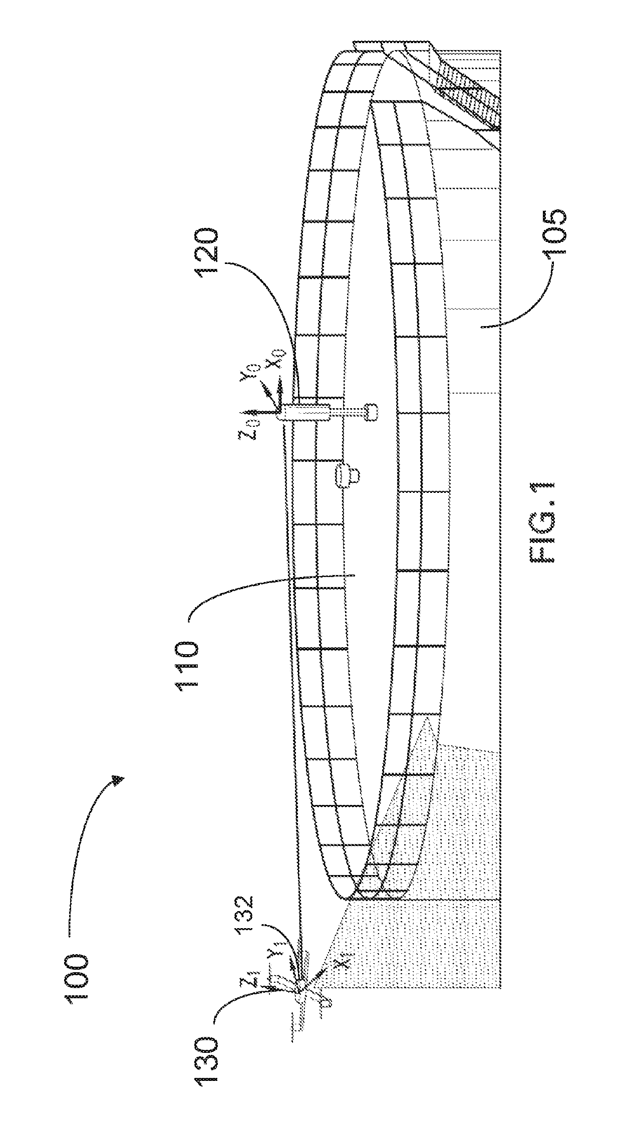
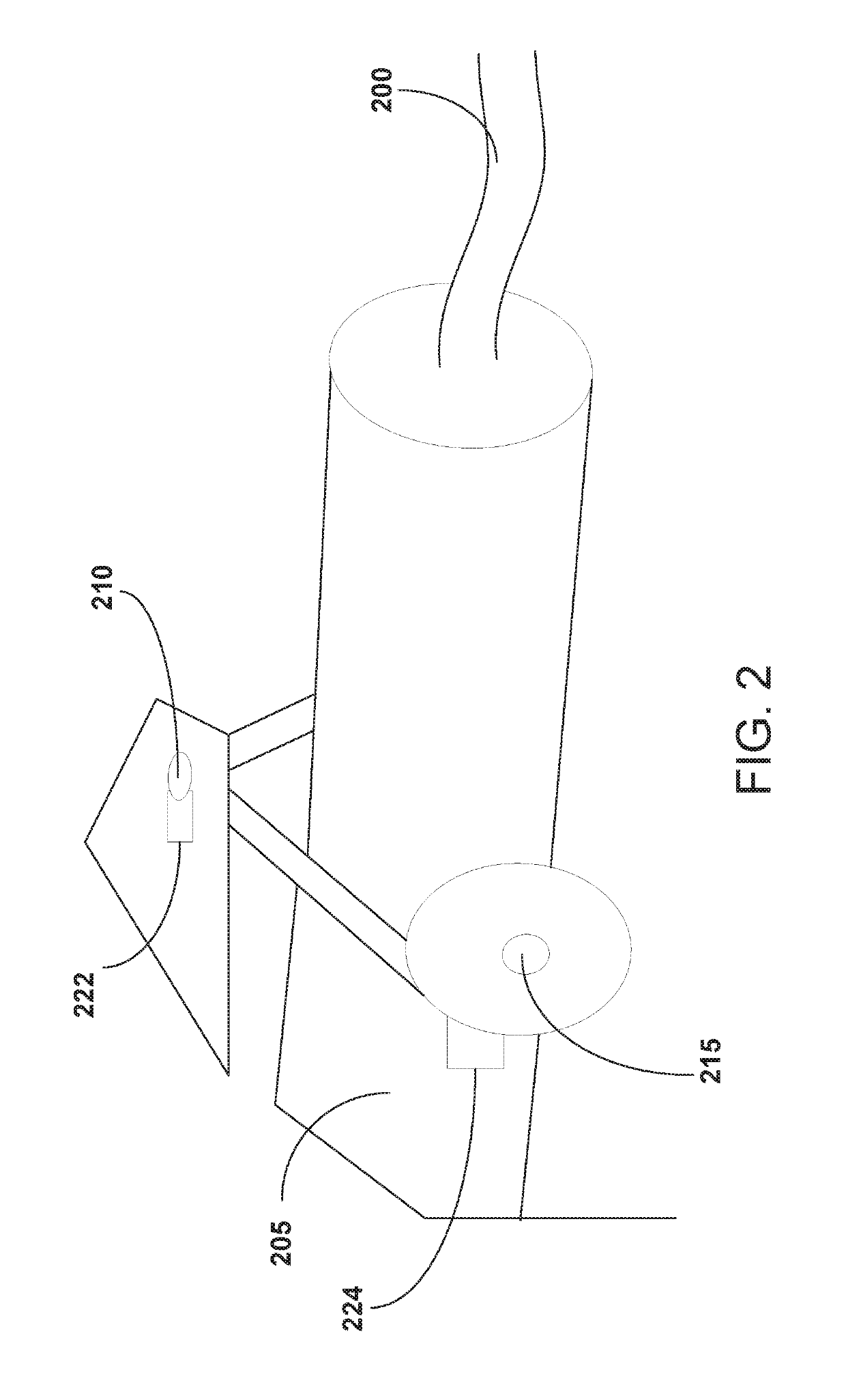
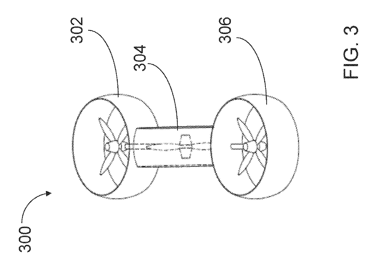
[0024]By way of overview, the present disclosure describes a method and system for calibrating a structure, such as a fuel storage tank. An unmanned aerial vehicle (sometimes referred to as a drone, but hereinafter referred to as a “UAV”) is tethered to a fixed point on the structure and travels around the structure in a trajectory while tethered. The UAV scans the external surface of the structure while traversing the trajectory. The tethering of the structure to the fixed point creates a coordinate reference frame since the precise location of the UAV with respect to the fixed point at any time can be accurately measured. Accordingly, the scanned data of the surface of the structure can be automatically converted into spatial coordinates within the reference frame. Since the UAV is tethered during its trajectory, maintaining unassisted stability is unnecessary, and unconventional UAV designs can be employed, including three-thruster (tricopter) designs.

[0025]FIG. 1 is a perspectiv...


PUM


Abstract

A method of calibrating a structure is provided. The method includes securing a first end of a tether to a device at a fixed location on an external surface of the structure, attaching an unmanned aerial vehicle to the second end of the tether, moving the unmanned aerial vehicle in a trajectory around the structure while tethered to the fixed device, scanning the external surface of the structure over a course of the trajectory using the unmanned aerial vehicle to obtain a mapping of the external surface of the structure, determining a position of the unmanned aerial vehicle with respect to the fixed device; and calibrating the structure based on i) the determined position of the unmanned aerial vehicle with respect to the fixed device, and ii) the mapping of external surface of the structure.

Description

FIELD OF THE INVENTION[0001]The present invention relates to structural calibration and mapping methods, and in particular relates to a technique that uses an unmanned aerial vehicle (UAV) to map large objects in three-dimensions.BACKGROUND OF THE INVENTION[0002]In the oil and gas industry the volume of storage tanks is calibrated periodically in order to be able to accurately determine the amount of fuel stored in the tank. Typically, a level gauge is used to determine the amount of fuel in a tank. However, storage tanks located in environments subject to high average temperatures tend to expand non-uniformly. The expansions are often difficult to measure accurately and can have an appreciable effect on the total volume. When the volume of a tank changes, the accuracy of standard gauge readings, which are based on a static volume of the tank, diminish. Inaccurate fuel level readings can lead to systematic undervaluation of fuel assets and consequent loss of revenue during custodial...

Claims


Application Information

Patent Timeline
Patent Type & Authority Patents(United States)
IPC IPC(8): G05D1/00G01S17/42G01S17/89G01S7/48G01S17/66G01S7/497
CPCG05D1/0094G01S7/4808G01S7/497G01S17/66G01S17/89G05D1/0088G01S17/42B64C2201/141G01F17/00G05D1/678G05D2105/89G05D2109/254G05D1/689G05D2111/17G05D2107/70B64U2201/10
Inventor CARRASCO ZANINI, PABLOABDELLATIF, FADL
Owner SAUDI ARABIAN OIL CO
Learn More