Updating missing attributes in navigational map data via polyline geometry matching

a technology of navigation map and attribute, applied in the field of navigation map data, can solve the problems of inability to compare inability to enhance map data from different sources, and inability to achieve the comparison of geometry for all entries, so as to reduce the size of the set of chain candidates

a technology of navigation map and attribute, applied in the field of navigation map data, can solve the problems of inability to compare inability to enhance map data from different sources, and inability to achieve the comparison of geometry for all entries, so as to reduce the size of the set of chain candidates

US10830594B2Active Publication Date: 2020-11-10HUANDA COMPUTER (SHANGHAI) CO LTD +1

Image

  • Updating missing attributes in navigational map data via polyline geometry matching
  • Updating missing attributes in navigational map data via polyline geometry matching
  • Updating missing attributes in navigational map data via polyline geometry matching

Examples


Embodiment Construction

[0017]The present invention provides a method of calculating and updating attributes missing in one dataset, using attributes from another dataset. If data have good geometry but poor additional information, it may be a good idea to fill missed attributes using attributes from the different dataset. This process may be tricky because geometry from different sources rarely match well.

[0018]To overcome the problem of enhancement of digital map data to include missing attributes from different sources taking an unacceptable amount of time, the present application reduces the number of necessary comparisons by avoiding comparison of definitely different objects.

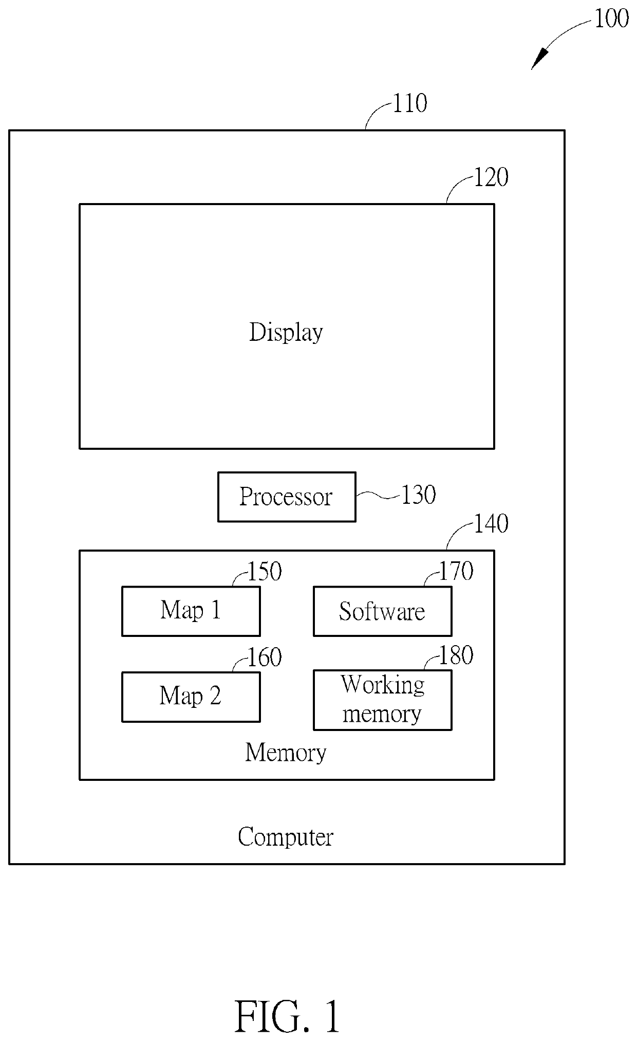
[0019]To accomplish this goal, the inventor has developed the following algorithm, which may be implemented on a computer 100 shown in FIG. 1. The computer 100 may comprise a case 110, a display 120, a processor 130, and a memory 140. The memory 140 may comprise stored map 1 data 150, stored map 2 data 160, software 170 configure...


PUM


Abstract

A method of updating navigational map data with missed attributes via polyline geometry matching includes obtaining first and second navigational map data sets. Chains are built of original road elements of the first navigational map data and chains are built of original road elements of the second navigational map data set. A spatial index of the chains is created. A set of chain candidates that are within a predetermined distance of each other is created according to the spatial index. The size of the set of chain candidates is reduced utilizing an angle filter. Each remaining chain candidate of the reduced set of chain candidates is ranked and the chain candidate having a best ranking is selected as the best candidate chain. The first navigational map data set is updated utilizing attributes from the best candidate chain.

Description

BACKGROUND OF THE INVENTION1. Field of the Invention[0001]The application relates to navigational map data, and particularly to updating missing attributes in navigational map data from one data set using attributes from another dataset via polyline geometry matching.2. Description of the Prior Art[0002]The problem of enhancement of map data from different sources is rather complicated. It is necessary to find objects from different vendors with similar geometry to use the attributes for enhancement of data. Due to enormous data size, it is impossible to compare geometry for all entries, because it will take unacceptable time.SUMMARY OF THE INVENTION[0003]A method of updating navigational map data with missed attributes via polyline geometry matching is proposed. The method includes obtaining a first navigational map data set to be updated and a second navigational map data set different from the first navigational map data set. Chains are built of original road elements of the firs...

Claims


Application Information

Patent Timeline
10 Nov 2020
Publication
US10830594B2
IPC
G01C21/32; G09B29/10; G09B29/00; G06F16/29
CPC
G01C21/32; G09B29/106; G06F16/29; G09B29/004; G01C21/3867; G01C21/3815
Inventors
KUO, JUHANG; KRUKOV, ILYA