

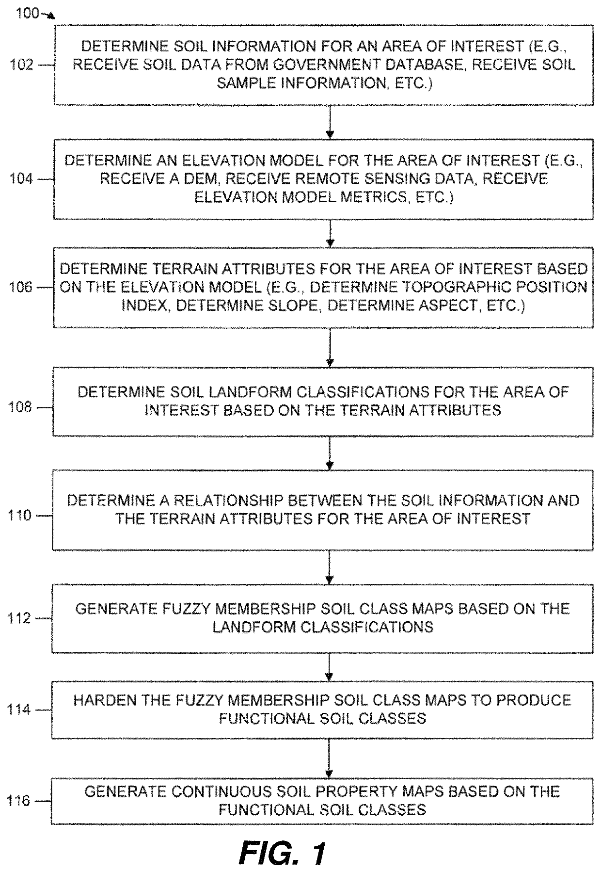
Functional soil maps
a soil map and functional technology, applied in the field of systems and methods of generating functional soil maps, can solve the problems of not providing guidance in altering management strategies, based on information stored in maps, and high-level maps that do not take into account the topography and landscape effects of soil characteristics on the surface, etc., to achieve the effect of improving management techniques
- Summary
- Abstract
- Description
- Claims
- Application Information
AI Technical Summary
Benefits of technology
Problems solved by technology
Method used
Image

Examples
Embodiment Construction
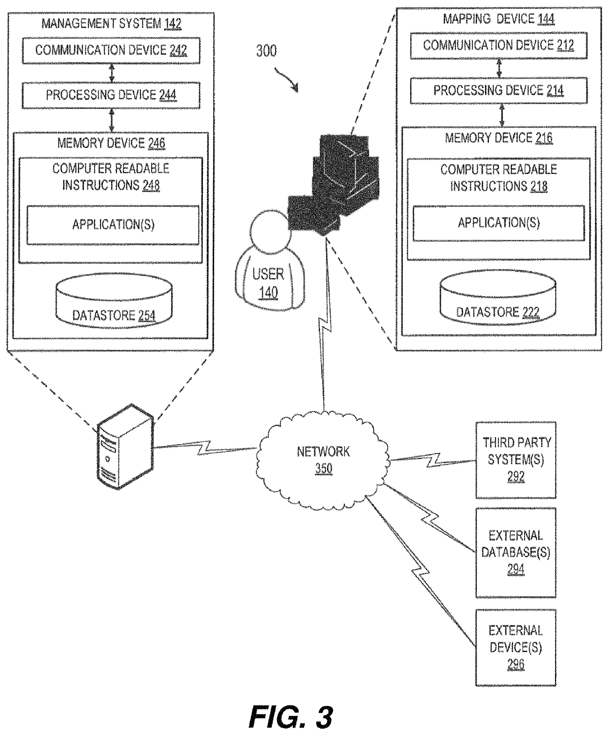
[0027]Embodiments of the present disclosure will now be described more fully hereinafter with reference to the accompanying drawings, in which some, but not all, embodiments are shown. Indeed, the disclosure may be embodied in many different forms and should not be construed as limited to the embodiments set forth herein; rather, these embodiments are provided so that this disclosure will satisfy applicable legal requirements. Additionally, while embodiments are disclosed as “comprising” elements, it should be understood that the embodiments may also “consist of” elements or “consist essentially of” elements. Where possible, any terms expressed in the singular form herein are meant to also include the plural form and vice versa unless explicitly stated otherwise. Also, as used herein, the term “a” and / or “an” shall mean “one or more,” even though the phrase “one or more” is also used herein. Like numbers refer to like elements throughout.
[0028]Throughout this disclosure, various inf...
PUM
| Property | Measurement | Unit |
|---|---|---|
| elevation model | aaaaa | aaaaa |
| elevation model | aaaaa | aaaaa |
| depths | aaaaa | aaaaa |
Abstract
Description
Claims
Application Information