
Apparatus and method for downloading and displaying images relating to global positioning information in a navigation system

a technology of global positioning information and image signal, which is applied in the direction of navigation instruments, process and machine control, instruments, etc., can solve the problem of difficulty in accurately comprehending a panoramic view of the area in which the navigation system is located using such display methods

Inactive Publication Date: 2005-01-06
SAMSUNG ELECTRONICS CO LTD
View PDF13 Cites 205 Cited by
  • Summary
  • Abstract
  • Description
  • Claims
  • Application Information

AI Technical Summary

Benefits of technology

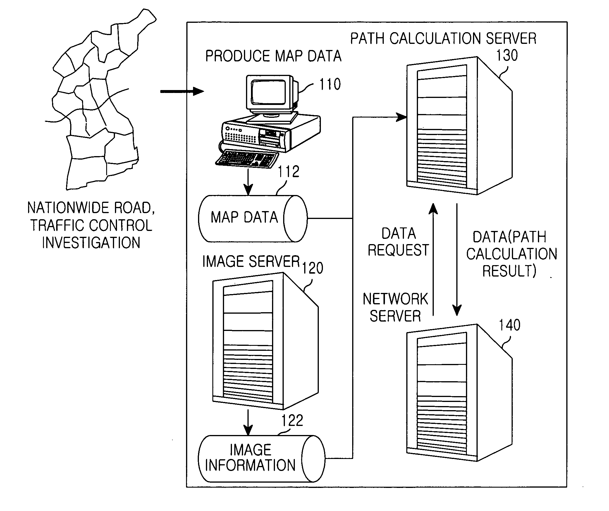
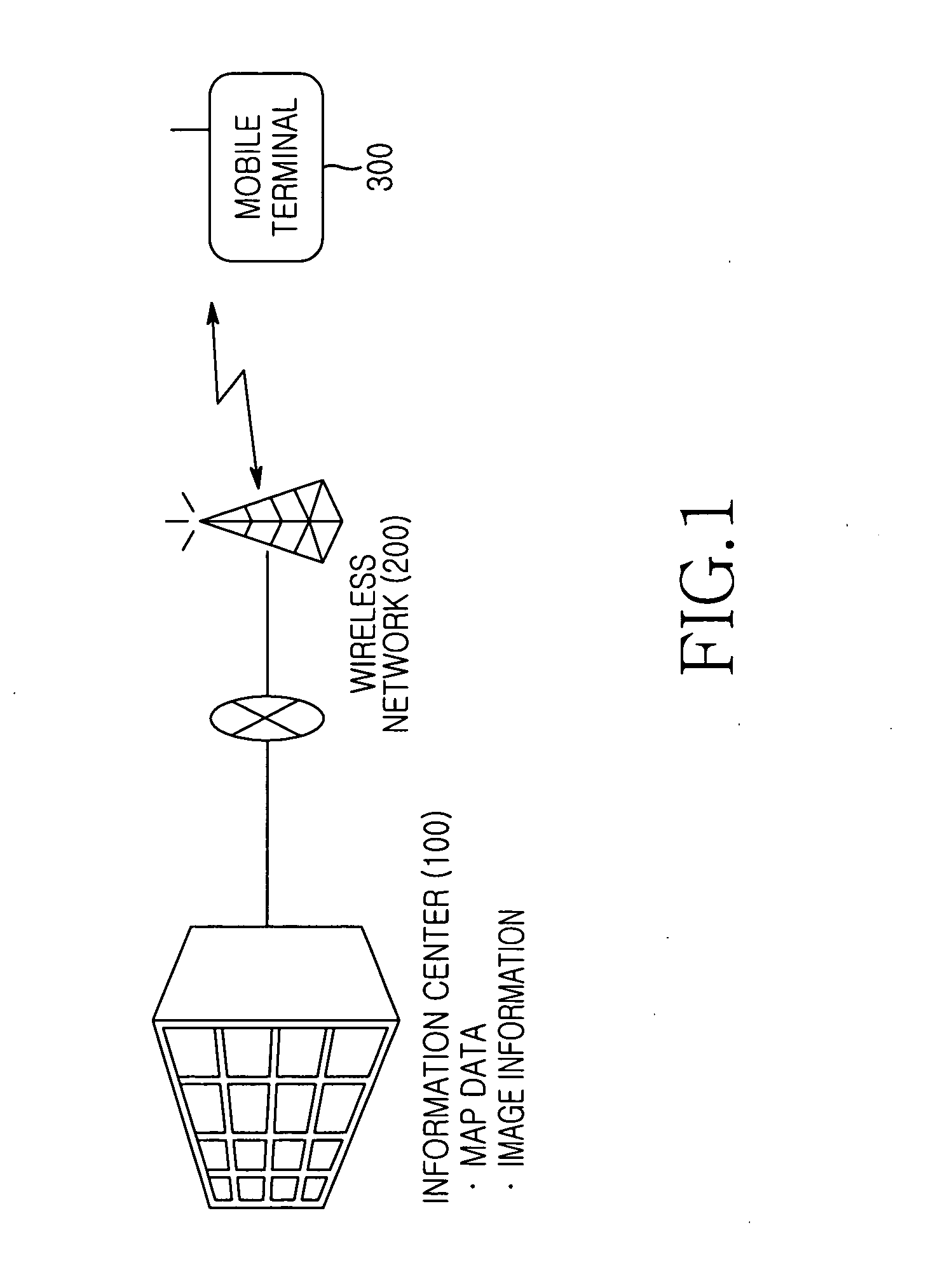
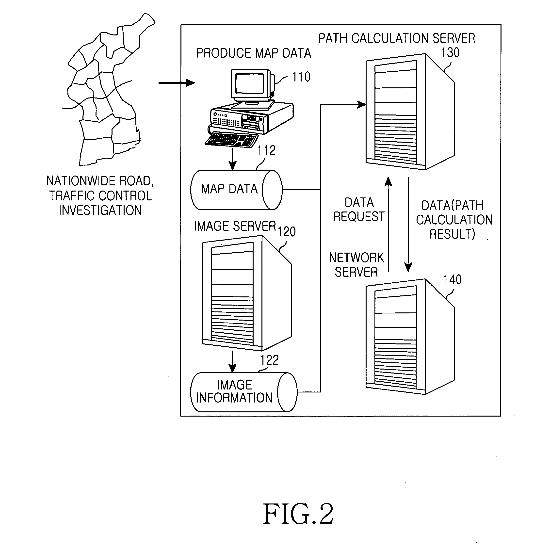
[0015] In order to accomplish the aforementioned object, according to one aspect of the present, there is provided a navigation system comprising mobile terminals and an information center apparatus, wherein the information center apparatus includes a map database for storing map data; an image information database for storing node image information of topographic features of a node, the node image information including partial image information according to a direction of movement of a mobile terminal; and a path server for calculating a travel path of the mobile terminal from a current position to a destination of the mobile terminal to transmit the map data, generating a node message for guiding a next node point whenever the mobile terminal reaches a node point, and transmitting partial image information of the node image information corresponding to the direction of movement of the mobile terminal, and the mobile terminal includes: a Global Positioning System (GPS) receiver for receiving current position information of the mobile terminal from a GPS; a velocity sensor for detecting a movement speed of the mobile terminal; a control unit for transmitting the position information of the mobile terminal to the information center apparatus, receiving the node message of the next node point transmitted from the information center apparatus whenever the mobile terminal reaches a node point, and displaying the partial image information corresponding to the direction of movement of the mobile terminal; and a display unit for displaying image information output from the second control unit.

Problems solved by technology

Accordingly, it is difficult to accurately comprehend a panoramic view of an area in which the navigation system is located using such display methods.

Method used


Image

  • Apparatus and method for downloading and displaying images relating to global positioning information in a navigation system
  • Apparatus and method for downloading and displaying images relating to global positioning information in a navigation system
  • Apparatus and method for downloading and displaying images relating to global positioning information in a navigation system

Examples


Embodiment Construction

[0030] Hereinafter, a preferred embodiment according to the present invention will be described with reference to the accompanying drawings. In the following description of the present invention, a detailed description of known functions and configuration incorporated herein will be omitted for conciseness.

[0031] A navigation system according to an embodiment of the present invention receives its position information from a Global Positioning System (GPS), receives image information of topographic features in the received position information, and displays the received image information. Accordingly, the navigation system can confirm visually topographic features for the next position along the direction of movement of the navigation system. An embodiment of the present invention provides a navigation system for downloading and displaying the image information in the direction of movement of the navigation system. Further, in an embodiment of the present invention, it is assumed th...


PUM


Abstract

An apparatus and method for a navigation system including an information center and a mobile terminal is disclosed. The information center stores node image information on topographic features of a node. The node image information includes partial image information according to a direction of movement of the mobile terminal. The information center includes a database for storing a node message having the partial image information and a database for storing map data. The information center generates the node message for guiding the next node point whenever the mobile terminal reaches a node point, and transmits partial image information of the node image information corresponding to the direction of movement of the mobile terminal. The mobile terminal displays the image information of the node received at each node point and confirms a movement path.

Description

PRIORITY [0001] This application claims the benefit under 35 U.S.C. § 119(a) of an application entitled “Apparatus and method for downloading and displaying images relating to global position information in navigation system” filed in the Korean Intellectual Property Office on Jun. 3, 2003 and assigned Serial No. 2003-35751, the entire contents of which are incorporated herein by reference.BACKGROUND OF THE INVENTION [0002] 1. Field of the Invention [0003] The present invention relates to an apparatus and a method for downloading and displaying an image signal. More particularly, the present invention relates to an apparatus and a method for downloading and displaying an image signal relating to position information in a geographic information system. [0004] 2. Description of the Related Art [0005] Communication terminals provided with global positioning system (hereinafter, referred to as a GPS) equipments typically determine their position through signals received from the GPS. Fu...

Claims


Application Information

Patent Timeline
IPC IPC(8): G01C21/36G08G1/0962G08G1/0969
CPCG01C21/3647G08G1/0969G01C21/3682G01C21/3655G08G1/0962H04W4/12
Inventor PARK, YOUNG-SIK
Owner SAMSUNG ELECTRONICS CO LTD
Learn More