Method and system for automated incident traffic reporting and dynamic routing

a traffic report and automatic technology, applied in surveying and navigation, instruments, navigation instruments, etc., can solve problems such as weather delays, current accidents, and construction events, and achieve the effect of avoiding traffic accidents, avoiding traffic accidents, and avoiding traffic accidents

Inactive Publication Date: 2005-10-06
IBM CORP
View PDF7 Cites 27 Cited by
  • Summary
  • Abstract
  • Description
  • Claims
  • Application Information

AI Technical Summary

Problems solved by technology

GPS devices installed in automobiles and other vehicles, typically, do not simply calculate a longitude and latitude of the automobile or vehicle.
However, these directions do not take into account current accidents, construction events, weather delays, or other environmental conditions that can affect driving times.

Method used


Image

  • Method and system for automated incident traffic reporting and dynamic routing
  • Method and system for automated incident traffic reporting and dynamic routing
  • Method and system for automated incident traffic reporting and dynamic routing

Examples


Embodiment Construction

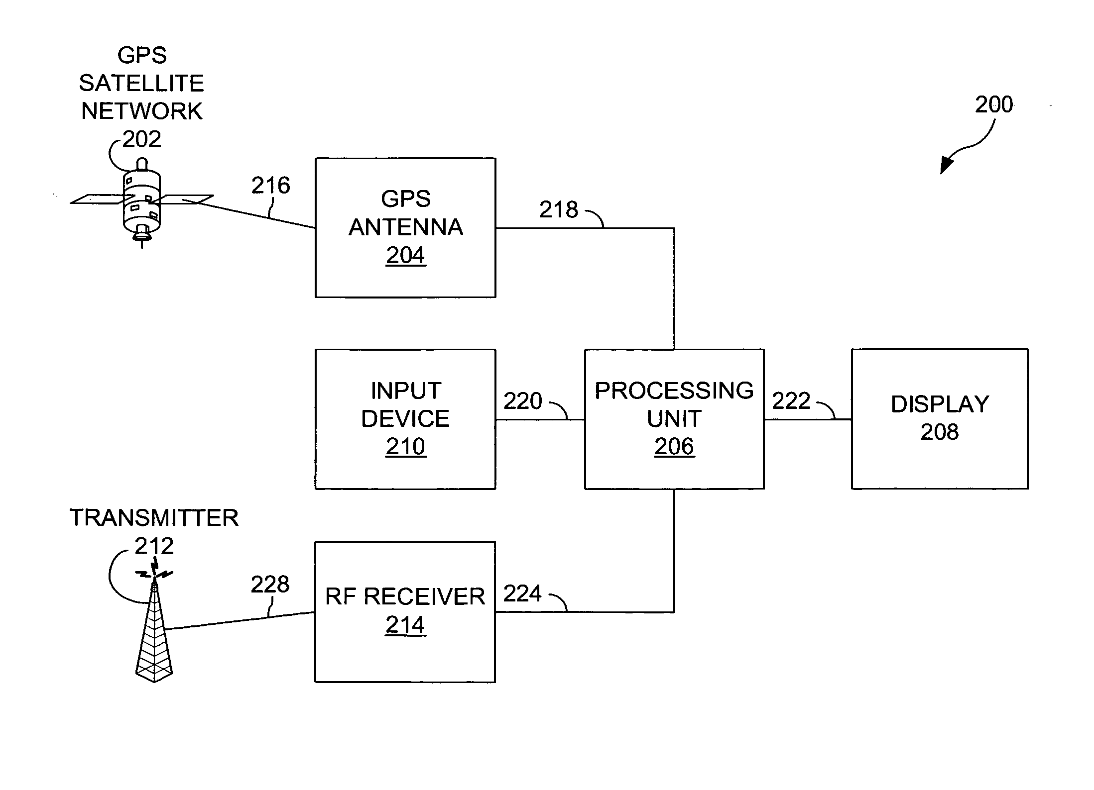
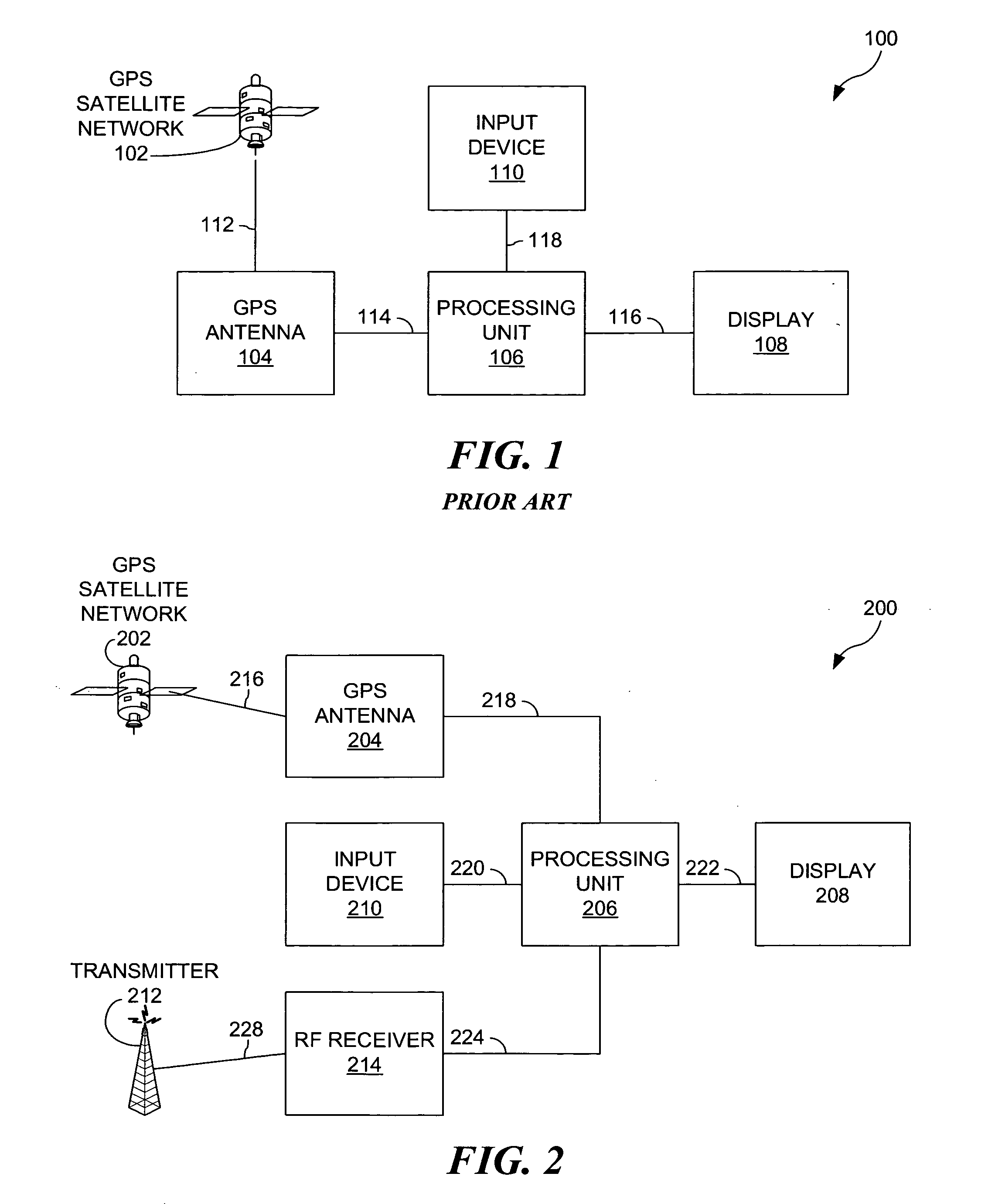
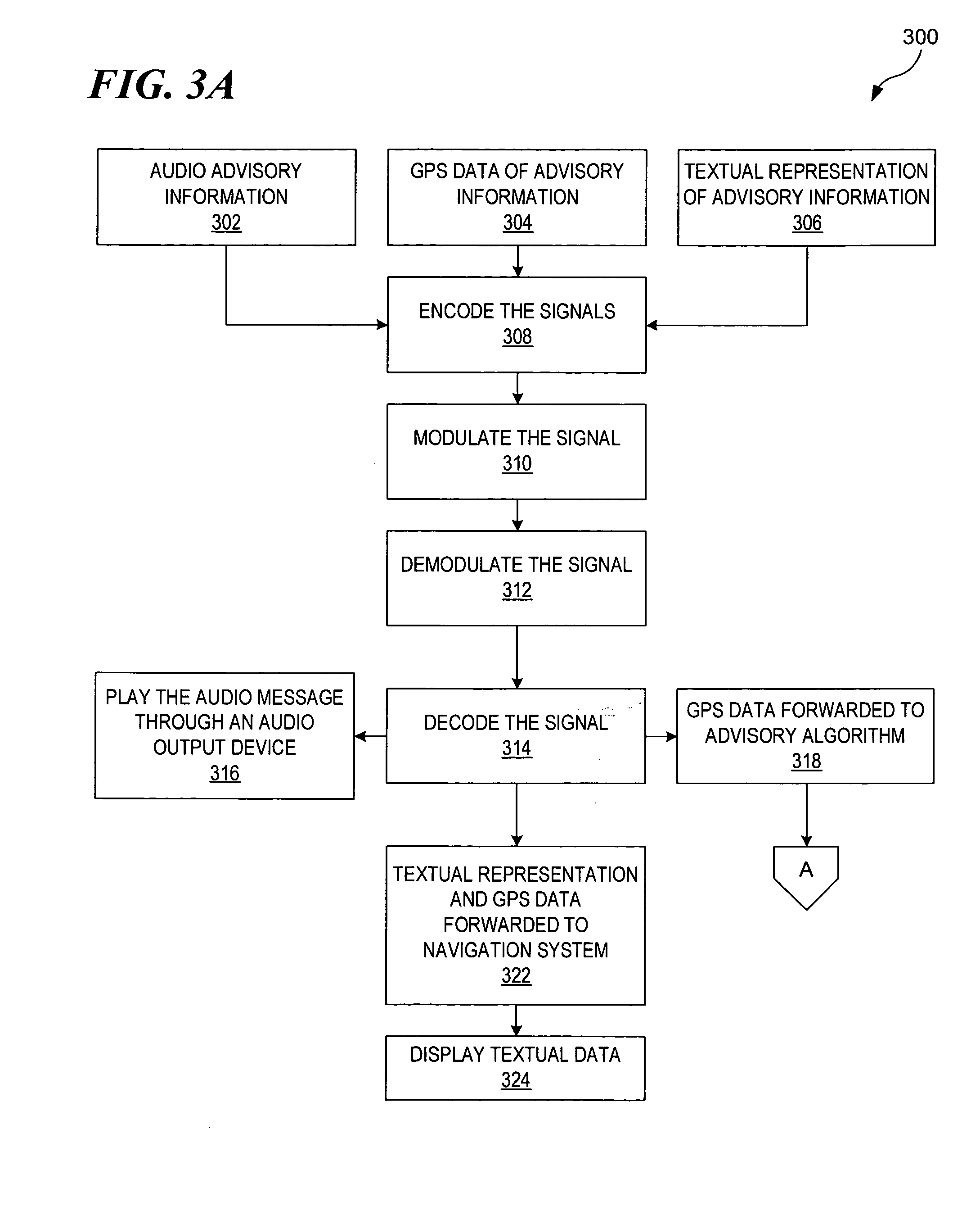
[0011] In the following discussion, numerous specific details are set forth to provide a thorough understanding of the present invention. However, those skilled in the art will appreciate that the present invention may be practiced without such specific details. In other instances, well-known elements have been illustrated in schematic or block diagram form in order not to obscure the present invention in unnecessary detail. Additionally, for the most part, details concerning network communications, electro-magnetic signaling techniques, and the like, have been omitted inasmuch as such details are not considered necessary to obtain a complete understanding of the present invention, and are considered to be within the understanding of persons of ordinary skill in the relevant art.

[0012] It is further noted that, unless indicated otherwise, all functions described herein may be performed in either hardware or software, or some combinations thereof. In a preferred embodiment, however,...


PUM


Abstract

A method, an apparatus, and a computer program are provided for dynamically routing traffic routs based on traffic reports. Utilizing current in-car navigation systems, a new implementation of that system can be developed where alternate routes can be plotted around varying traffic events. By receiving radio or Radio Frequency (RF) communications regarding current traffic conditions, the in-car navigation system can be modified to plot alternate routes. Also, the in-car navigation systems could utilize computer memory to develop histories of events so that reoccurring traffic events such as rush hour conditions can be avoided.

Description

FIELD OF THE INVENTION [0001] The present invention relates generally to the real-time acquisition of traffic data and, more particularly, to acquisition of traffic data based on the use of Global Positioning System (GPS). DESCRIPTION OF THE RELATED ART [0002] In automobiles and other vehicles, GPS units have become commonplace. The GPS system utilizes 24 satellites in varying orbits to transmit signals to GPS receivers. A GPS receiver receives a minimum of signals from 4 satellites to triangulate the relative position of the receiver in relation to the satellites. Then comparing that relative position to a map, the receiver can calculate the position on Earth. [0003] GPS devices installed in automobiles and other vehicles, typically, do not simply calculate a longitude and latitude of the automobile or vehicle. The GPS device, with a GPS receiver included, usually have a number of other features. Further incorporated in the GPS receivers are varying programs, equipment, and databas...

Claims


Application Information

Patent Timeline
Patent Type & Authority Applications(United States)
IPC IPC(8): G01C21/34G08G1/09
CPCG01C21/3492G08G1/096827G08G1/096844
Inventor HAMILTON, RICK ALLENSCHWARTZ, MICHAEL EDWARDSEAMAN, JAMES WESLEYWATERS, TIMOTHY MOFFETT
Owner IBM CORP
Why Eureka
Try Eureka