Method for quantifying plant resources using gis
a plant resource and gis technology, applied in the field of gis-based methods for quantifying plant resources, can solve the problems of large cost and time requirements, and achieve the effects of less manpower, time and cost, efficient surveying and analysis, and easy recognition
- Summary
- Abstract
- Description
- Claims
- Application Information
AI Technical Summary
Benefits of technology
Problems solved by technology
Method used
Image
Examples
Embodiment Construction
[0037] The method for quantifying plant resources using a GIS according to a preferred embodiment of the present invention will be described with reference to the accompanying drawings.
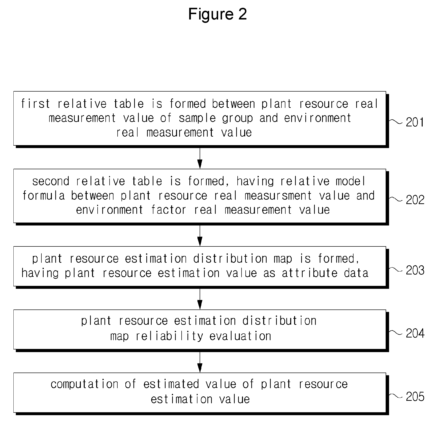
[0038]FIG. 2 is a schematic flow chart of an example of a method for quantifying plant resources using a GIS according to the present invention.
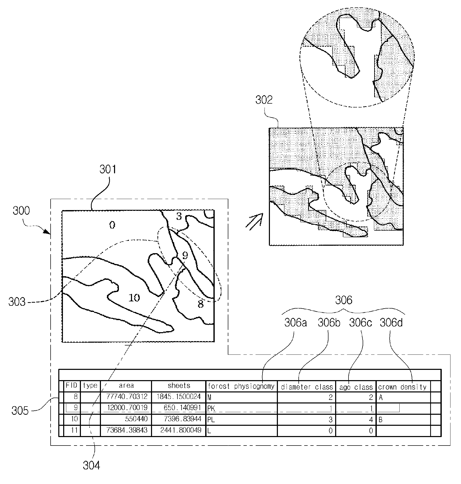
[0039] As shown in FIG. 2, the method for quantifying plant resources using a GIS according to an embodiment of the present invention comprises a first step 201 in which a sample group is extracted from a mother group, and a first relative table is formed between a plant resource real measurement value of the sample group and an environment factor real measurement value; a second step 202 in which a second relative table is made by extracting a relative model formula between a plant resource real measurement value and an environment factor real value by relating the first relative table using a certain statistic analysis program; and a third step 203 in whic...
PUM
 Abstract
Description
Claims
Application Information
 - R&D
- Intellectual Property
- Life Sciences
- Materials
- Tech Scout
- Unparalleled Data Quality
- Higher Quality Content
- 60% Fewer Hallucinations
Browse by: Latest US Patents, China's latest patents, Technical Efficacy Thesaurus, Application Domain, Technology Topic, Popular Technical Reports.
© 2025 PatSnap. All rights reserved.Legal|Privacy policy|Modern Slavery Act Transparency Statement|Sitemap|About US| Contact US: help@patsnap.com


