Method and System for Generating an Image-Textured Digital Surface Model (DSM) for a Geographical Area of Interest

a digital surface model and geographic area technology, applied in the field of topography, can solve the problems of not providing the desired results for geographic areas of interest, the approach may not provide the desired results, and the features on the side of such objects may not be adequately captured by a single nadir imag

Active Publication Date: 2007-11-15
HARRIS CORP
View PDF24 Cites 70 Cited by
  • Summary
  • Abstract
  • Description
  • Claims
  • Application Information

AI Technical Summary

Benefits of technology

[0012] By way of example, the polygons may be triangles. The predetermined position grid may include a plurality of spaced apart posts, and the polygons may have vertices positioned on the posts. Also, the posts may have a uniform spacing therebetween of less than about 100 cm, and the oblique optical images may have a resolution higher than about 20 cm, for example. Furthermore, the collection of optical images may furthe

Problems solved by technology

While this approach may provide a very realistic looking DSM of the area of interest, this approach is very labor intensive and thus cost prohibitive for many applications.
While this approach may provide fairly realistic texturing for DEMs of relatively undeveloped terrain, this approach may not provide desired results for geographical areas of interest, such as cities, which include a large number of manmade objects.
This

Method used


Image

  • Method and System for Generating an Image-Textured Digital Surface Model (DSM) for a Geographical Area of Interest
  • Method and System for Generating an Image-Textured Digital Surface Model (DSM) for a Geographical Area of Interest
  • Method and System for Generating an Image-Textured Digital Surface Model (DSM) for a Geographical Area of Interest

Examples


Embodiment Construction

[0020] The present invention will now be described more fully hereinafter with reference to the accompanying drawings, in which preferred embodiments of the invention are shown. This invention may, however, be embodied in many different forms and should not be construed as limited to the embodiments set forth herein. Rather, these embodiments are provided so that this disclosure will be thorough and complete, and will fully convey the scope of the invention to those skilled in the art. Like numbers refer to like elements throughout, and prime notation is used to indicate similar elements in alternative embodiments.

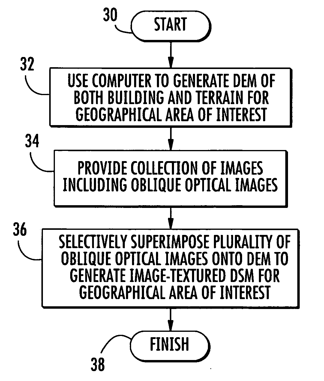
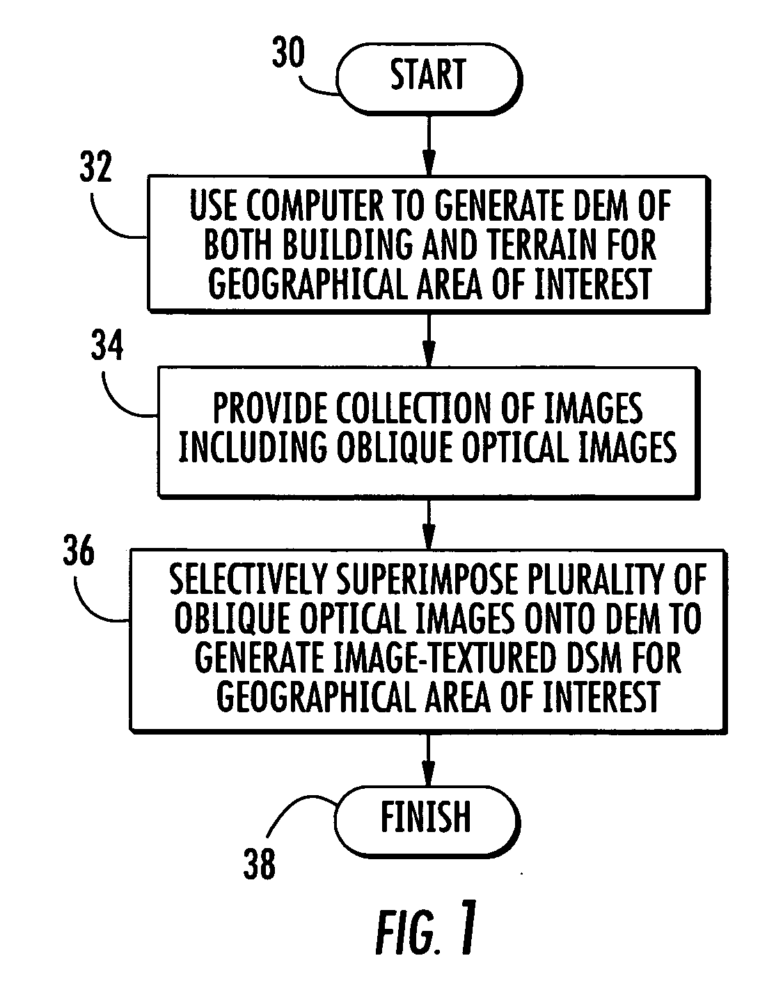
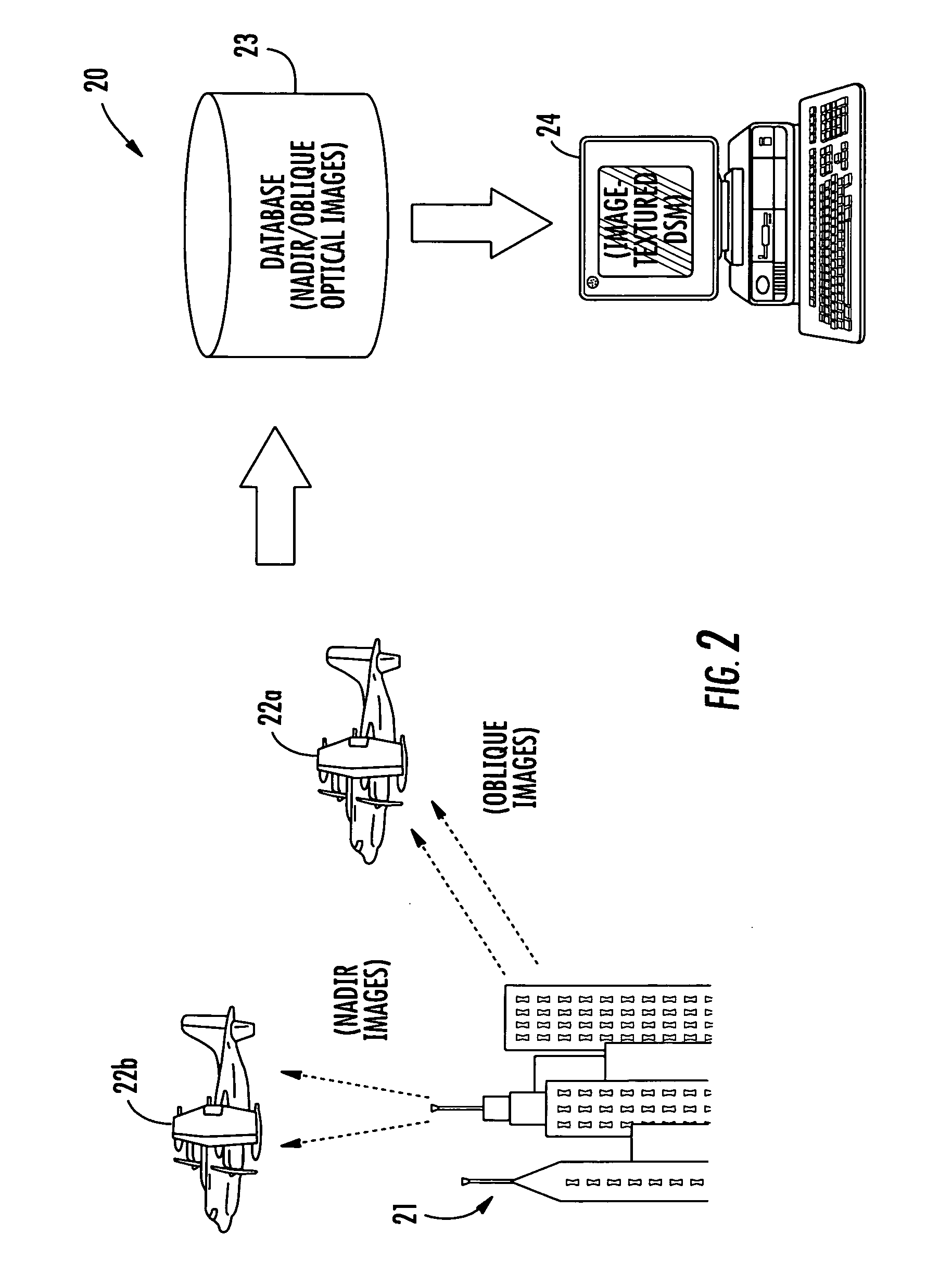
[0021] Referring initially to FIGS. 1 through 3, a method and system 20 for generating an image-textured digital surface model (DSM) for a geographical area of interest 21 is first described. Beginning at Block 30, the method illustratively includes generating a digital elevation model (DEM) of both buildings and terrain for the geographical area of interest 21, as will b...


PUM


Abstract

A computer-implemented method for generating an image-textured digital surface model (DSM) for a geographical area of interest including both buildings and terrain may include using a computer to generate a digital elevation model (DEM) of both the buildings and terrain for the geographical area of interest. The method may further include providing a collection of optical images including oblique optical images for the geographical area of interest including both buildings and terrain. The computer may also be used to selectively superimpose oblique optical images from the collection of optical images onto the DEM of both the buildings and terrain for the geographical area of interest and to thereby generate the image-textured DSM for the geographical area of interest including both buildings and terrain.

Description

FIELD OF THE INVENTION [0001] The present invention relates to the field of topography, and, more particularly, to automated methods and related systems for generating topographical models. BACKGROUND OF THE INVENTION [0002] Topographical models of geographical areas may be used for many applications. For example, topographical models may be used in flight simulators and for planning military missions. Furthermore, topographical models of man-made structures (e.g., cities) may be extremely helpful in applications such as cellular antenna placement, urban planning, disaster preparedness and analysis, and mapping, for example. [0003] Various types and methods for making topographical models are presently being used. One common topographical model is the digital elevation map (DEM). A DEM is a sampled matrix representation of a geographical area which may be generated in an automated fashion by a computer. In a DEM, coordinate points are made to correspond with a height value. DEMs are...

Claims


Application Information

Patent Timeline
IPC IPC(8): G06F17/00G06T15/04G06T17/05
CPCG01C7/02G06T17/05G06T15/04G06Q10/02G06F3/00
Inventor NEMETHY, JOESPH M.VAN WORKUM, JOHN A.SARKAR, SHAYAN K.KARP, JOHN P.DUBOIS, DAVID W.BELL, DAVID M.KILLAM, ROBERT A.APPOLLONI, THOMAS J.VENEZIA, JOSEPH A.
Owner HARRIS CORP
Why Eureka
Try Eureka