

Method and System for Displaying Graphical Objects on a Digital Map
- Summary
- Abstract
- Description
- Claims
- Application Information
AI Technical Summary
Benefits of technology
Problems solved by technology
Method used
Image

Examples
example embodiments
DESCRIPTION OF EXAMPLE EMBODIMENTS
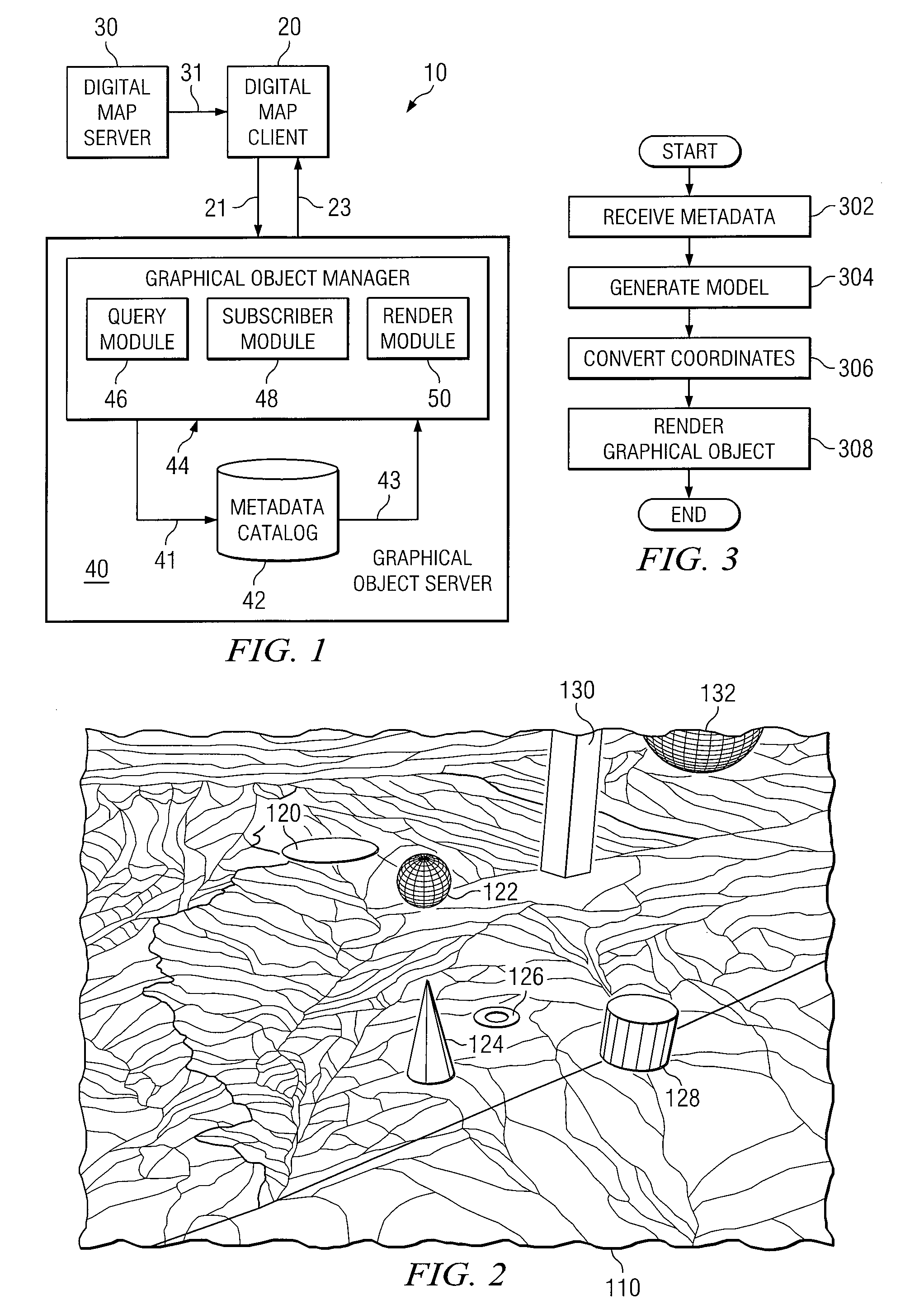
[0011]Embodiments of the present invention and its advantages are best understood by referring to FIGS. 1 through 3 of the drawings, like numerals being used for like and corresponding parts of the various drawings.
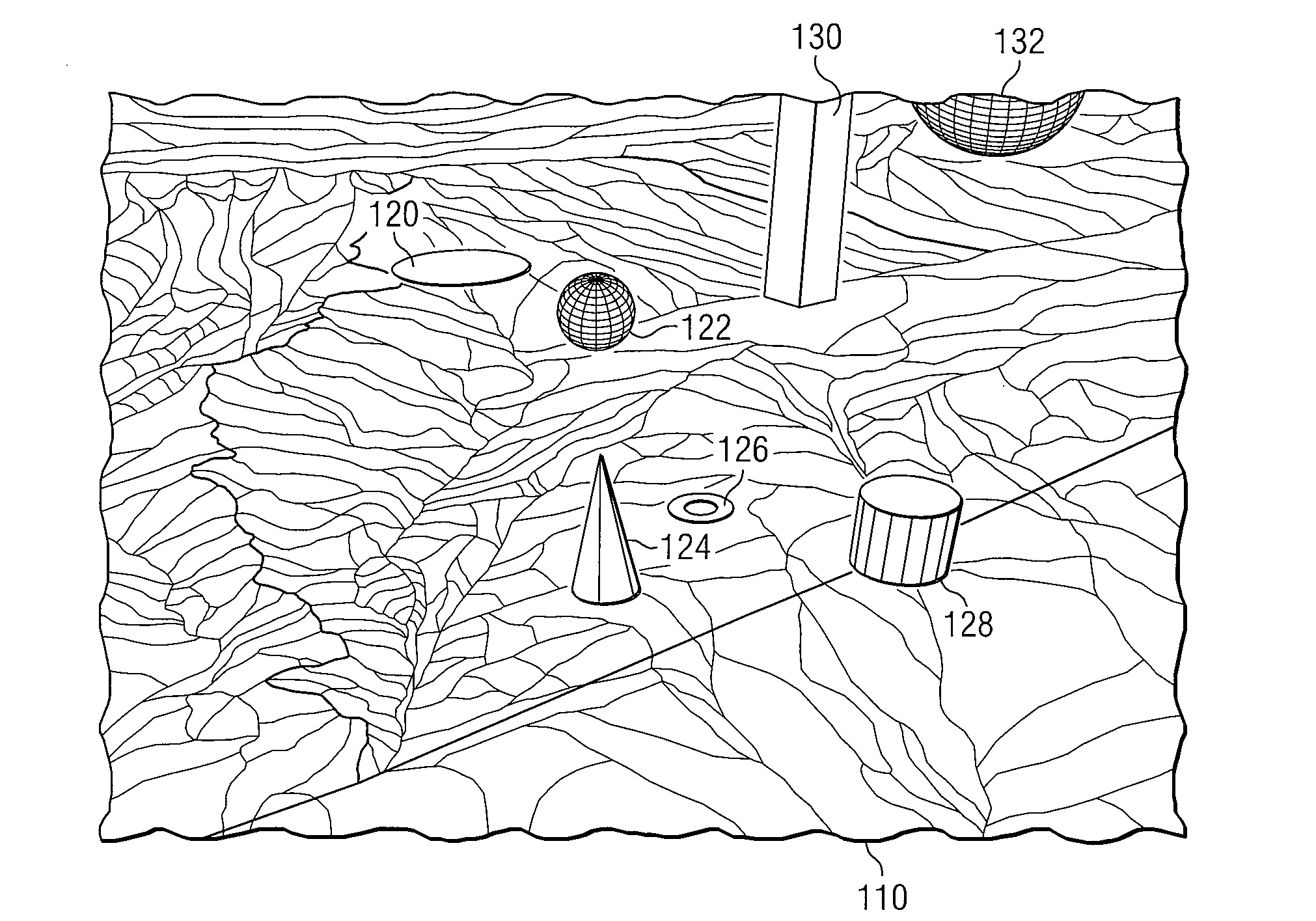
[0012]FIG. 1 is a block diagram illustrating a system 10 for displaying graphical objects on a digital map according to the teachings of the invention. As shown in FIG. 1, system 10 generally includes a digital map client 20, a digital map server 30, and a graphical object server 40. System 10 is particularly adapted for displaying graphical objects on a digital map.
[0013]Digital map client 20 may refer to any suitable device operable to display a digital map. A digital map may refer to any computerized representation of a geographic area that can be displayed and analyzed by a computer. For example, the most common method of digital map creation is digitization, where a hardcopy map is transferred into a digital medium through the use of...
PUM
 Abstract
Description
Claims
Application Information