Multiplatform TDOA correlation interferometer geolocation

a geolocation and interferometer technology, applied in the field of radio geolocation, to achieve the effect of improving the accuracy of geolocation

Active Publication Date: 2008-08-07
BAE SYST INFORMATION & ELECTRONICS SYST INTERGRATION INC
View PDF4 Cites 121 Cited by
  • Summary
  • Abstract
  • Description
  • Claims
  • Application Information

AI Technical Summary

Benefits of technology

[0039]FIG. 12 shows a subsystem that may be used to combine a copy capture arrangement with two or more antennas on each aircraft to impro

Problems solved by technology

One of the major problems with existing TDOA\FDOA geolocation algorithms is

Method used


Image

  • Multiplatform TDOA correlation interferometer geolocation
  • Multiplatform TDOA correlation interferometer geolocation
  • Multiplatform TDOA correlation interferometer geolocation

Examples


Embodiment Construction

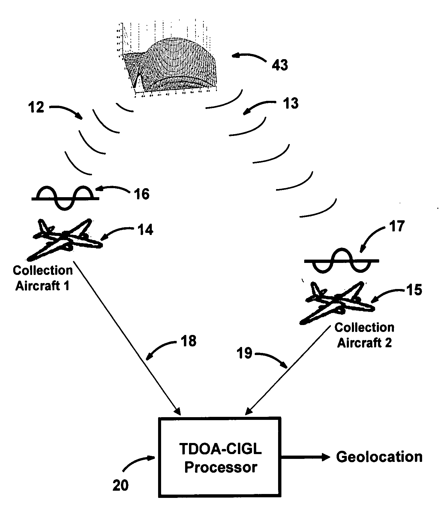
[0040]The novel combination of TDOA and CIGL signal processing described herein solves problems of the prior art and improves on transmitter geolocation from moving aircraft. CIGL is adapted to TDOA / FDOA processing as described immediately herebelow. The theory for the present invention is described after a description of the Figures.

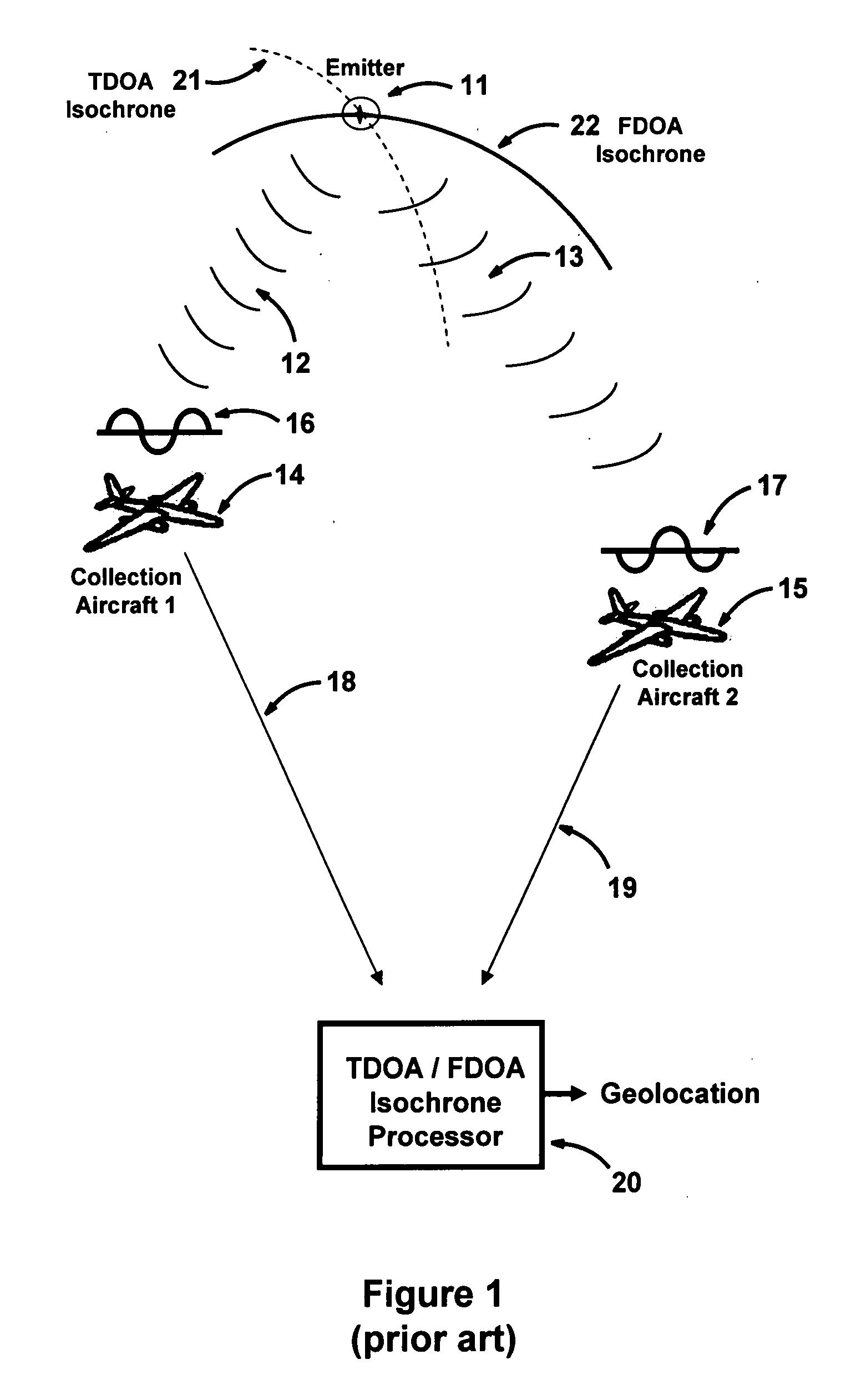
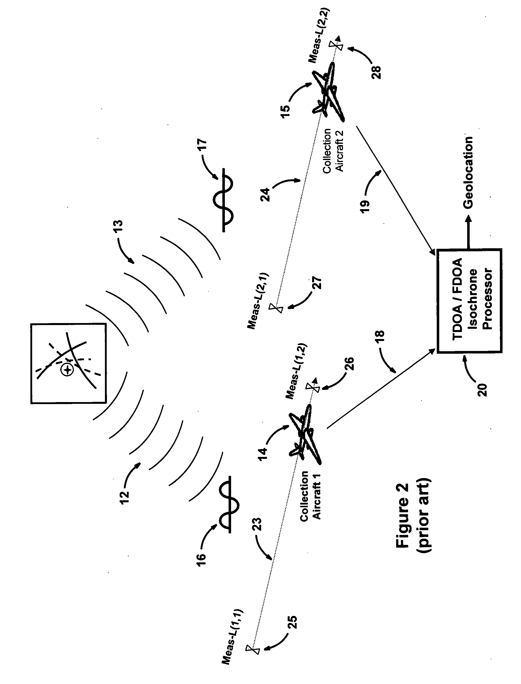
[0041]FIG. 1 shows a prior art TDOA / FDOA radio geolocation system that utilizes receivers on separate aircraft 14 and 15 receiving a signal over paths 12 and 13 from a remote emitter / transmitter 11. The radio geolocation system on the aircraft 14 and 15 processes and retransmits the received signals via paths 18 and 19 to a central TDOA / FDOA processor for determining TDOA and FDOA isochrones 21 and 22 to geolocate remote emitter / transmitter 11. Further in this specification, with reference to FIG. 3, is a detailed description of these isochrones and their use in locating transmitter 11, and of TDOA and FDOA.

[0042]A TDOA radio geolocation system utilizin...


PUM


Abstract

A radio geolocation system is described in which a plurality of moving platforms such as aircraft concurrently receive a signal from a remote transmitter and the geolocation of the transmitter is determined. At each platform every thirty seconds a plurality of samples of the received signal are taken over a one second period. The samples are digitized and a time and GPS location stamp are added to each sample. The digitized samples with time and location stamps from all platforms are transmitted to a central location and stored in covariance matrices, one matrix per one second sample period. The signal samples in each matrix are processed utilizing a unique algorithm to generate a data set which defines a correlation surface. The data from a plurality of data sets are summed together on a point by point basis and normalized to yield a summation data set which defines a summation correlation surface. The summation correlation surface has a well defined peak that defines the geolocation of the remote transmitter.

Description

FIELD OF THE INVENTION[0001]The present invention relates to radio geolocation and, more particularly, to correlating signals received from a remote transmitter using antennas and receivers on different moving platforms to determine the geographical location of the remote transmitter.BACKGROUND OF THE INVENTION[0002]In the earliest prior art the method of locating the position of a remote transmitter was to utilize a direction finding (DF) triangulation technique where signals from the transmitter are received at widely spaced DF antenna sites. A line-of-bearing (LOB) measurement to the transmitter is measured at each antenna site. When the LOBs are plotted on a map they intersect at the transmitter location. The accuracy of this intersection is directly related to the accuracy of these lines-of-bearing.[0003]In interferometric radio direction finding systems, the phase difference between signals received by two antennas and receivers is measured to determine the angle of arrival of...

Claims


Application Information

Patent Timeline
IPC IPC(8): G01S3/02G01S1/00
CPCG01S5/0221G01S5/12G01S5/06G01S5/02213G01S5/0249
Inventor STRUCKMAN, KEITH A.KABEL, ALLAN M.
Owner BAE SYST INFORMATION & ELECTRONICS SYST INTERGRATION INC
Why Eureka
Try Eureka