

Geolocating a remote emitter
a technology of remote emitter and geolocation, which is applied in the direction of measurement devices, communication jamming, instruments, etc., can solve the problems of long observation time and inaccurateness, and achieve the effect of reducing receiver noise, reducing the impact of random receiver noise, and increasing observation tim
- Summary
- Abstract
- Description
- Claims
- Application Information
AI Technical Summary
Benefits of technology
Problems solved by technology
Method used
Image

Examples
Embodiment Construction
[0016]A description of example embodiments of the present disclosure follows.
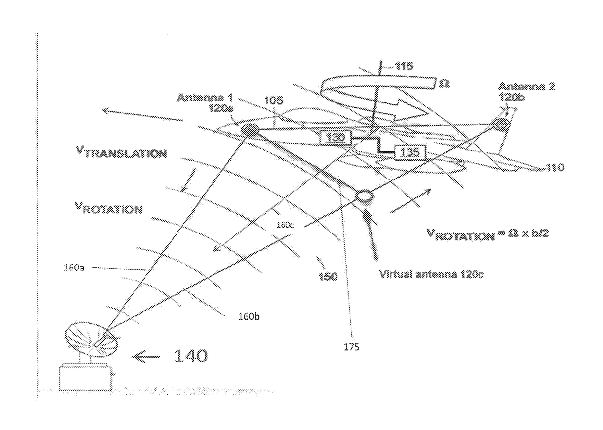
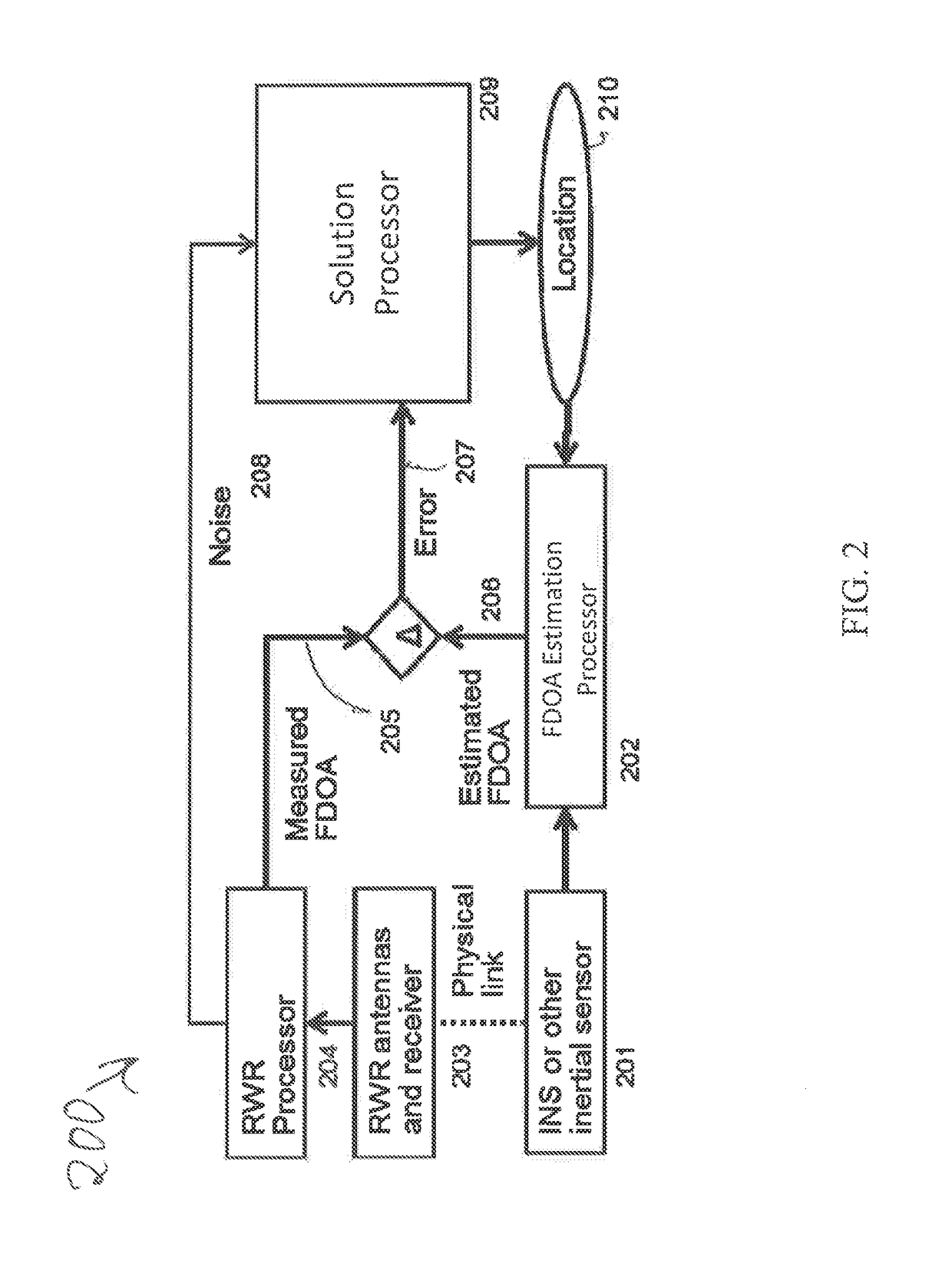
[0017]A technique for determining the location of a radar emitter is based on passive measurement of radar pulses received by two receivers separated by a fixed distance on a moving platform (e.g., an aircraft). The measured radar pulses together with measured platform motion and position, enable geometric location of the radar emitter. In the preferred embodiment, the radar measurements are made with a radar warning receiver (RWR), while the platform measurements are made with position-aided navigation system (NAV). The description to follow also applies to other embodiments, such as an acoustic or sonar system, a semi-active radar system, or an optical or ladar system.
[0018]A geolocation technique determines the location on earth of a radar emitter, using measurements of time difference of arrival (TDOA) or frequency difference of arrival (FDOA) of a pulsed waveform. Joint solutions based on TDOA and FDOA...
PUM
 Abstract
Description
Claims
Application Information