

Multi-functional map displayer
a multi-functional, map technology, applied in the direction of maps/plans/charts, navigation instruments, instruments, etc., can solve the problems of increasing costs and burdening on the money to be spent, and achieve the effect of costing for purchasing
- Summary
- Abstract
- Description
- Claims
- Application Information
AI Technical Summary
Benefits of technology
Problems solved by technology
Method used
Image

Examples
Embodiment Construction
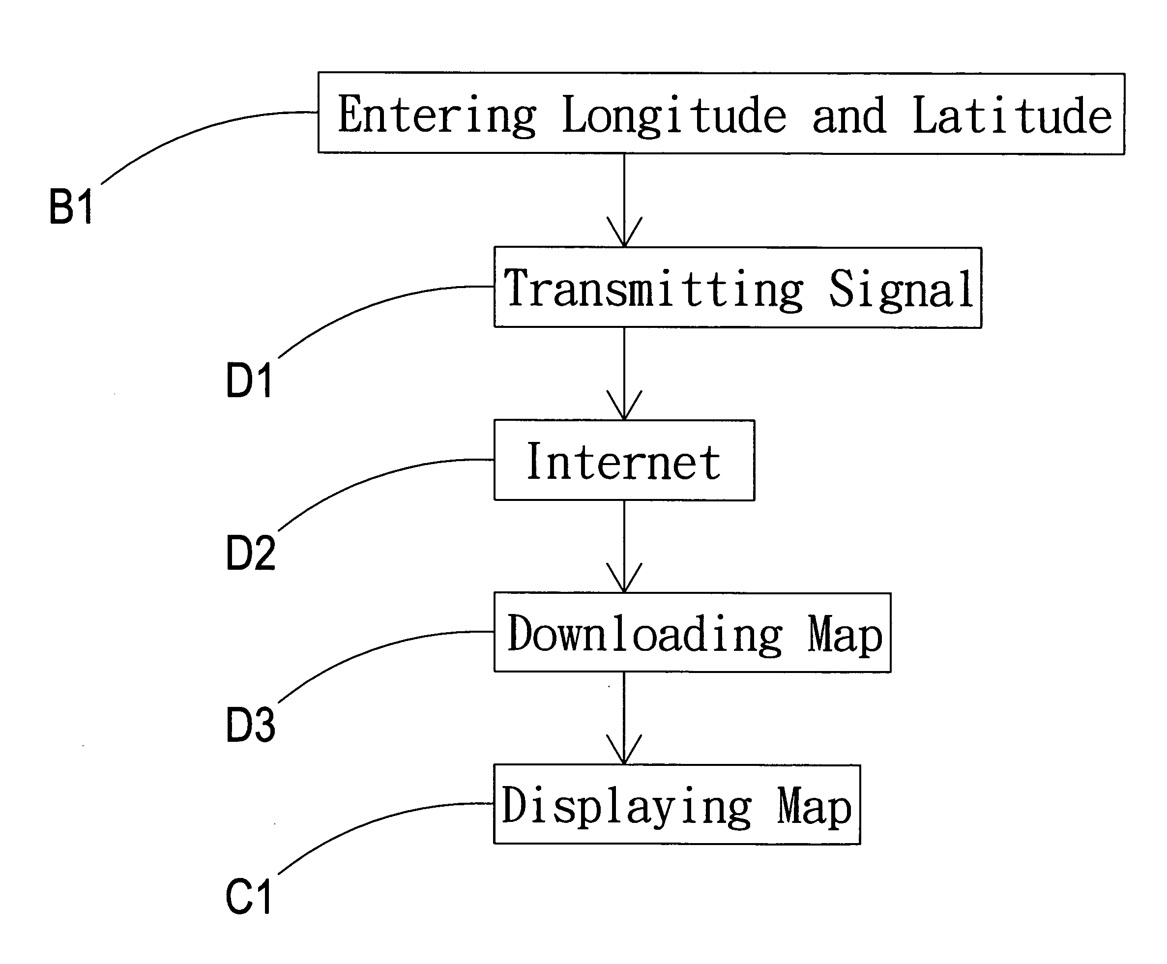
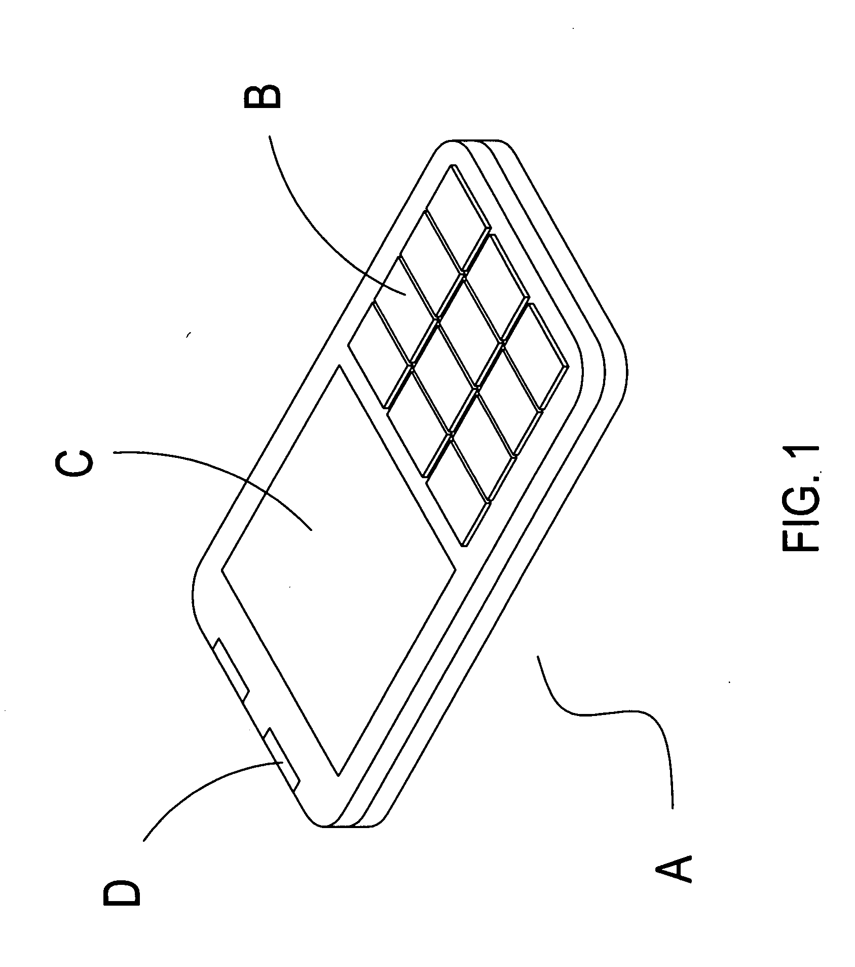
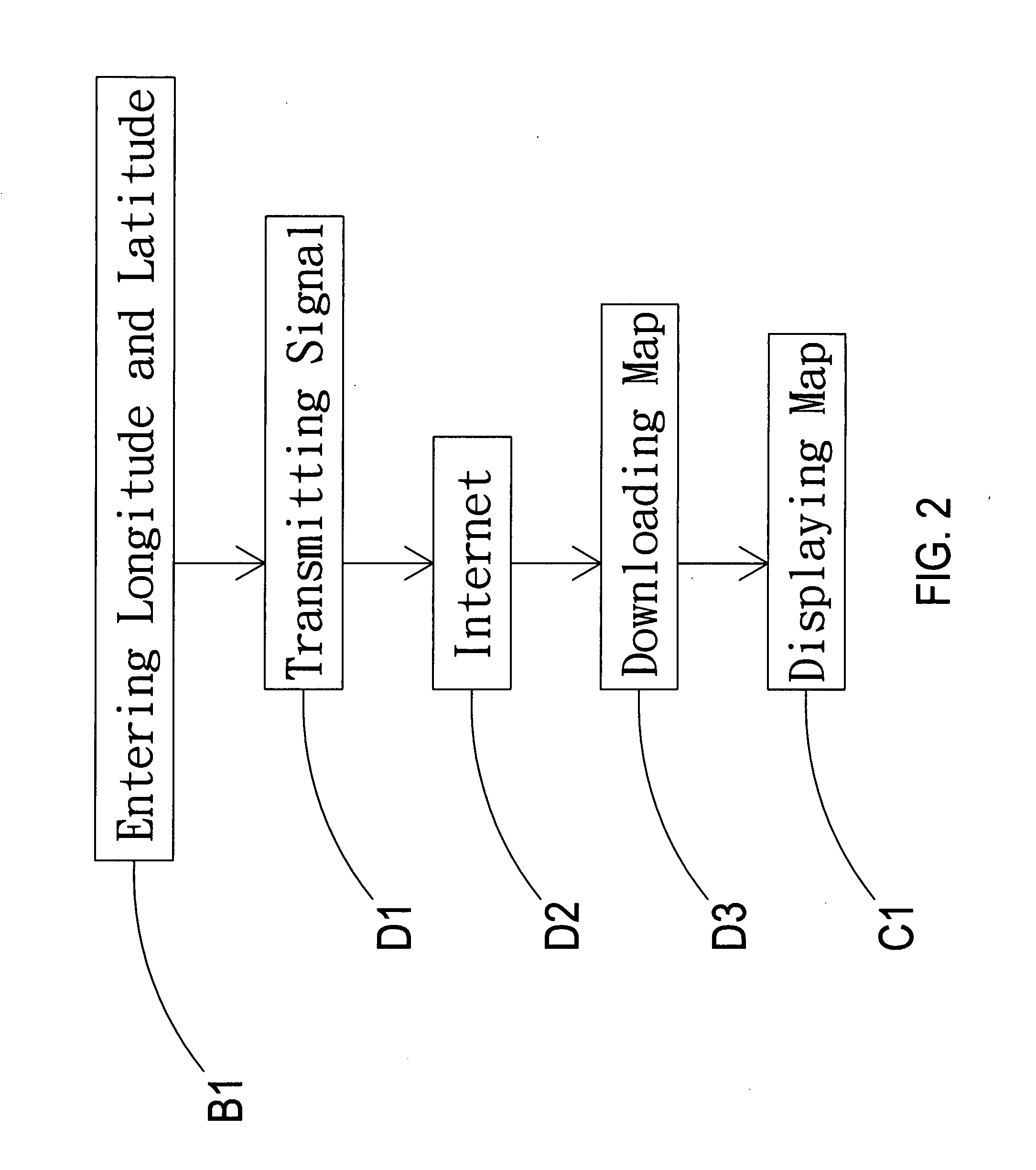
[0012]Referring to FIG. 1 and FIG. 2, the present invention is to provide a multi-functional map displayer A which comprises an input interface B, a display interface C, and a transmission interface D. A longitude and latitude of a desired area can be entered B1 through the input interface B, and a signal of the inputted longitude and latitude B1 is transmitted D1 to internet D2 through the transmission interface D, such that a map can be downloaded D3 from the internet D2, and be received by the display interface C for displaying the map C1 or other map-related data, allowing a user to be aware of the map of the desired area by inputting the longitude and latitude, to save a memory space used for storing the complete map, and cost spent for purchasing map software of each place, and to achieve purposes of providing the user to check, navigate, and ensure a safe trip.
[0013]Referring to FIGS. 2 to 5, when the user needs to be aware of information of an area map by the map displayer A...
PUM
 Abstract
Description
Claims
Application Information