

Method to share and exchange geographic based information
a technology of geographic information and information exchange, applied in the field of systems and methods for organizing and retrieving geolocated information, can solve the problems of not facilitating the organization and interrelation of various geographic information sources and geographic data structures, unable to store multiple views of the same data in the existing system, and corresponding increase in the difficulty and complexity of referencing, organizing and managing geographic resources. achieve the effect of maintaining exactness and reproducibility, and easy sharing with others
- Summary
- Abstract
- Description
- Claims
- Application Information
AI Technical Summary
Benefits of technology
Problems solved by technology
Method used
Image

Examples
Embodiment Construction
Definitions
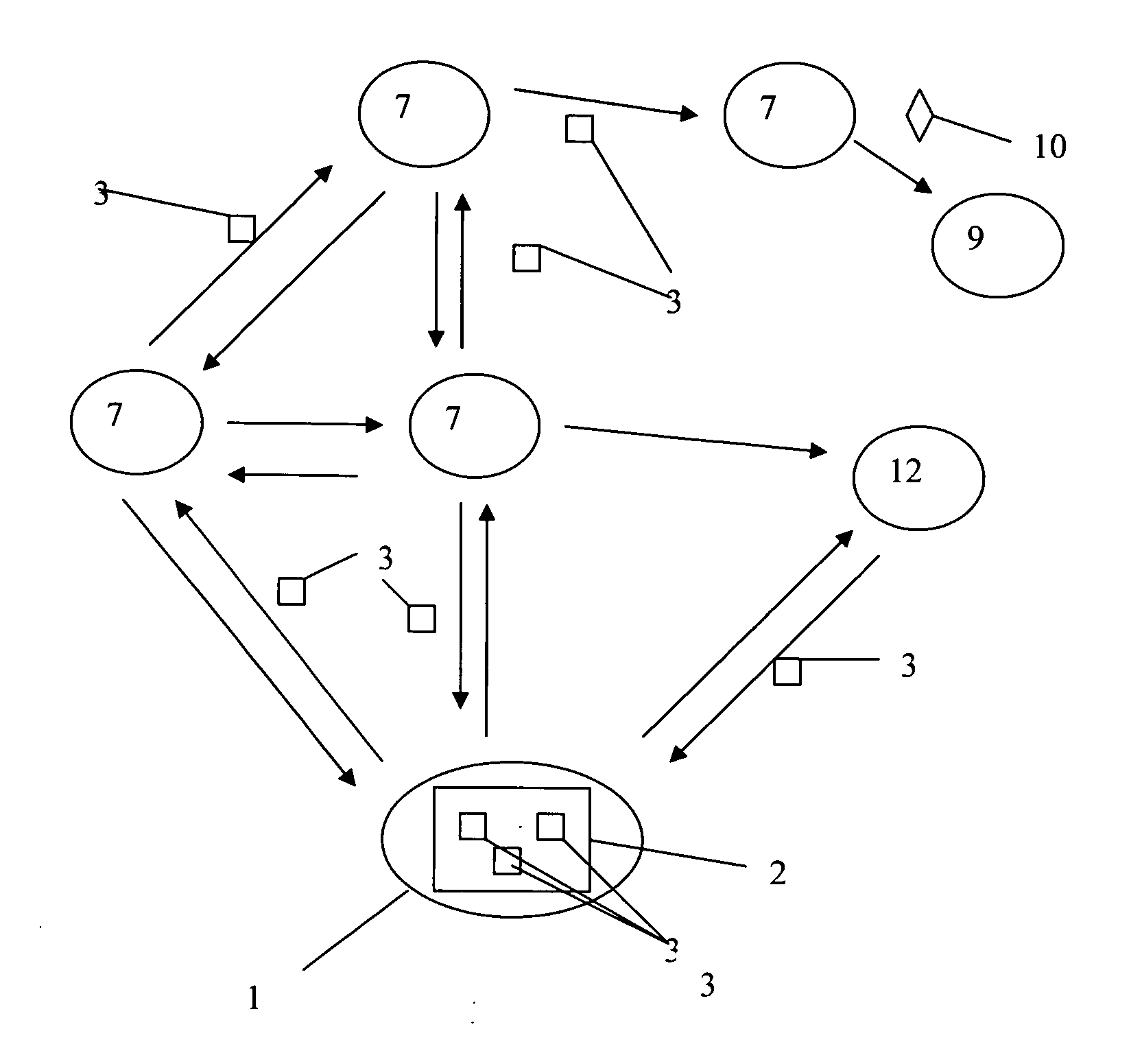
[0021]Exchange file means that a complete package of geo-referenced data is packaged and stored in such a way that, upon retrieval, all the data are re-constructed exactly as prepared by the author. Multiple layers and their attributes, images, connected spreadsheets and databases are all contained within this Map Exchange File along with metadata (the citation / source of each layer) color rendering for each attribute, and any associated My Maps—compilations of specific attributes, colored specific ways (and the same attribute can be colored in different ways for each My Map) and presented with specific zoom (the view). Each My Map is potentially a separate set of layers and attributes viewed specifically.
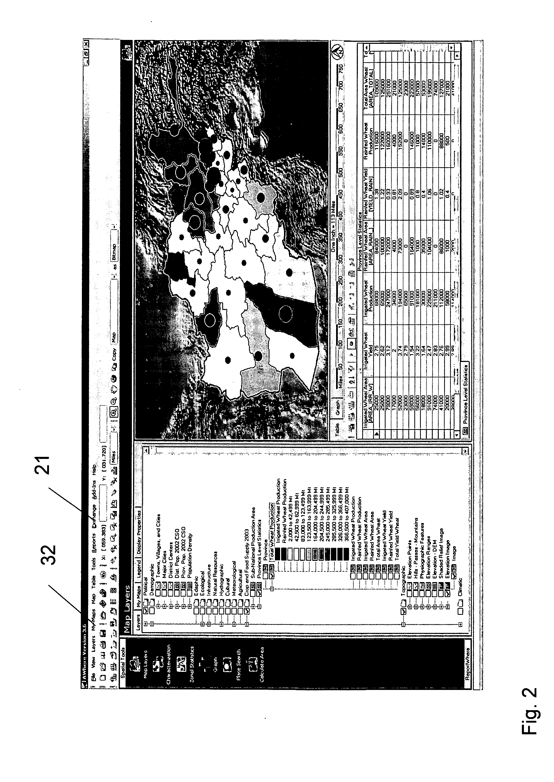
[0022]Map layers a Map Layer is a complete set of spatial information. This can range from 100,000s of points each with multiple attributes describing the point (e.g., address, name, sales, items purchased) to all counties of the USA. A Map Layer is a coherent set of topo...
PUM
 Abstract
Description
Claims
Application Information