Method For Operating A Navigation System

a navigation system and method technology, applied in surveying, navigation, measurement devices, etc., can solve problems such as difficulty in orienting the driver, and achieve the effect of simplifying the entrance and exit of motor vehicles and simple recognizability

Active Publication Date: 2009-02-05
NAVIGON AG
View PDF17 Cites 61 Cited by
  • Summary
  • Abstract
  • Description
  • Claims
  • Application Information

AI Technical Summary

Benefits of technology

[0025]Due to the constructional circumstances at the entrance or exit of most intersecting roads, these roads frequently have a significant curvature in the region directly before the traffic circle in order to thusly simplify the entrance and exit of the motor vehicles. The immediate intersecting region of the intersecting roads therefore is not significant for the intuitive observation and perception of the traffic circle geometry. This is the reason why the interpolation point used for computing the intermediate angle should not lie on the traffic circle or in the immediate vicinity of the intersecting point with the traffic circle. A much better and intuitively simpler recognizability is attained if the interpolation point on the intersecting road that serves for computing the intermediate angle a

Problems solved by technology

The illustration of the circular symbol in the schematic maneuvering image frequently does not reflect the actual local circumstances such that i

Method used


Image

  • Method For Operating A Navigation System
  • Method For Operating A Navigation System
  • Method For Operating A Navigation System

Examples


Embodiment Construction

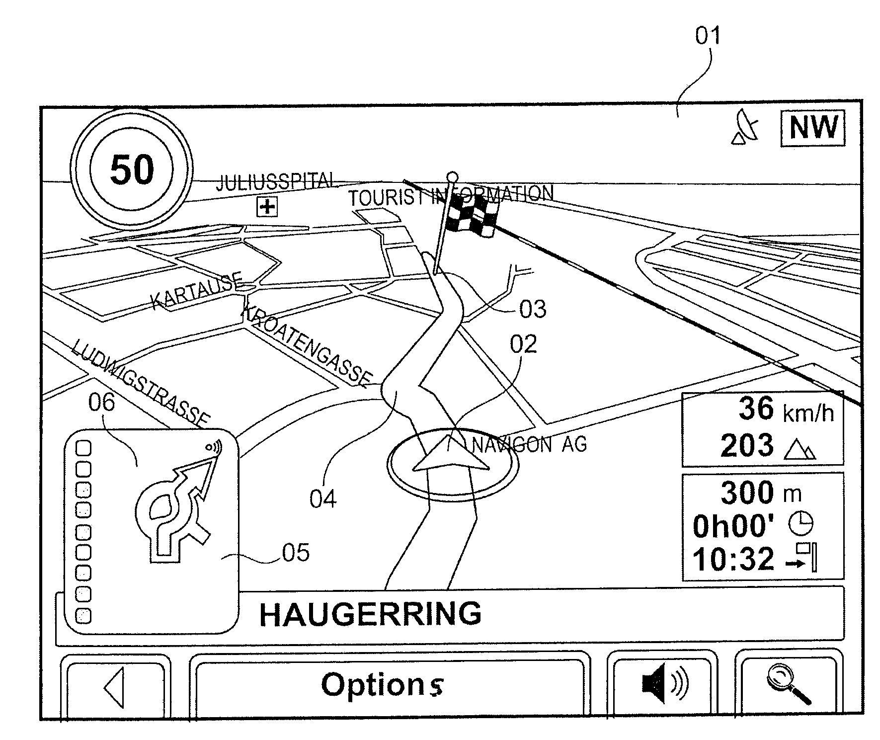
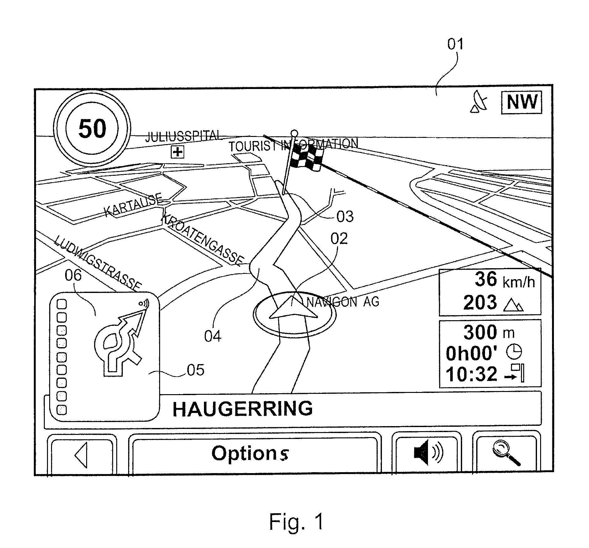
[0046]FIG. 1 shows the image content of a display device 01 as it is illustrated, for example, on the monitor of a mobile navigation device. The road situation relative to the current position that is indicated in the form of an arrow symbol 02 and the route 04 leading to the destination 03 are illustrated in the form of a perspective representation. In addition, a schematic maneuvering image 05 is shown in the lower left corner of the display device 01 and graphically illustrates the next maneuver to be carried out by the driver in order to follow the planned route in schematic form. The next maneuver along the route 04 requires driving through a traffic circle that is not illustrated in greater detail in FIG. 1 and is schematically indicated in the form of a circle symbol 06 in the schematic maneuvering image 05.

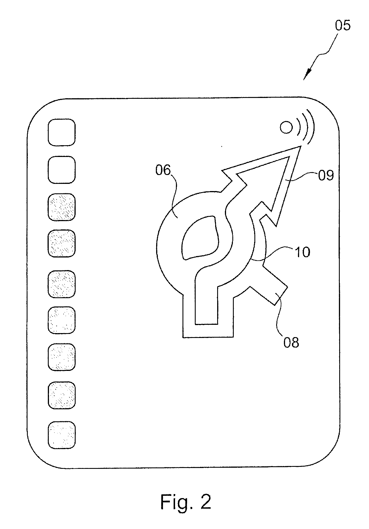
[0047]FIG. 2 shows an enlarged representation of the schematic maneuvering image 05. The traffic circle to be traveled along the route 04 has three intersecting roads that...


PUM


Abstract

A method for operating a navigation system includes the following steps:
  • a) computing a route from a starting point to a destination, wherein the route consists of a sequence of road segments and junctions between the road segments that is selected from a database, in which a geographic area is described in the form of road segments and junctions, with a route computation method,
  • b) computing at least one maneuvering instruction that contains instructions for the user in order to follow the route from the current position, and
  • c) computing and displaying a schematic maneuvering image on a display device, wherein the schematic maneuvering image graphically illustrates the maneuvering instructions in schematic form, wherein adjacent junctions that do not lie along the route and/or adjacent road segments that do not lie along the route and do not converge with a junction along the route are also analyzed during the computation of the schematic maneuvering image, wherein at least part of the adjacent road segments and/or adjacent junctions is illustrated in the schematic maneuvering image in addition to the maneuvering instruction that represents the route.

Description

CROSS-REFERENCE TO RELATED APPLICATION[0001]This application claims the priority benefit of German Patent Application No. 10 2007 036 627.4 filed on Aug. 2, 2007, the contents of which are hereby incorporated by reference as if fully set forth herein in their entirety.STATEMENT CONCERNING FEDERALLY SPONSORED RESEARCH OR DEVELOPMENT[0002]Not applicable.FIELD OF THE INVENTION[0003]The invention pertains to a method for operating a navigation system, and in particular, a method of operating a navigation system that displays at least a portion of a route.BACKGROUND OF THE INVENTION[0004]Navigation systems of the generic type are used, for example, as mobile navigation devices in order to guide the driver of a motor vehicle from a starting point to a destination. In this case, the navigation device scans the data of a database, in which a geographic area is described in the form of road segments and junctions. Consequently, the database contains a network of road segments and intermediat...

Claims


Application Information

Patent Timeline
IPC IPC(8): G01C21/34
CPCG01C21/3632
Inventor SCHMIDT, THORSTEN W.
Owner NAVIGON AG
Why Eureka
Try Eureka