

Geophysical surveying
a geophysical and seismic data technology, applied in seismology for waterlogging, instrumentation, electromagnetic wave detection, etc., can solve the problems of not always able to determine the concentration of gas, non-commercial, high-saturation gas reservoirs, and non-conventional stack seismic data only being used for determining geological structure,
- Summary
- Abstract
- Description
- Claims
- Application Information
AI Technical Summary
Benefits of technology
Problems solved by technology
Method used
Image

Examples
example rock
Physics Model
[0055]Before describing the specific example, it is noted that the general objective when defining a suitable rock physics model for the region of interest is to find a set of equations relating the elastic properties, bulk modulus (K), shear modulus (μ), bulk density (ρ), and the electrical properties, conductivity (σ), on the one hand, to the rock properties of primary interest on the other; particularly porosity (φ), water, gas and oil saturations (Sw, Sg, So), clay mineral content (Vclay). To achieve this other properties of the constituent minerals and fluids are also required. Typically such properties are obtained by analysing well logs and by using known properties from published tables.
[0056]In one example, the elastic and electrical properties are calculated with various different porosity values. For this case, the cemented sand model was chosen using quartz properties for the sand grains and average clay mineral properties for the cement. The cemented sand m...
case study 1
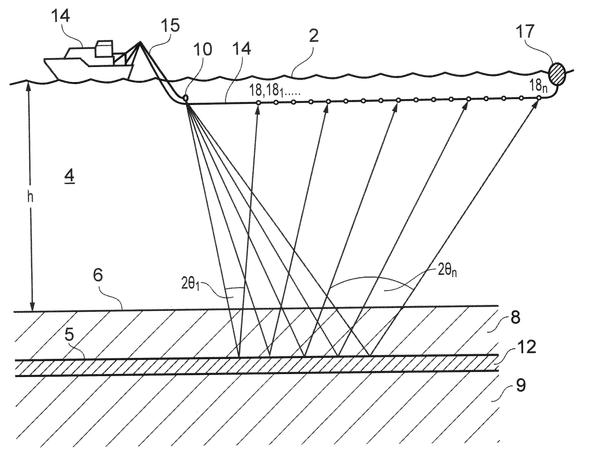
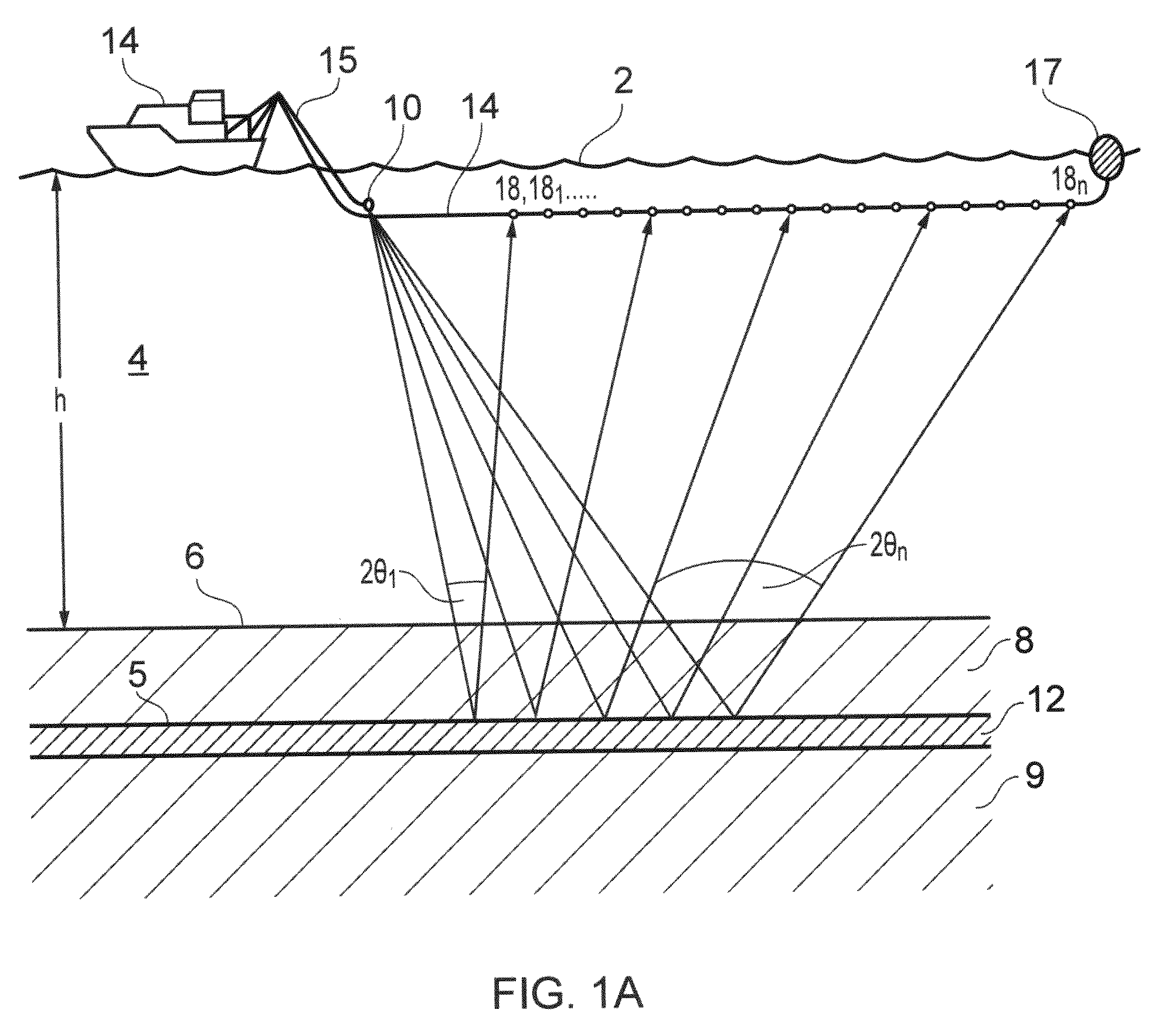
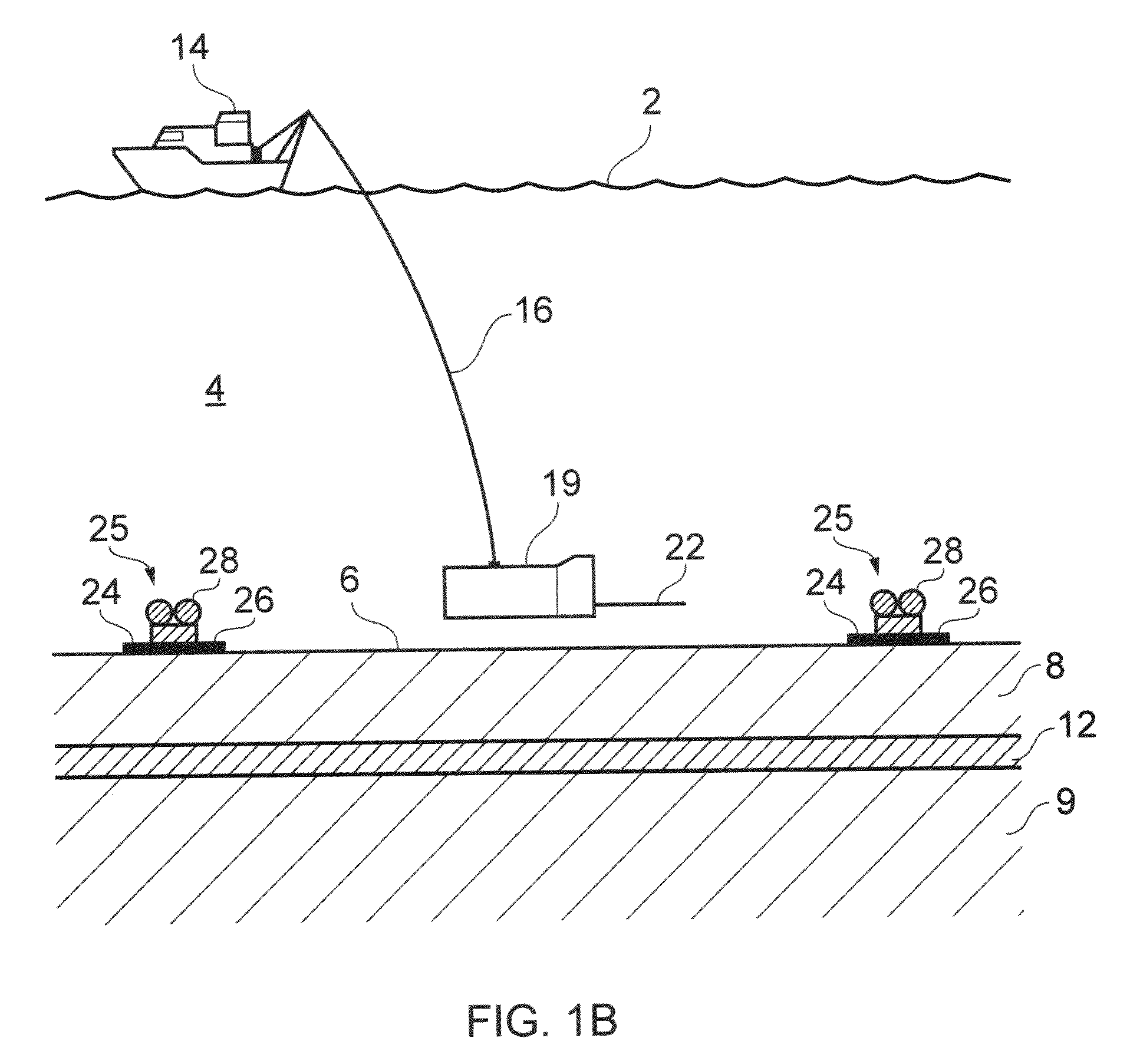
[0074]The invention is exemplified using a case study from the Luva gas discovery, which lies on the Nyk High in the Voring Basin of the Norwegian Sea. The water depth in the area is 1274 m. Well 6707 / 10-1 encountered gas in an interval approximately 150 m thick at a depth of 1680 m below the seafloor. In this example, we use electric and elastic models constructed from the well log data to examine the sensitivity of both data types to hydrocarbon properties.
[0075]As a starting point we calculate the seismic and CSEM response to a baseline water saturated case, using Biot-Gassman to compute the seismic velocity changes, and calculating the electrical resistivity changes for clean sand and shaly cases using Archie and Simandoux models respectively (Mavko et al 2003).
[0076]FIG. 2 shows the CSEM anomaly (calculated as the difference between the amplitude response between the gas saturated and wet reservoir) and seismic response for the case of a postulated 80% gas saturation level, whi...
case study 2
[0079]This case study is also based on the Luva discovery. The first step in modeling is to compute the seismic AVA and 1D CSEM responses at in-situ and 100% water saturated conditions. If these models show substantial differences between gas and wet cases, then we have an important indication that hydrocarbon detection is feasible. The average in-situ gas saturation in the pay sand is about 85%, so our initial model will represent the 85% Sg case.
[0080]FIG. 4 shows there is a substantial difference between the wet and 85% gas synthetic gathers. In the wet case, the top of the sand has positive amplitude (high impedance) but in the gas case, we see negative amplitude (low impedance) assuming the USA polarity standard. We used Biot-Gassmann to compute the seismic velocity changes. Electrical resistivity changes were computed for clean sand and shaly sand cases using Archie and Simandoux, models respectively (Mavko, et al, 1998). Seismic gathers were computed using a 30 Hz Ricker wave...
PUM
 Abstract
Description
Claims
Application Information