
Video processing system providing enhanced tracking features for moving objects outside of a viewable window and related methods

Active Publication Date: 2011-06-16
OLLNOVA TECH LTD
View PDF16 Cites 15 Cited by
  • Summary
  • Abstract
  • Description
  • Claims
  • Application Information

AI Technical Summary

Benefits of technology

[0008]In view of the foregoing background, it is therefore an object of the present invention to provide a system and related methods for enhanced processing of georeferenced video feeds and related methods.
[0009]This and other objects, features, and advantages are provided by a video processing system which may include a display and a video processor coupled to the display. More particularly, the video processor may be configured to display a georeferenced video feed on the display defining a viewable area, determine actual geospatial location data for a selected moving object within the viewable area, and generate estimated geospatial location data along a predicted path for the moving object when the moving object is no longer within the viewable area and based upon the actual geospatial location data. The video processor may be further configured to define a successively expanding search area for the moving object when the moving object is no longer within the viewable window and based upon the estimated geospatial location data, and search within the successively expanding search area for the moving object when the successively expanding search area is within the viewable area. As such, the video processor may relatively quickly re-acquire a moving object after it exits and re-enters the viewable area, after panning away from and back to the object, etc., to thereby provide enhanced tracking and / or monitoring of objects within georeferenced video feeds.

Problems solved by technology

Given the large amounts of georeferenced video data that can be generated and stored with technology, it can become difficult to communicate the video and associated metadata to users in a relatively straightforward and intuitive way.
Another potential difficulty with georeferenced video is how to provide desired situational awareness.
Another problem which may be encountered with sensor data providing georeferenced video is that position accuracy may vary from one sensor type to the next.

Method used


Image

  • Video processing system providing enhanced tracking features for moving objects outside of a viewable window and related methods
  • Video processing system providing enhanced tracking features for moving objects outside of a viewable window and related methods
  • Video processing system providing enhanced tracking features for moving objects outside of a viewable window and related methods

Examples


Embodiment Construction

[0028]The present invention will now be described more fully hereinafter with reference to the accompanying drawings, in which preferred embodiments of the invention are shown. This invention may, however, be embodied in many different forms and should not be construed as limited to the embodiments set forth herein. Rather, these embodiments are provided so that this disclosure will be thorough and complete, and will fully convey the scope of the invention to those skilled in the art. Like numbers refer to like elements throughout, and prime notation is used to indicate similar elements in alternate embodiments.

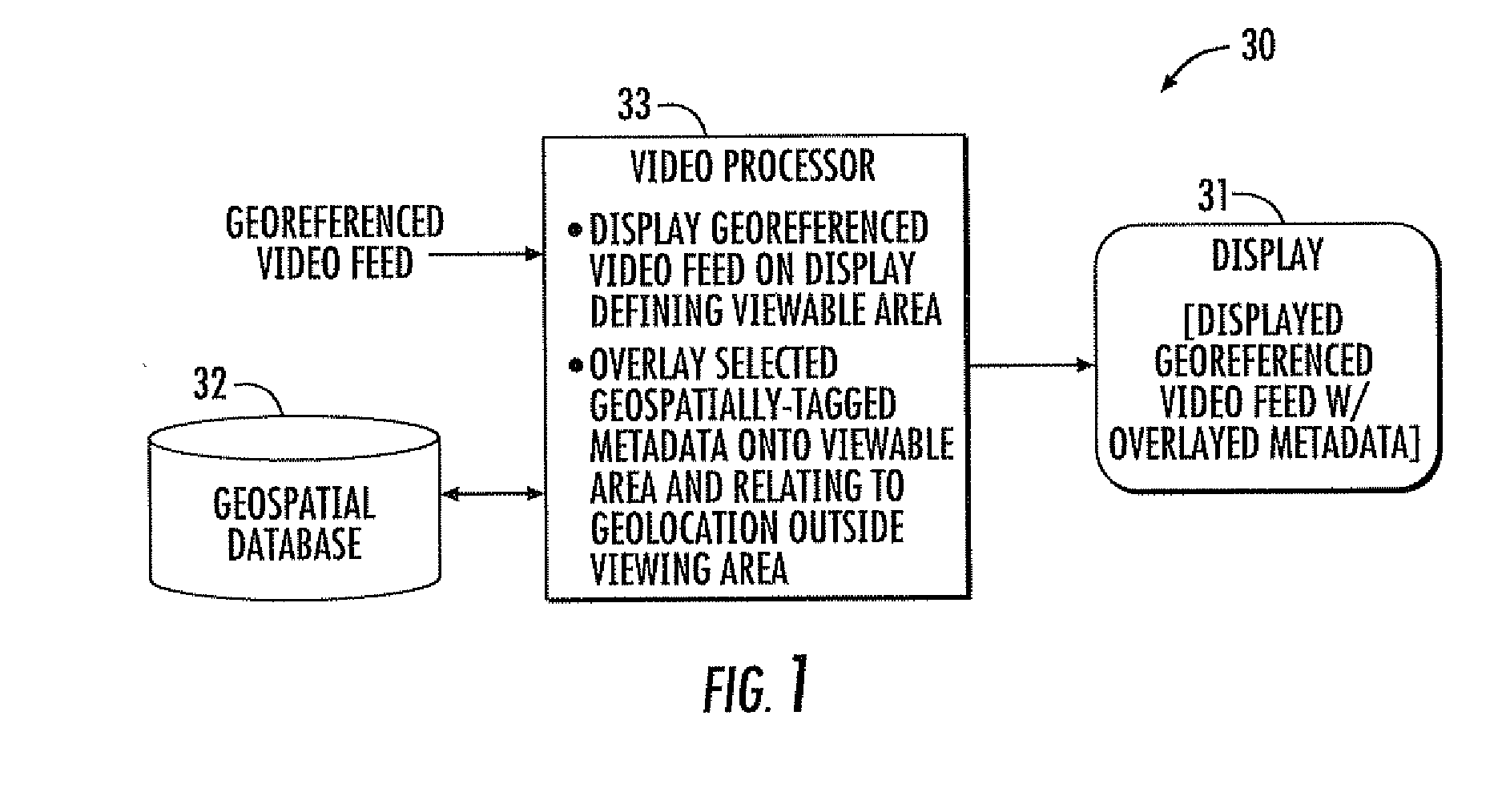
[0029]Referring initially to FIGS. 1 and 4, a video processing system 30 and associated method aspects are first described. The system 30 illustratively includes a display 31, one or more geospatial databases 32, and a video processor 33. By way of example, the video processors described herein and the various functions that they perform, may be implemented using a combinatio...


PUM


Abstract

A video processing system may include a display and a video processor coupled to the display. The video processor may be configured to display a georeferenced video feed on the display defining a viewable area, determine actual geospatial location data for a selected moving object within the viewable area, and generate estimated geospatial location data along a predicted path for the moving object when the moving object is no longer within the viewable area and based upon the actual geospatial location data. The video processor may be further configured to define a successively expanding search area for the moving object when the moving object is no longer within the viewable window and based upon the estimated geospatial location data, and search within the successively expanding search area for the moving object when the successively expanding search area is within the viewable area.

Description

FIELD OF THE INVENTION[0001]The present invention relates to the field of video processing, and, more particularly, to processing of geospatially referenced video and related methods.BACKGROUND OF THE INVENTION[0002]Enhancements in video imaging, data storage capabilities, and satellite location technology have lead to the relatively widespread use of georeferenced video in numerous applications such as recognizance, surveillance, surveying, and the like. Generally speaking, georeferenced video includes video imagery frames encapsulated in a transport stream along with geospatial metadata that correlates the pixel space of the imagery to geospatial coordinate values (e.g., latitude / longitude coordinates).[0003]Given the large amounts of georeferenced video data that can be generated and stored with technology, it can become difficult to communicate the video and associated metadata to users in a relatively straightforward and intuitive way. Various approaches are used to communicate...

Claims


Application Information

Patent Timeline
IPC IPC(8): H04N5/225G06K9/00
CPCG06T7/20G06T2207/30232G06T2207/30212
Inventor DUNKEL, CHRISTOPHER T.BAKIR, TARIQMCDONALD, ROBERTHEMINGHOUS, JOHNPETERSON, ARIC
Owner OLLNOVA TECH LTD
Learn More