
Physical disability probes for geographic information

a technology for physical disabilities and geographic information, applied in the field of geographic data collection, generating, storing, etc., can solve the problems of time and cost, affecting the quality of geographic limiting the amount of geographic data and types of data to be collected or provided,

Active Publication Date: 2011-09-29
HERE GLOBAL BV
View PDF2 Cites 36 Cited by
  • Summary
  • Abstract
  • Description
  • Claims
  • Application Information

AI Technical Summary

Benefits of technology

The patent describes a method for collecting data for a geographic and navigation database using a probe sensor on a device used by a person with a physical disability. The collected data is sent to a facility for analysis and development of the database. The technical effect of this invention is the ability to gather valuable information about the geographic and navigation needs of people with physical disabilities, which can be used to improve the quality and accessibility of the information provided to them.

Problems solved by technology

Time and cost may limit how much geographic data and types of data to be collected or provided.
Or, such collection of data corresponding to handicapped or physical disability accessible paths or ways may be time consuming or not as cost effective.

Method used


Image

  • Physical disability probes for geographic information
  • Physical disability probes for geographic information
  • Physical disability probes for geographic information

Examples


Embodiment Construction

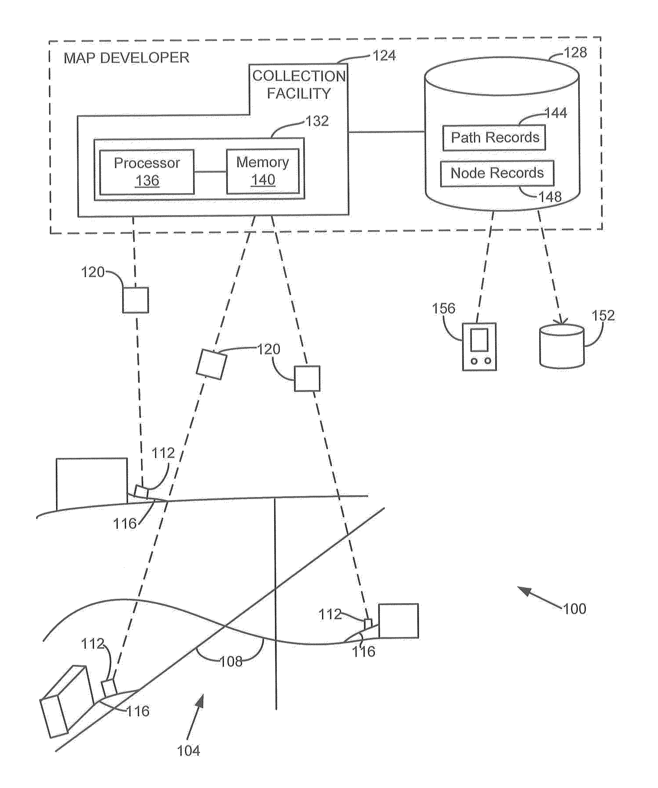
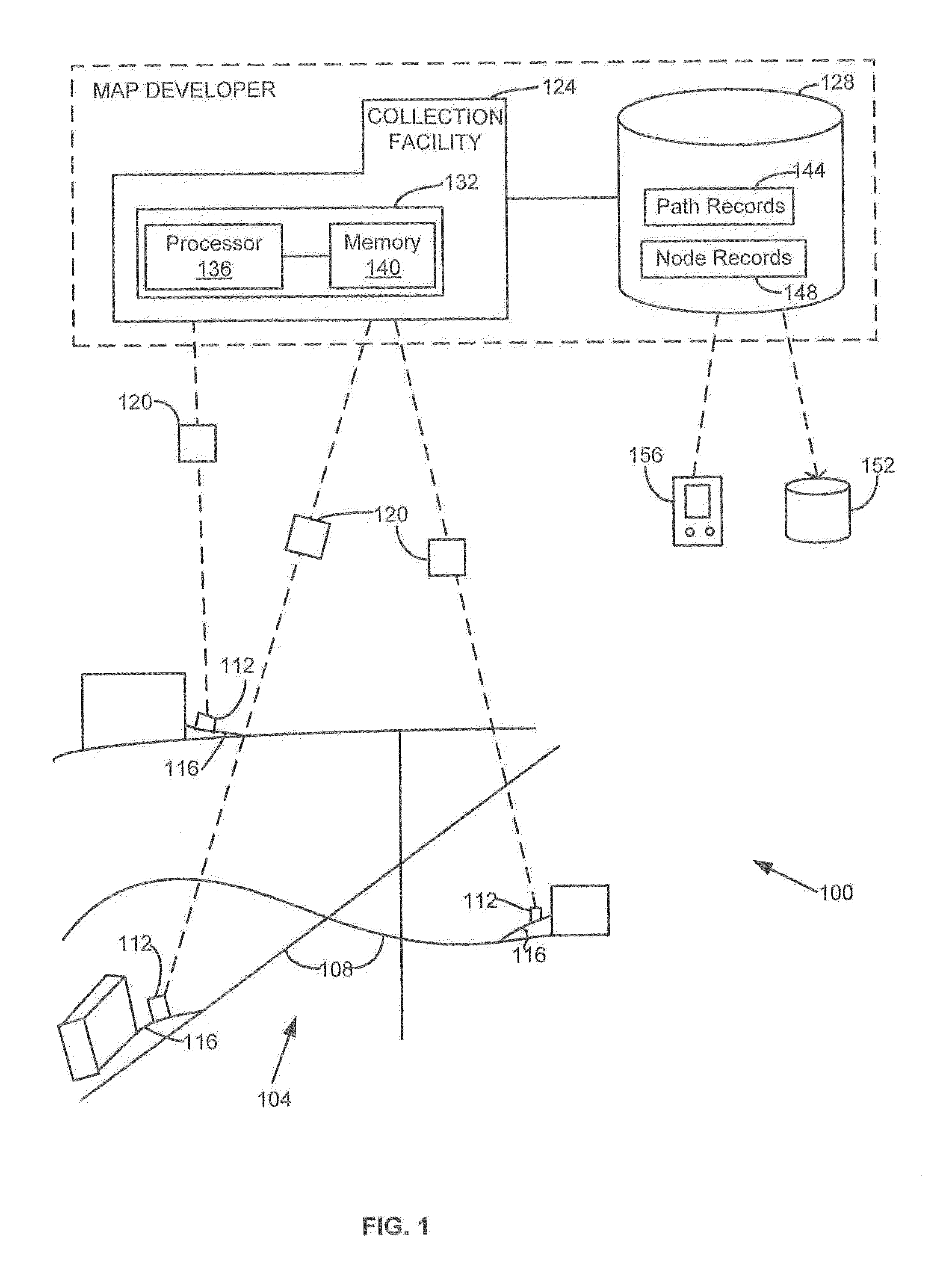
[0013]FIG. 1 shows one embodiment of a system 100 for obtaining and / or using probe data. The geographic data, probe, and / or navigation system 100 includes, but is not limited to, a geographic region 104, a road or path network 108, objects 112 traveling on paths 116, a data collection facility 124, a geographic and / or navigation database 128, a database product 152, and / or an end user device 156. Additional, fewer, or different components may be provided. For example, a proxy server, a name server, a map server, a cache server or cache network, a router, a switch or intelligent switch, additional computers or workstations, a user interface, administrative components (such as an administrative workstation), a gateway device, a backbone, ports, network connections, and / or network interfaces may be provided. While the components in FIG. 1 are shown as separate from one another, one or more of these components may be combined.

[0014]The objects 112 are probes or probe devices. For exampl...


PUM


Abstract

Systems, devices, features, and methods for obtaining, enhancing, or using data for or with a geographic database, such as a navigation database, are disclosed. For example, one method includes receiving input to enable a probe sensor that is associated with a device used by a being with a physical disability. Geographic data is collected via the probe sensor when the device is in use by the being with the physical disability. The collected geographic data is provided to a data collection facility to develop data corresponding to a geographic and / or navigation database.

Description

BACKGROUND OF THE INVENTION[0001]The present invention relates to collecting, generating, storing, and / or using data and, more particularly, to geographic probe data and uses thereof.[0002]Navigation systems or devices may provide useful guidance or route information. For example, an end user navigation device may provide a display of a route and / or directions from an origin to a desired destination. Such navigation devices may use or rely on a geographic database that includes geographic data records representing a geographic region.[0003]For example, in regards to vehicle navigation, road data segments or links and node data records corresponding to respective real-world roads and intersections are stored in a geographic database. These road segments and node data are retrieved when forming a navigation route from one place to another. As time goes on, new and different roads are built and / or existing structures may be modified. To accommodate for the changes as well as for genera...

Claims


Application Information

Patent Timeline
Patent Type & Authority Applications(United States)
IPC IPC(8): G01C21/00G06F17/30
CPCG01C21/32G01C21/3807G01C21/3841A61H3/02A61H3/04
Inventor BACH, JEFFREY R.
Owner HERE GLOBAL BV
Learn More