
Method and apparatus for determining accuracy of location information

a technology of location information and method, applied in the field of navigation technology, can solve the problems of low reliability of location information in the shadow area, errors may occur in location information,

Inactive Publication Date: 2011-12-01
SAMSUNG ELECTRONICS CO LTD
View PDF9 Cites 77 Cited by
  • Summary
  • Abstract
  • Description
  • Claims
  • Application Information

AI Technical Summary

Benefits of technology

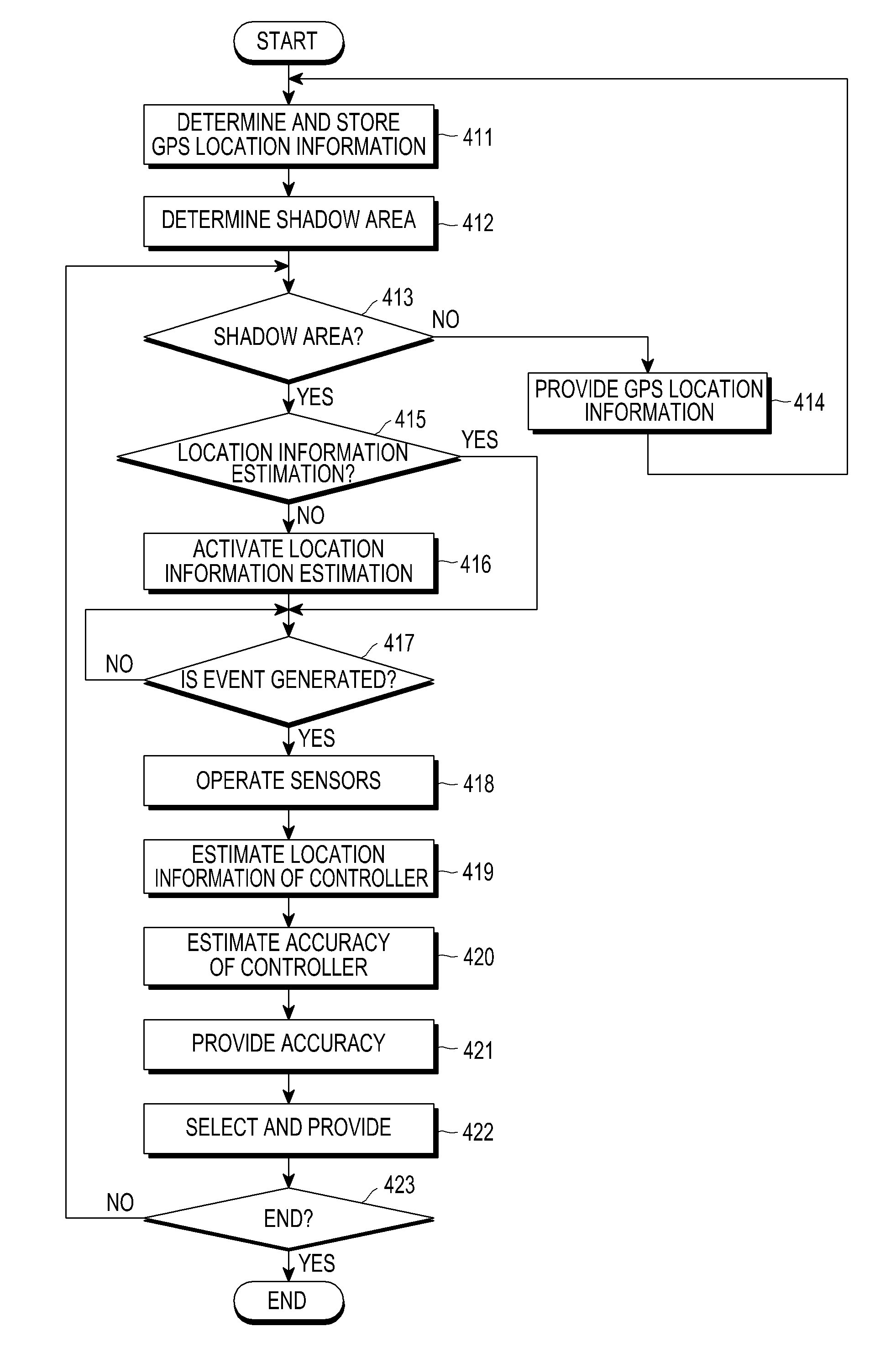
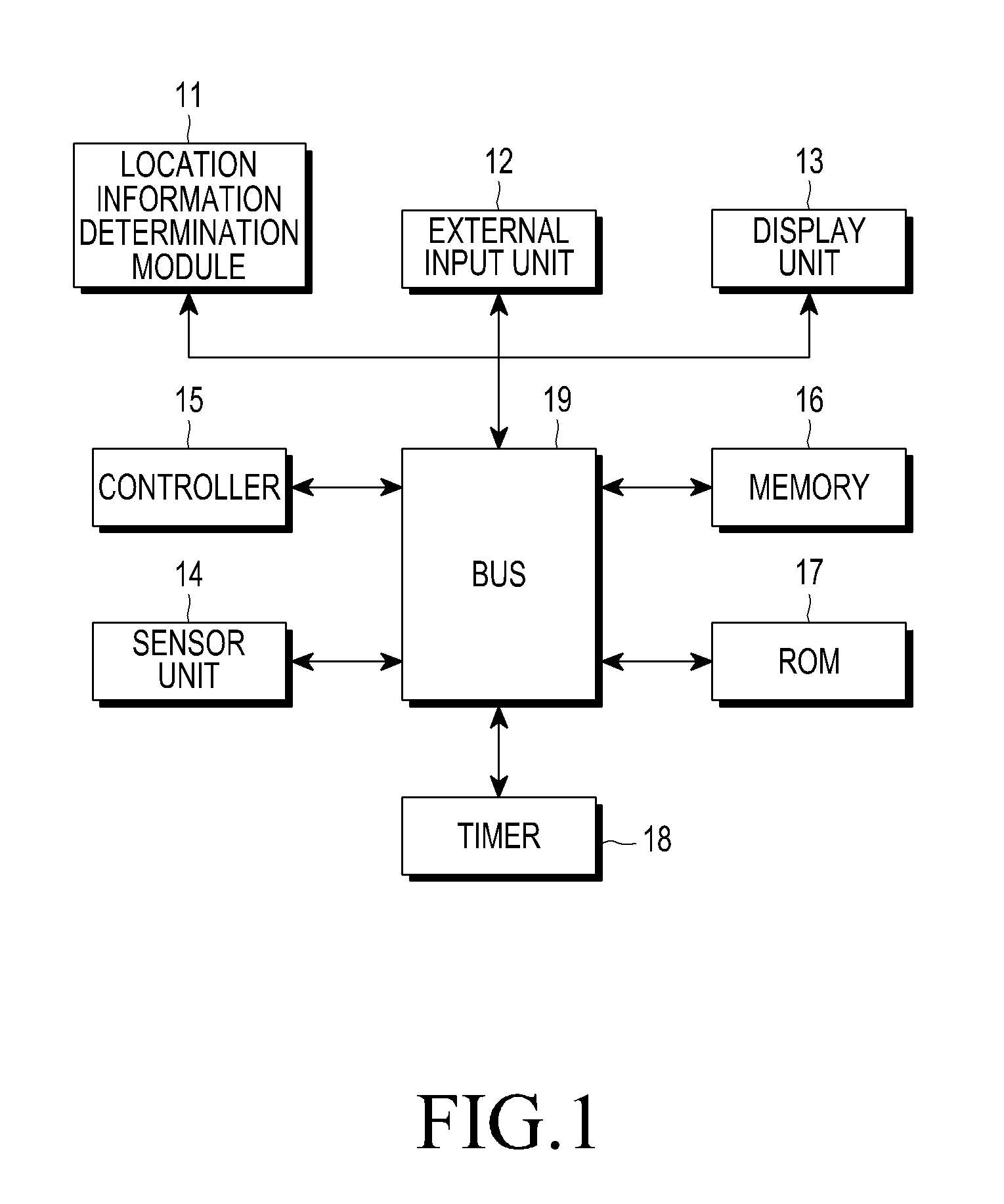
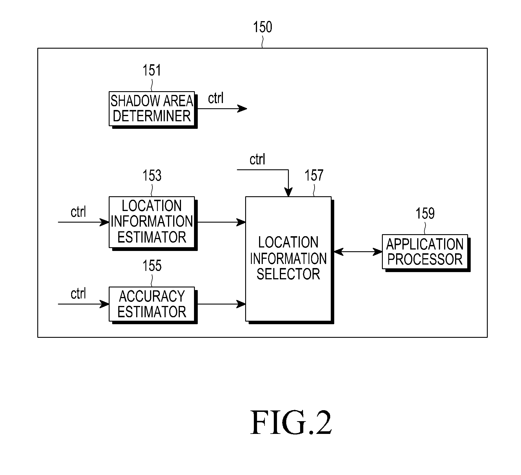
The present invention provides a method and apparatus for accurately determining the location of a user terminal in a shadow area. This is achieved by receiving GPS location information, determining if the user terminal enters a GPS shadow area, checking terminal movement information, estimating location information based on the terminal movement information, checking auxiliary location information, and determining accuracy information based on the accumulated location error of the estimated location information. The invention also provides a user terminal with a location information determination module for determining GPS location information, sensing acceleration and azimuth information, checking auxiliary location information, and determining accuracy information. The technical effects of the invention include providing reliable location information and improving the accuracy of location information estimation in shadow areas.

Problems solved by technology

However, when a user enters into a shadow area wherein a GPS signal cannot be received, the pedestrian navigation system estimates a location in the shadow area based on valid GPS location information received before the user entered into the shadow area.
Because the PDR method estimates a moving distance and direction of a user, an error may occur in location information according to a surrounding environment change, a moving time, a moving speed, a terminal moving state, and a sensor tolerance.
However, because the PDR method estimates location information in a shadow area without considering these errors, reliability of the location information in the shadow area is often low.

Method used


Image

  • Method and apparatus for determining accuracy of location information
  • Method and apparatus for determining accuracy of location information
  • Method and apparatus for determining accuracy of location information

Examples


Embodiment Construction

[0022]Various embodiments of the present invention will be described in detail herein below with reference to the accompanying drawings. In the following description, although many specific items are shown, they are only provided to help general understanding of the present invention, and it will be understood by those of ordinary skill in the art that these specific items can be modified or changed within the scope of the present invention.

[0023]In the present invention, GPS location information indicates a location of a user terminal through data provided from a GPS, and the location information indicates location information of a user terminal, which is estimated using information provided from an acceleration sensor and a terrestrial magnetism sensor. In addition, indoor location information indicates information indicating a location of a user terminal, which is determined using a Wi-Fi Positioning System (WPS) module, a cell based location information providing module for prov...


PUM


Abstract

A method and apparatus for determining accuracy information of location information. The method includes receiving Global Positioning System (GPS) location information of a user terminal from a GPS, determining whether the user terminal enters into a GPS shadow area, checking terminal movement information including a moving speed and a moving direction of the user terminal, when the user terminal enters into the GPS shadow area, estimating location information of the user terminal based on the terminal movement information, checking auxiliary location information including a moving state of the user terminal, error information of a terrestrial magnetism sensor, and the moving speed of the user terminal, and determining the accuracy information based on an accumulated location error of the estimated location information, based on the auxiliary location information.

Description

PRIORITY[0001]This application claims priority under 35 U.S.C. §119 to an application filed in the Korean Intellectual Property Office on May 31, 2010 and assigned Serial No. 10-2010-0051400, the content of which is incorporated herein by reference.BACKGROUND OF THE INVENTION[0002]1. Field of the Invention[0003]The present invention relates generally to navigation technology, and more particularly, to a method and apparatus for determining accuracy information for a location estimated in a Global Positioning System (GPS) shadow area.[0004]2. Description of the Related Art[0005]In general, a pedestrian navigation system uses GPS location information provided from GPS. However, when a user enters into a shadow area wherein a GPS signal cannot be received, the pedestrian navigation system estimates a location in the shadow area based on valid GPS location information received before the user entered into the shadow area.[0006]A conventional pedestrian navigation system provides locatio...

Claims


Application Information

Patent Timeline
Patent Type & Authority Applications(United States)
IPC IPC(8): G01S19/48
CPCG01S19/48G01S19/396G01C21/28G01S19/14H04W4/025
Inventor OH, JI-HEONHONG, HYUN-SUSHIN, GYE-JOONGPARK, KYONG-HAPARK, SUNG-MIN
Owner SAMSUNG ELECTRONICS CO LTD
Learn More