
Image information output method

Inactive Publication Date: 2012-05-17
KODAIRA ASSOC
View PDF16 Cites 60 Cited by
  • Summary
  • Abstract
  • Description
  • Claims
  • Application Information

AI Technical Summary

Benefits of technology

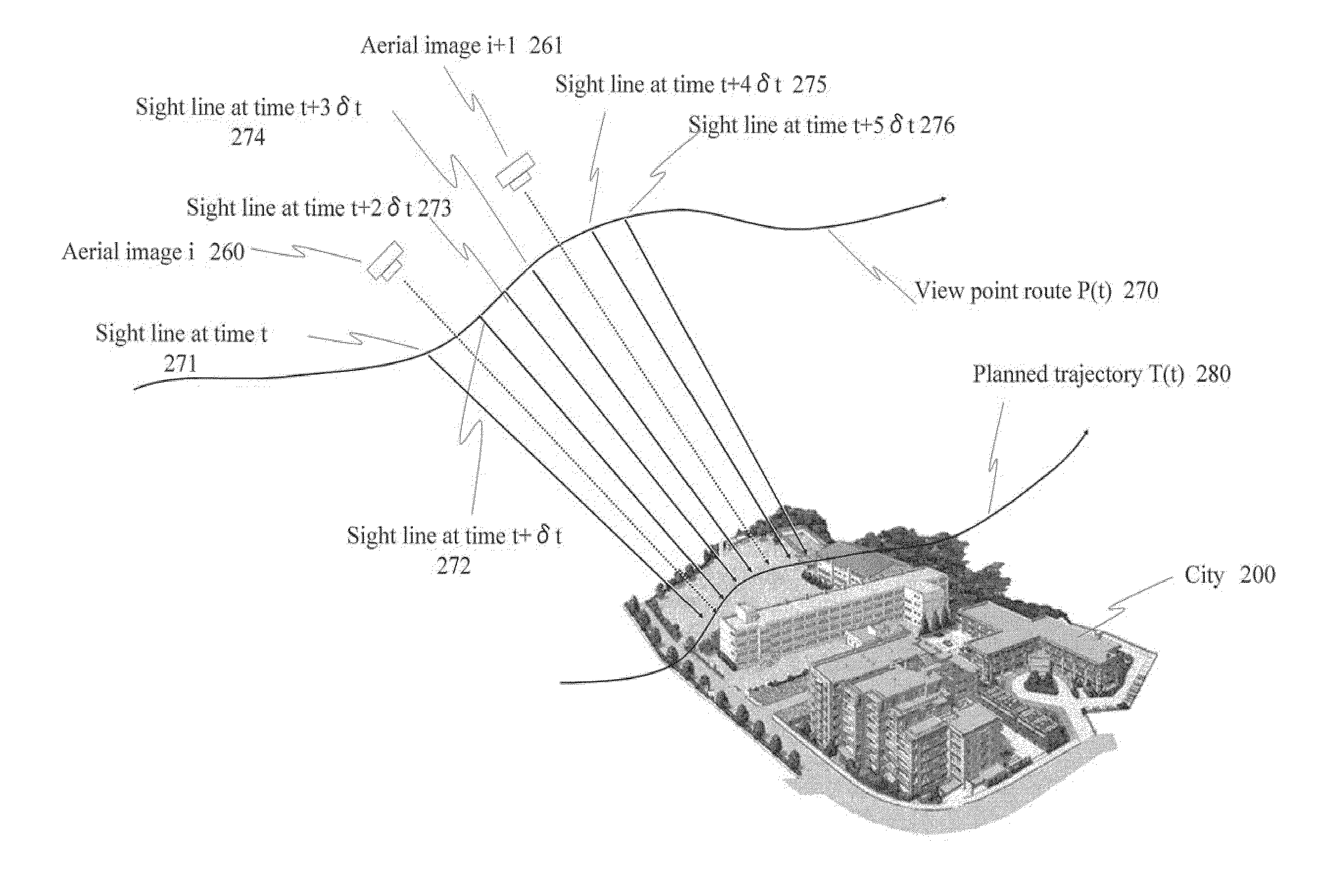
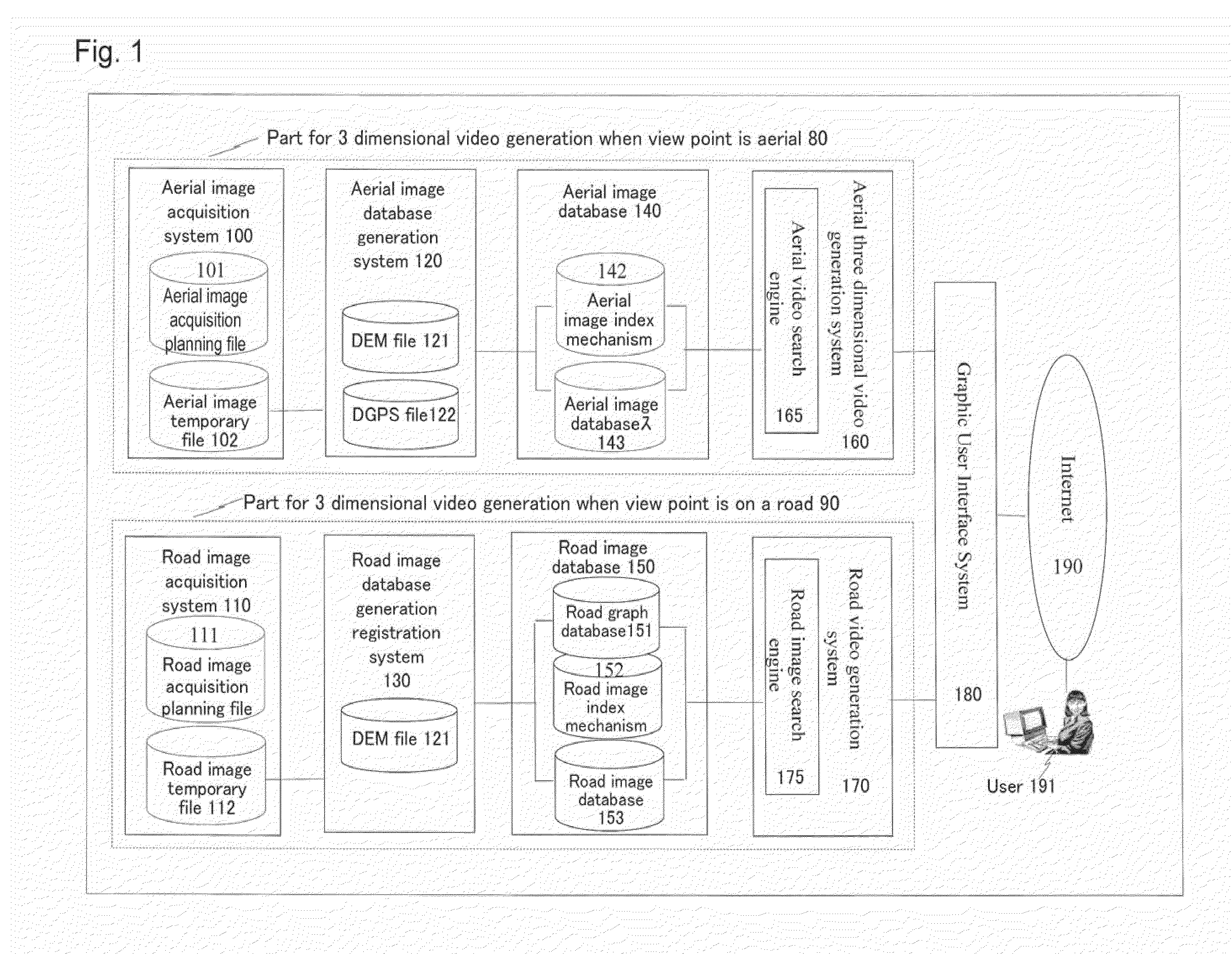
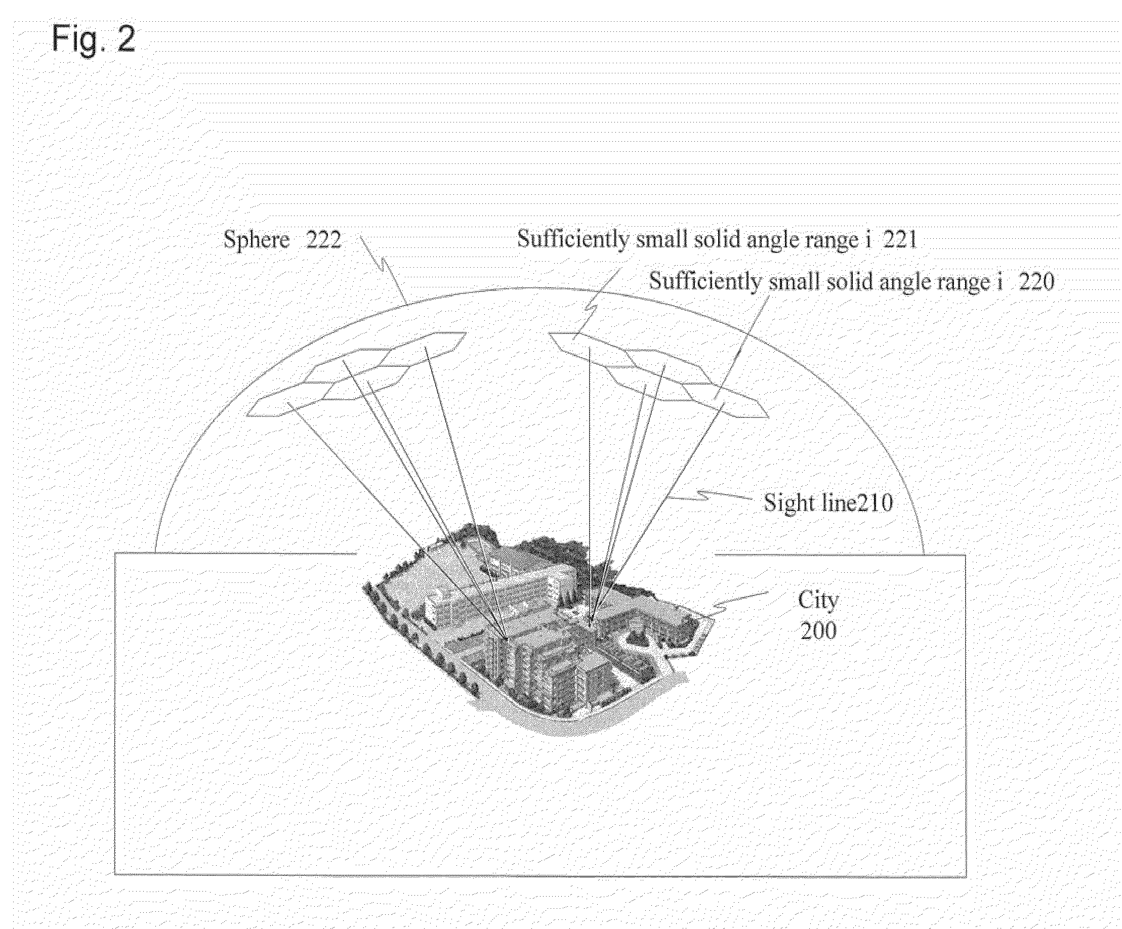
[0013]As one embodiment of the present invention a system is provided, the system configured to photograph in a large range a plurality of images in multi-direction at mesh points in high density and in air by aircrafts, by storing these lots of images being as a database the system being configured to fast search images which have the little disparities in the case when seen from an arbitrary direction at an arbitrary point of a city, and moreover a morphing system is provided the morphing system generating a smooth continuous video from images which has the little disparities corresponding a specified view point, sight direction, and position in the city.
[0017]As described above, according to the present invention, it is possible to generate three dimensional images for aerial arbitrary perspective routes and perspective directions for an arbitrary city location using actual images taken aerial without performing costly generation of a three dimensional numeric model of a city space and a texture application process of building surfaces. In addition, it is also possible to generate three dimensional images for arbitrary perspective routes and perspective directions at human sight line for geographic points on arbitrary city roads and passageways using actual images taken on roads and passageways. Furthermore, by not generating a three dimensional numeric model or performing a texture application process on building surfaces, it is possible to automate processes and generate and browse three dimensional images with a short period after the images are obtained.

Problems solved by technology

However, while the method and system of ACECOMBAT is a three dimensional visual data generation and browsing system which pursues realism using high resolution satellite imagery as a landscape material, because the object is a foreign war zone and the mage itself is not updated from the time it is created, it is different to the an actual three dimensional image of a city landscape.
However, the dimensions and position of a photography aperture part in the floor surface of an aircraft used for aerial photography is strictly regulated as an object of airworthiness certification and therefore it is not possible to expand the aperture part or increase the number of cameras by projecting from the aperture part outside of the aircraft.

Method used


Image

  • Image information output method
  • Image information output method
  • Image information output method

Examples


Embodiment Construction

[0098]The embodiments for carrying out the present invention are explained in detail below while referring to the diagrams. Furthermore, the present invention is not limited to the explanations below and may be performed with various changes and modifications without departing from the scope of the invention.

[0099]The inventors of the present invention became aware that the largest obstacle to carrying out a city landscape three dimensional visual data generation and browsing system is that there is no cheap and frequent means for obtaining three dimensional data of city buildings and constructions and furthermore there is no cheap and frequent means for acquiring images for mapping to the surfaces of these three dimensional objects or applying such images. Furthermore, in the present application, images and visual data refers to contents which display video and still images on an electronic display device including an LCD screen. In addition, while contents in the present applicati...


PUM


Abstract

Provided is a video image data generation system including a database for storing a plurality of image data photographed in various directions in various locations, correlating the directions and the locations with the stored image data, and correlating and storing a photographed sub-region when the image data is acquired, a route view point specifying device which specifies various locations and eye level directions arranged on a view point route, an image search engine which searches an image of an eye level direction specified from a location of a view point route specified by the route view point specifying device and outputs video data, wherein the image search engine searches image data stored in a database and the image data including a sub-region located in an eye level direction in each of a plurality of locations on a view point route by referencing photography direction data correlated with the sub-region.

Description

CROSS-REFERENCE TO RELATED APPLICATION[0001]This application is a U.S. continuation application filed under 35 USC 111(a) claiming benefit under 35 USC 120 and 365(c) of PCT application JP2010 / 058313, filed on May 17, 2010, which claims priority to Japanese Patent Application No. 2009-119484, filed on May 18, 2009, the entire contents of which are incorporated herein by reference.BACKGROUND OF THE INVENTION[0002]1. Field of the Invention[0003]The present invention is related to a method of generating and outputting image information. In particular, the present invention is related to a system and a method of generating video image information, wherein a three dimensional image of above ground landscape including urban areas using aerial photographs taken from the sky by an aircraft or photographs taken above ground at street level is generated, and the present invention is also related to a system and a method of generating image information wherein a video picture of three dimensio...

Claims


Application Information

Patent Timeline
IPC IPC(8): G06T15/00G06T15/20
CPCG06F17/30271G06F17/30781G06F17/30793G06F17/30831G06T15/205H04N13/0203G06T19/003G06T2210/44H04N9/8205G01C11/02G06T17/05G06F16/784G06F16/7335G06F16/70G06F16/56H04N13/204
Inventor KODAIRA, TAKATOSHIKODAIRA, TAKAMOTO
Owner KODAIRA ASSOC
Learn More