Methods and systems for precise vehicle localization using radar maps

a technology of precise vehicle location and radar map, applied in the direction of process and machine control, using reradiation, instruments, etc., can solve the problems of low resolution of current system, inability to use for more demanding navigational situations, and less effective gps system in certain environments

Active Publication Date: 2013-04-25
ROBERT BOSCH GMBH
View PDF3 Cites 94 Cited by
  • Summary
  • Abstract
  • Description
  • Claims
  • Application Information

AI Technical Summary

Benefits of technology

[0005]In another embodiment the invention provides a method of assembling a high-resolution database for precise vehicle localization. The method includes steps of obtaining a plurality of radar sensor readings from at least one vehicle; obtaining a

Problems solved by technology

However, with regard to vehicle localization in particular, the resolution of current systems is too low to use for more demanding navigational situations, e.g. controlling an autonomous vehicle.
Furthermore, GPS

Method used


Image

  • Methods and systems for precise vehicle localization using radar maps
  • Methods and systems for precise vehicle localization using radar maps
  • Methods and systems for precise vehicle localization using radar maps

Examples


Embodiment Construction

[0012]Before any embodiments of the invention are explained in detail, it is to be understood that the invention is not limited in its application to the details of construction and the arrangement of components set forth in the following description or illustrated in the following drawings. The invention is capable of other embodiments and of being practiced or of being carried out in various ways.

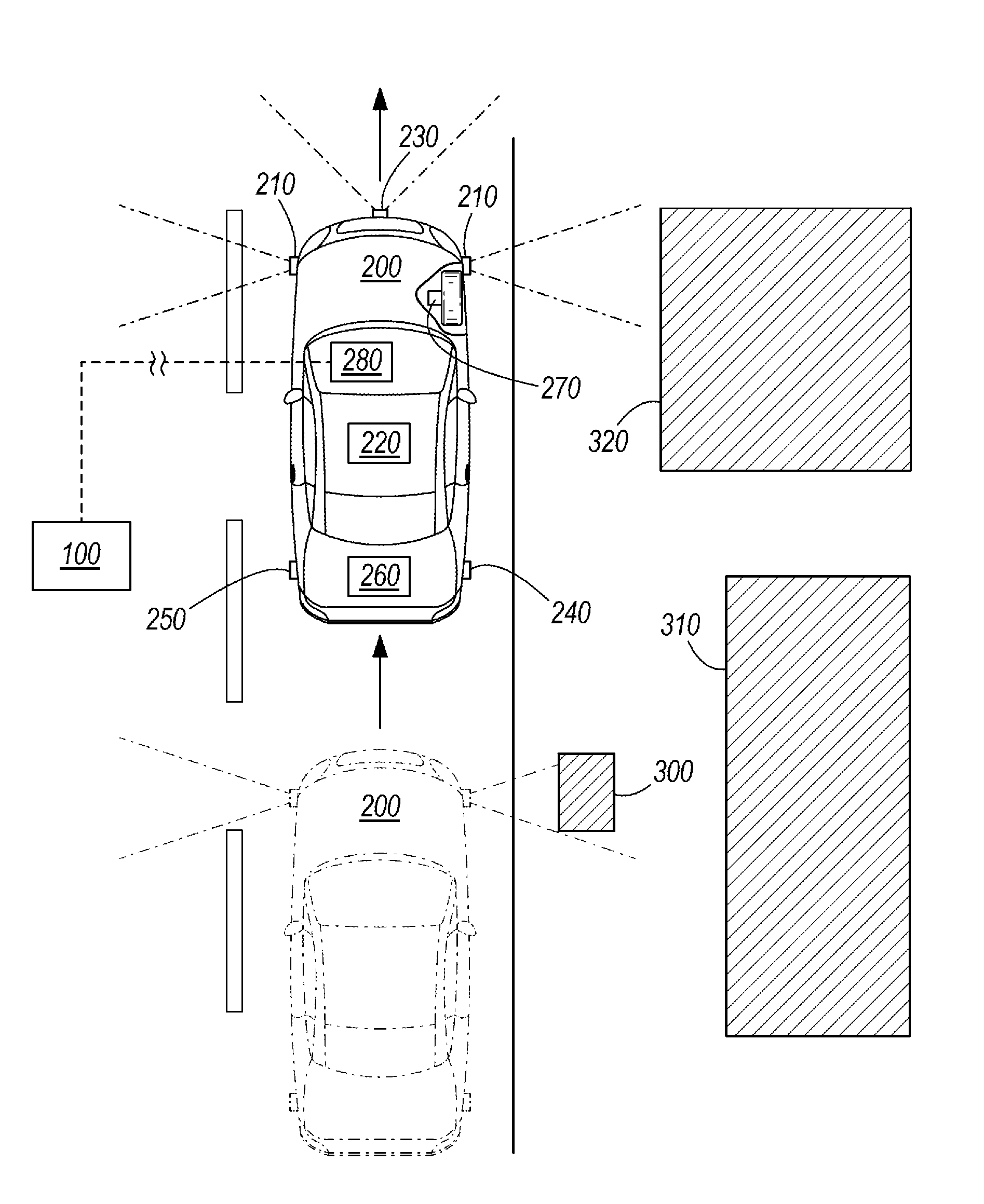
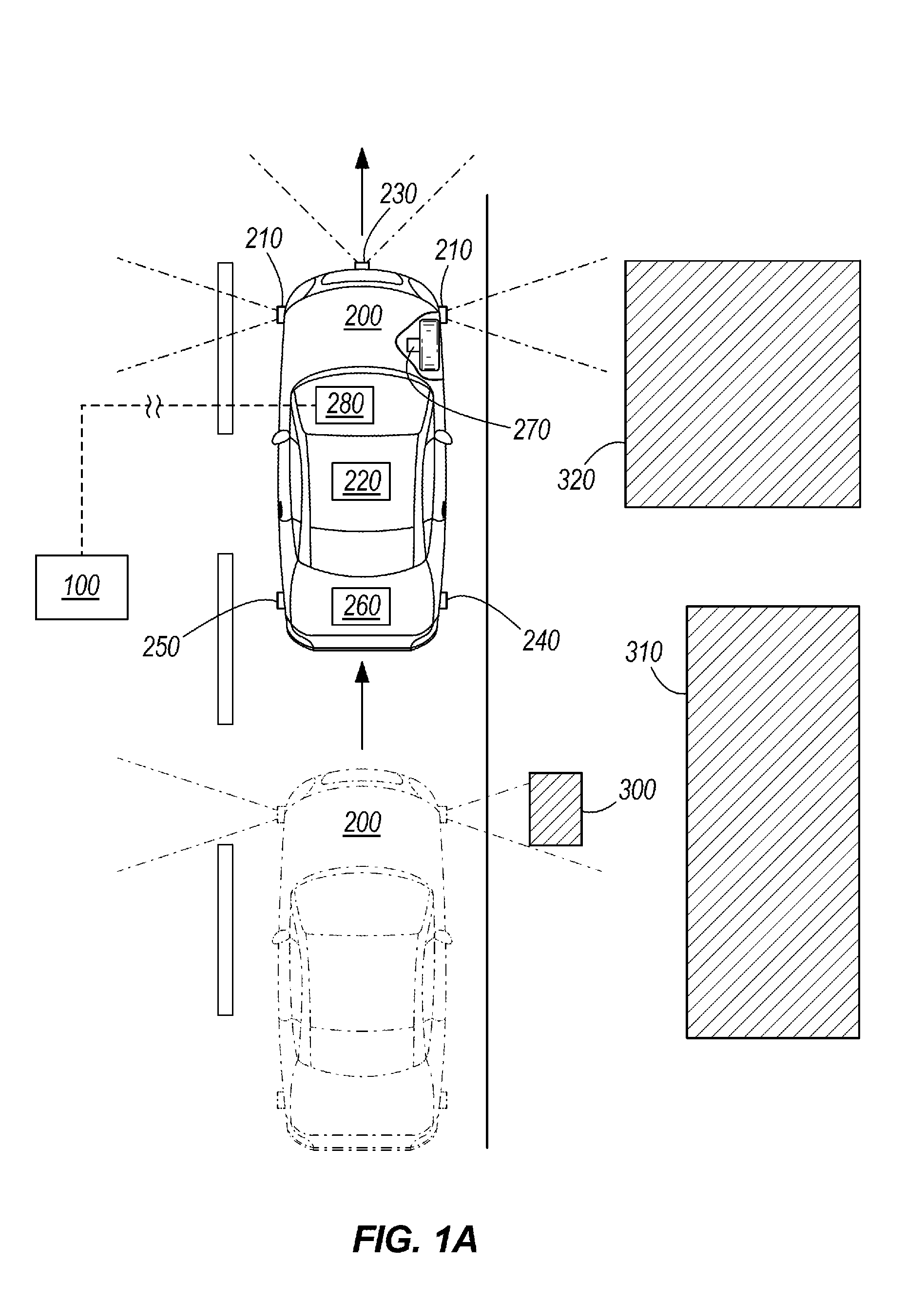
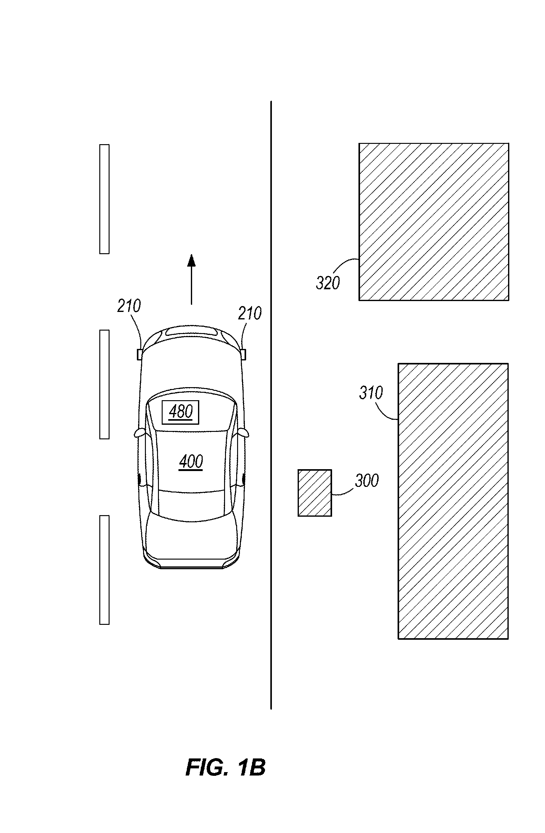
[0013]In one embodiment, the invention provides a method and system for producing a database 100 of high-resolution radar data for one or more roadways and for using the database 100 to provide precise vehicle localization. The invention also includes a method and system for updating the database 100 of radar data, as well as enhancing the database and the method of precise vehicle localization using data from other sensor systems.

[0014]In various embodiments, the method and system for producing the database 100 include a measurement vehicle 200 equipped with one or more high-resolution r...


PUM


Abstract

A method for determining a location of a vehicle. The method includes steps of acquiring a plurality of sensor data from a radar sensor associated with the vehicle; obtaining an approximate location of the vehicle using a GPS unit; comparing the sensor data to a database of geo-referenced sensor data; and based on the comparison, determining a location of the vehicle.

Description

BACKGROUND OF THE INVENTION[0001]The present invention relates to determining a precise location of a vehicle using radar-generated maps.[0002]Current technology permits mapping of roadways and surrounding areas for use with navigational tools (e.g. online street view services) and vehicle localization (e.g. vehicle GPS units). However, with regard to vehicle localization in particular, the resolution of current systems is too low to use for more demanding navigational situations, e.g. controlling an autonomous vehicle. Furthermore, GPS systems are less effective in certain environments, e.g. in tunnels or underpasses, under bridges, or in crowded cities with tall buildings where GPS data is unavailable or inexact (e.g. due to multipath effects).SUMMARY OF THE INVENTION[0003]In one embodiment, the invention provides a method for determining a location of a vehicle. The method includes steps of acquiring a plurality of sensor data from a radar sensor associated with the vehicle; obta...

Claims


Application Information

Patent Timeline
IPC IPC(8): G06G7/78
CPCG01S13/89G01S13/86G01S19/45G01S13/895
Inventor BECKER, JANSCHWINDT, OLIVERKAMMEL, SOEREN
Owner ROBERT BOSCH GMBH
Why Eureka
Try Eureka