
Three-dimensional map display device

a display device and three-dimensional map technology, applied in maps/plans/charts, instruments, educational models, etc., can solve the problems of reducing the volume of map information in the three-dimensional map, difficult to recognize characters, and difficult to understand the relationship between the character string and the featur

Inactive Publication Date: 2016-01-14
GEO TECHN LAB
View PDF11 Cites 2 Cited by
  • Summary
  • Abstract
  • Description
  • Claims
  • Application Information

AI Technical Summary

Benefits of technology

The patent text describes a method for improving the visibility and efficiency of displaying character information in a three-dimensional map. The technique involves increasing the size of characters, adding space to their display position in the vertical direction, and changing the display direction gradually to match the natural display of the map. This allows for easier recognition of the characters and better discrimination between feature-related characters and general characters. Additionally, the method avoids the issue of hidden buildings and ensures that all buildings are displayed in a visible manner. Overall, the technique enhances the overall user experience in exploring the map and accessing information.

Problems solved by technology

Simply reducing the number of character strings to be displayed over the entire area in the three-dimensional map, however, reduces the volume of map information in the three-dimensional map.
Simply reducing the font size of characters makes it difficult to recognize the characters.
Displacement of the display position of the character string from the specified position makes it difficult to understand the relation between the character string and the feature.

Method used


Image

  • Three-dimensional map display device
  • Three-dimensional map display device
  • Three-dimensional map display device

Examples


Embodiment Construction

[0038]The following describes an embodiment of the invention in which the three-dimensional map display device is applied to a navigation system according to one aspect of the invention. Although the embodiment describes the configuration of a navigation system, the invention is not limited to this configuration but may be implemented by any of various other devices that display a three-dimensional map.

A. System Configuration

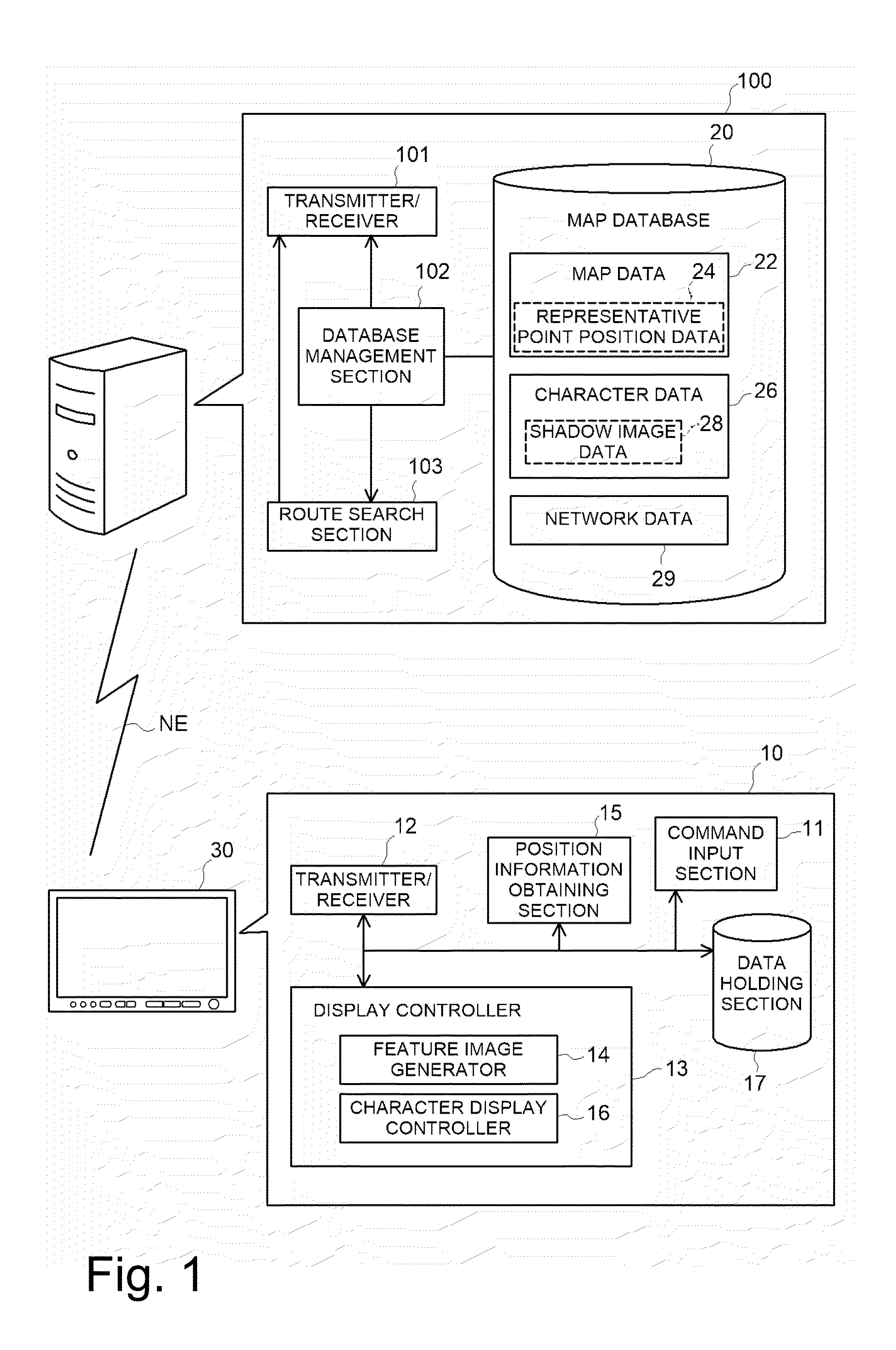
[0039]FIG. 1 is a diagram illustrating the general configuration of a navigation system according to an embodiment. The navigation system is configured by connecting a server 100 with a terminal 10 having the functions as a three-dimensional map display device by means of a network NE. Alternatively, the navigation system may be configured as a standalone device by incorporating the functions provided by the server 100 of the embodiment in the terminal 10. Otherwise the navigation system may be may be configured as a distribution system including a greater numbe...


PUM


Abstract

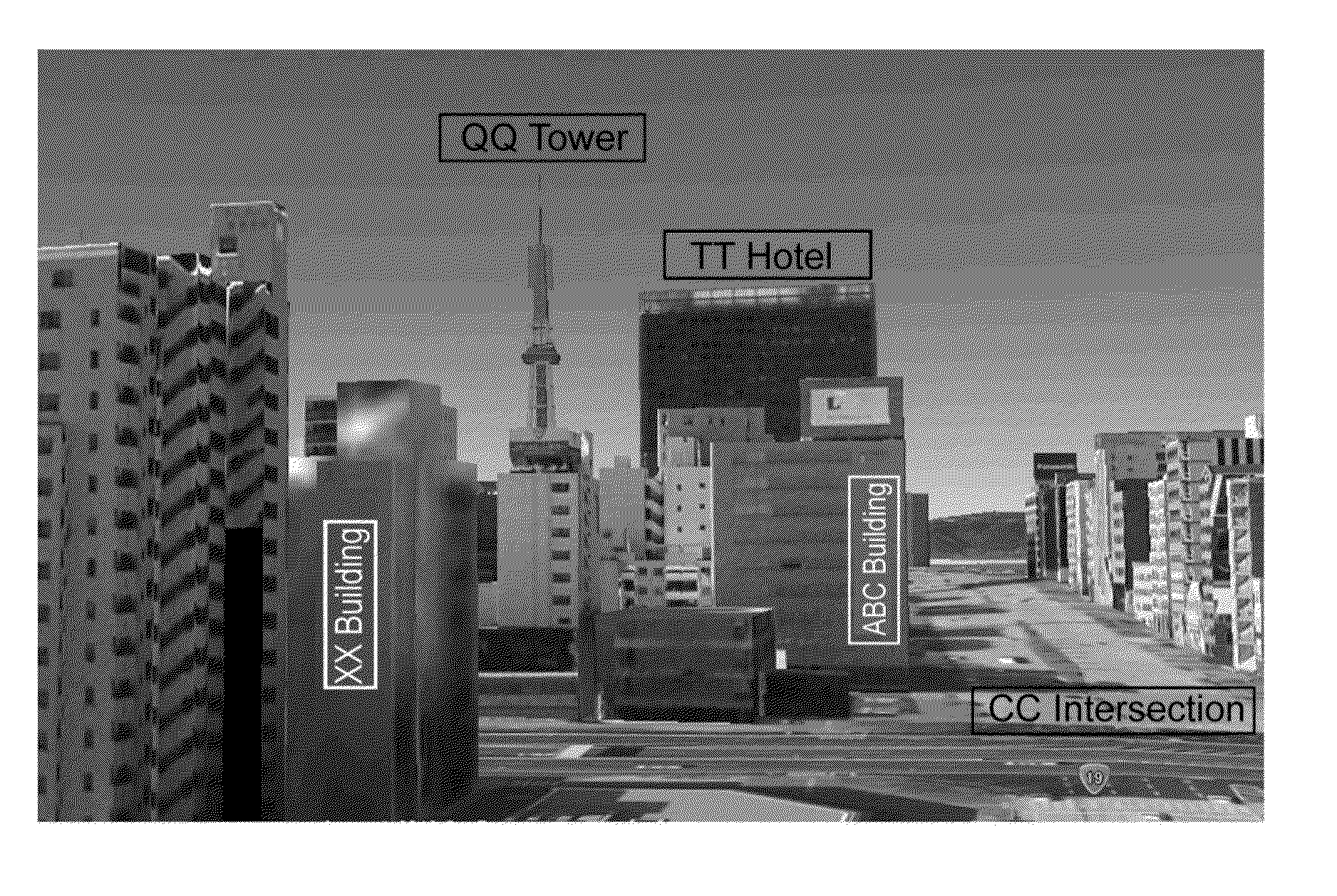
A three-dimensional map effectively uses a space of the sky or the background to display character strings. A transmitter / receiver obtains map data used to display each feature three-dimensionally and character data representing a character string to be displayed in the three-dimensional map from a map database. A feature image generator generates a feature image in which each feature is drawn three-dimensionally. A character display controller controls display of the character string on the feature image. The character display controller changes over at least one of a display direction and a number of display lines of the character string with respect to each of a plurality of areas in the feature image specified according to a distance from a viewpoint set for generating the feature image, such that a length of the character string in a vertical direction increases with a decrease in distance from the viewpoint.

Description

CLAIM OF PRIORITY[0001]This application is a Continuation of International Patent Application No. PCT / JP2014 / 001530, filed on Mar. 18, 2014, which claims priority to Japanese Patent Application No. 2013-057498, filed on Mar. 21, 2013, each of which is hereby incorporated by reference.BACKGROUND OF THE INVENTION[0002]1. Field of the Invention[0003]The present invention relates to a technology of displaying a character string on a three-dimensional map in which features are expressed three-dimensionally.[0004]2. Description of the Related Art[0005]Three-dimensional maps in which features such as buildings and roads are expressed three-dimensionally have conventionally become popular in navigation systems and other map display devices. The three-dimensional maps include a bird's eye view looking down obliquely from a viewpoint above and an upward view looking up from a viewpoint near to the ground surface.[0006]Like a two-dimensional map, character strings representing, for example, ge...

Claims


Application Information

Patent Timeline
Patent Type & Authority Applications(United States)
IPC IPC(8): G09B29/00
CPCG09B29/007G09B29/008G09B29/005G06T17/05G09B29/106G01C21/3638
Inventor KISHIKAWA, KIYONARITESHIMA, EIJIARAMAKI, MASATOSHIUCHINOUMI, MASASHINAKAGAMI, MASARUAZAKAMI, TATSUYA
Owner GEO TECHN LAB
Learn More