Integrated architecture for near-real-time satellite imaging applications

a satellite imaging and integrated architecture technology, applied in the field of remote sensing systems and technology, can solve the problems of difficult to get near-real-time data collection access, difficult to get nearly continuous observational coverage of the earth, and high cost of design, construction and operation

Active Publication Date: 2016-01-21
MAXAR INTELLIGENCE INC
View PDF2 Cites 26 Cited by
  • Summary
  • Abstract
  • Description
  • Claims
  • Application Information

AI Technical Summary

Benefits of technology

[0008]The inventor has accordingly conceived and reduced to practice an integrated architecture designed to address the needs described above. In the proposed invention, we expand the composition of satellites from predominantly mid-morning or mid-afternoon polar, sun-synchronous orbits to polar and mildly inclined orbits with a complete range of earlier or later times of descending nodes and orbital inclinations at the equator. We further include electro-optic (EO) satellites, synthetic aperture radar (SAR) satellite and signals (including, but not limited to Automated Identification System (A...

Problems solved by technology

Despite the rapid progress, there are still several challenges involved in satellite imaging and signals sensing.
But they are extremely expensive to design, build, and operate, and hence tend to be few in number.
Smaller satellites and even microsatellites are beginning to proliferate, but they tend to be lower resolution, and they usually operate at lower orbits which means they have smaller footprints on the earth and fewer opportunities to interact with remote ground terminals (RGTs).
In both cases, two prominent challenges emerge: it is difficult to get nearly continuous observational coverage of the earth (except through use of geostationary satellites, which ...

Method used


Image

  • Integrated architecture for near-real-time satellite imaging applications
  • Integrated architecture for near-real-time satellite imaging applications
  • Integrated architecture for near-real-time satellite imaging applications

Examples


Embodiment Construction

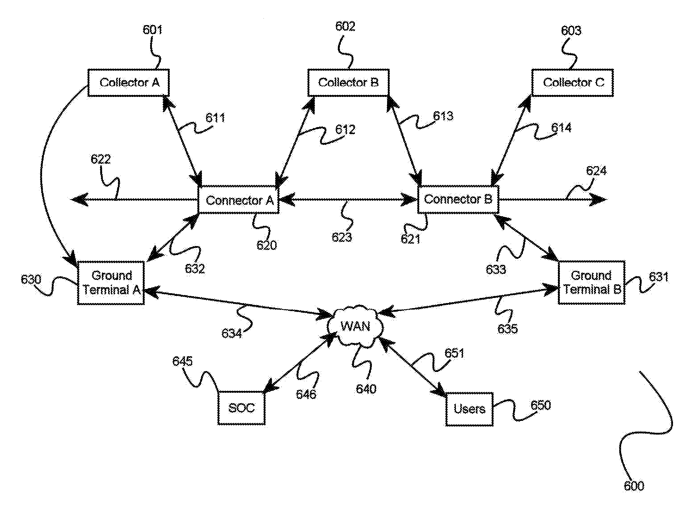
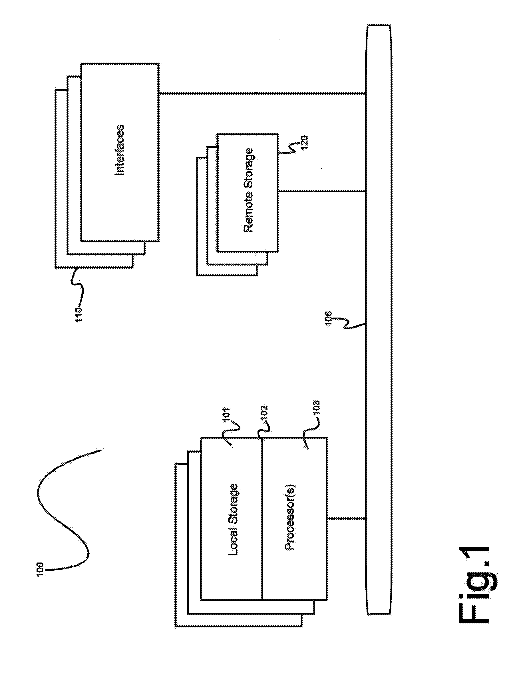
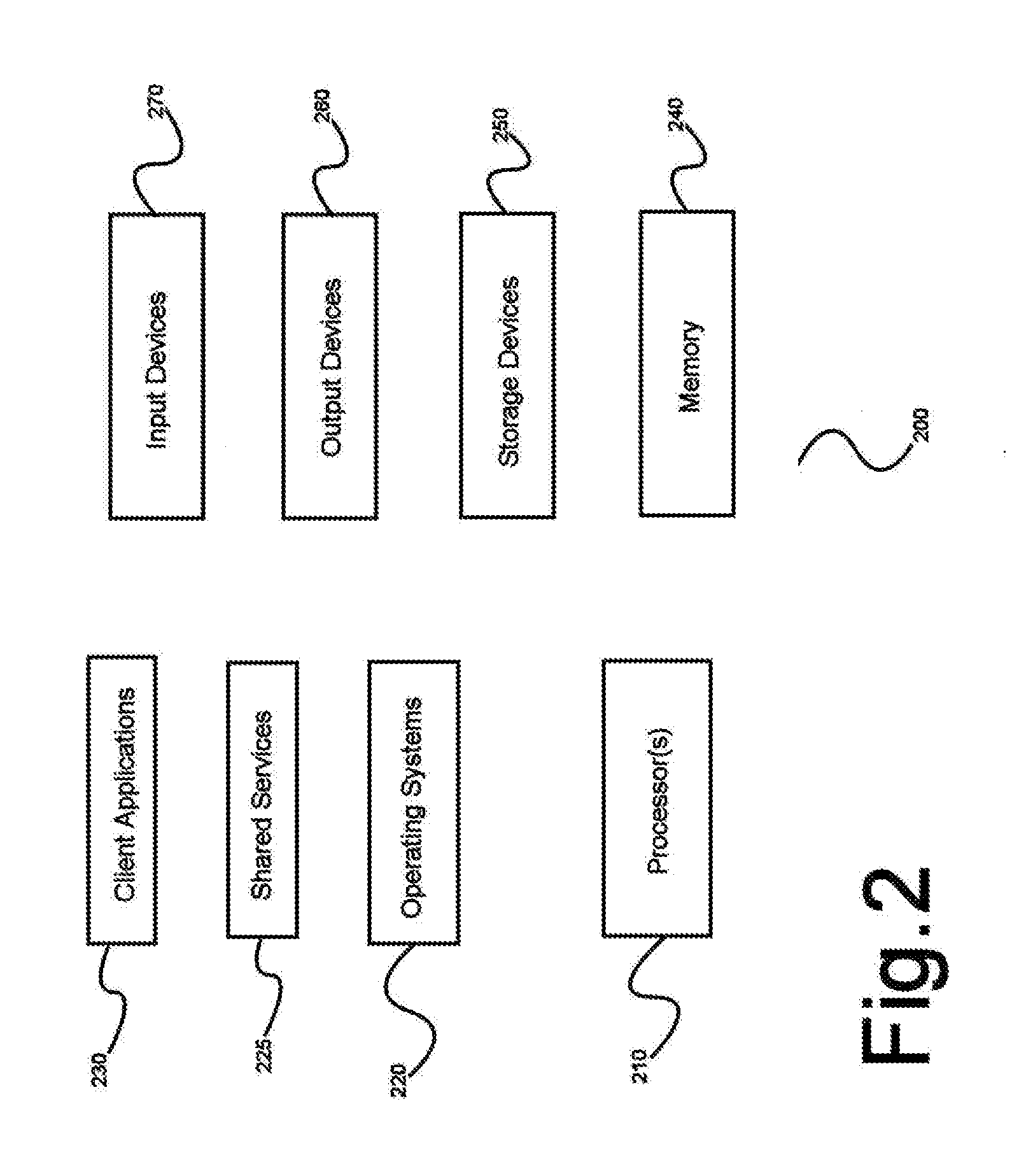
[0022]One or more different inventions may be described in the present application. Further, for one or more of the inventions described herein, numerous alternative embodiments may be described; it should be understood that these are presented for illustrative purposes only. The described embodiments are not intended to be limiting in any sense. One or more of the inventions may be widely applicable to numerous embodiments, as is readily apparent from the disclosure. In general, embodiments are described in sufficient detail to enable those skilled in the art to practice one or more of the inventions, and it is to be understood that other embodiments may be utilized and that structural, logical, software, electrical and other changes may be made without departing from the scope of the particular inventions. Accordingly, those skilled in the art will recognize that one or more of the inventions may be practiced with various modifications and alterations. Particular features of one o...


PUM


Abstract

A system for operating an integrated architecture for near real-time satellite communications, comprising a plurality of collector satellites augment by aerial and terrestrial sensing systems that capture a plurality of EO, SAR and/or Signals sensor data of a portion of a region of the surface of the Earth, and a plurality of connector satellites that communicate with at least a collector satellite using a communication interface, and a method for using advanced environmental monitoring to adaptively task a collector satellite.

Description

CROSS-REFERENCE TO RELATED APPLICATIONS[0001]The present application claims the benefit of, and priority to, U.S. provisional patent application Ser. No. 62 / 025,003, titled “INTEGRATED ARCHITECTURE FOR NEAR-REAL-TIME SATELLITE IMAGING APPLICATIONS” and filed on Jul. 15, 2014, the entire specification of which is incorporated herein by reference in its entirety.BACKGROUND OF THE INVENTION[0002]1. Field of the Invention[0003]The present invention is in the field of remote sensing systems and technology, and more particularly it pertains to an integrated architecture for operating a constellation of sensing satellites augmented by aerial and terrestrial sensing systems adapted to provide near-real-time, very high performance electro-optic (EO), synthetic aperture radar (SAR) and / or signals sensor data of the earth. The present invention is a method for creating virtual information persistence (VIP) that partially addresses the long-standing need for effectively persistent monitoring an...

Claims


Application Information

Patent Timeline
IPC IPC(8): H04B7/185
CPCH04B7/18528H04B7/18513H04B7/18523H04B10/118
Inventor LEONARD, VICTOR, H
Owner MAXAR INTELLIGENCE INC
Why Eureka
Try Eureka