Check patentability & draft patents in minutes with Patsnap Eureka AI!

System and Method for Roundabouts from Probe Data Using Vector Fields

Active Publication Date: 2016-11-17
HERE GLOBAL BV
View PDF0 Cites 6 Cited by
  • Summary
  • Abstract
  • Description
  • Claims
  • Application Information

AI Technical Summary

Benefits of technology

The patent describes an apparatus that can identify a potential roundabout location based on probe data points. The apparatus selects a subset of the data points and normalizes their length. It then performs a vector fit to determine the direction of flow and the best fit radius of the data points. This allows for the accurate identification of roundabout locations.

Problems solved by technology

These changes are particularly hard to detect because two roadways that simply intersected in straight lines now merge into a common path for a short amount of time.
Detecting roundabouts and other road features from probe is challenging due to the noisy nature of probe data in both position and heading data.
Further, detecting roundabouts and other road features from probe is challenging because probe data is sparse and uneven with respect to probe distribution.
For example, using a least squares vector field fitting method may be performed quickly and may not be computationally intensive.
Slow or stationary probes may be unreliable because the heading angle may not be accurate.
Additionally, the illustrations are merely representational and may not be drawn to scale.

Method used


Image

  • System and Method for Roundabouts from Probe Data Using Vector Fields
  • System and Method for Roundabouts from Probe Data Using Vector Fields
  • System and Method for Roundabouts from Probe Data Using Vector Fields

Examples


Embodiment Construction

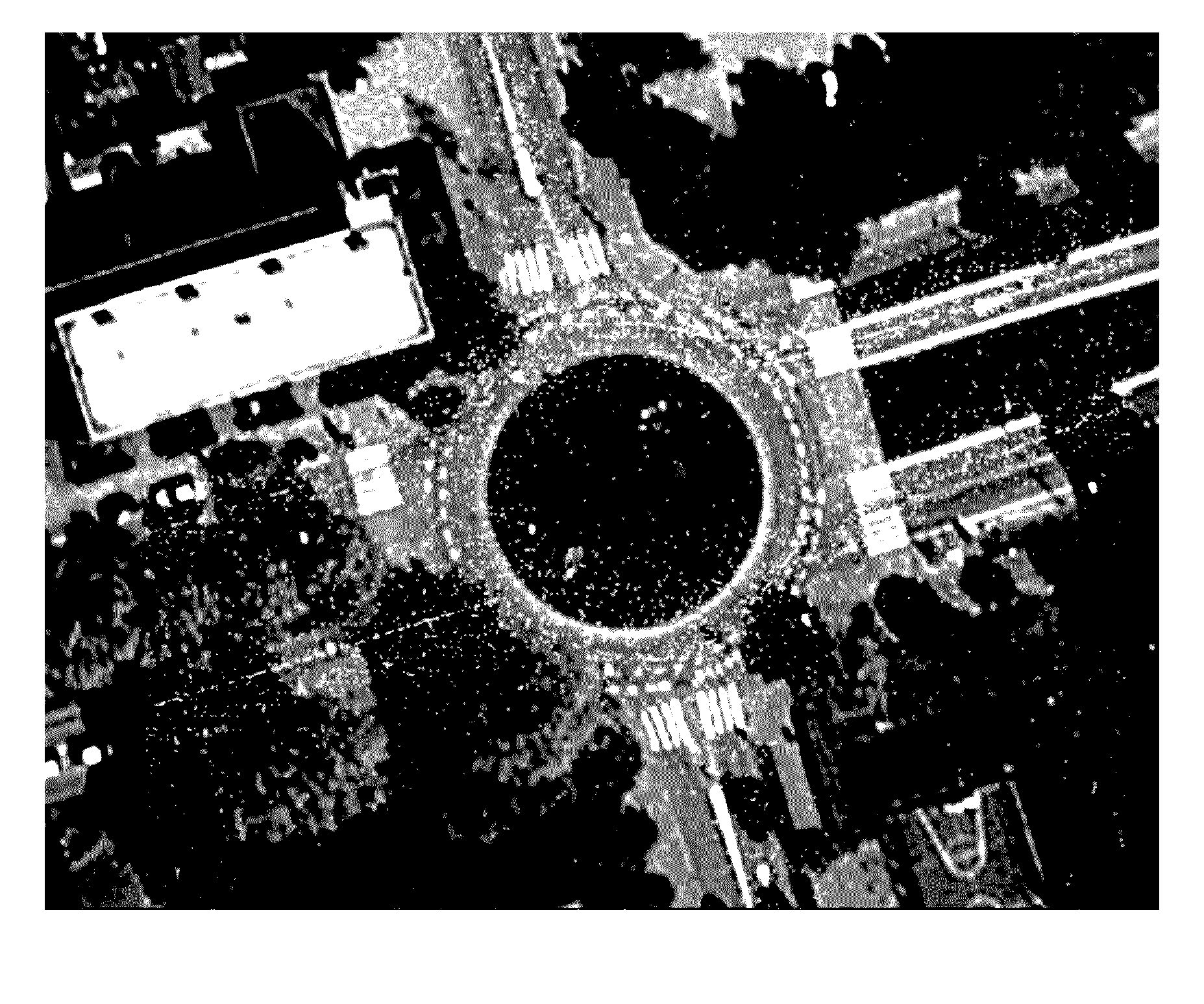
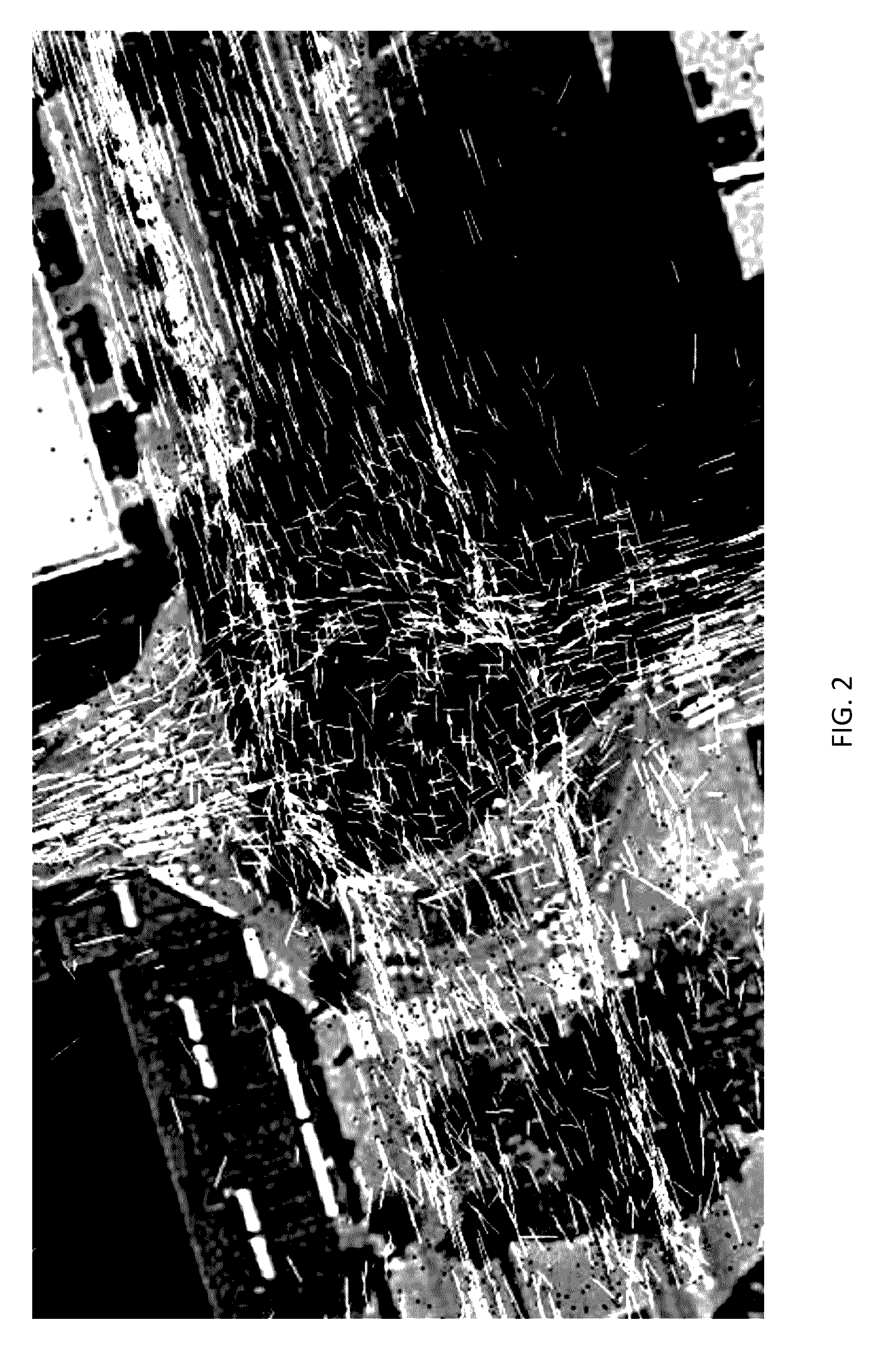
[0020]The following embodiments describe systems and methods for automatically detecting roundabouts and other road feature from probe data using probe heading information. The systems and methods model the probe data as vectors in vector fields. The heading data provides a probe flow for a roundabout or road feature that can be used to detect the location and characteristics of the roundabout or other road feature. For example, modeling the probe data in close proximity to a roundabout creates circular probe flow pattern with a center that can be computed from the vector field. The center of the circular flow pattern for the probe data corresponds with the approximate center of the roundabout.

[0021]The disclosed embodiments take advantage of vector field fitting to identify circulation in vector fields. When circulation is present, the center is the singularity point which can be derived from the vector field. In one embodiment, a least squares vector field fitting method utilizes ...


PUM


Abstract

A computing device may detect roundabouts and other road features from probe data including probe heading information. The computing device may model the probe data as vector points in vector fields and perform vector field fitting on a subset of the probe data vectors to identify circulation in the vector fields. The computing device uses the circulation in the vector fields to detect the location of a roundabout or other road feature.

Description

FIELD[0001]The following disclosure relates to detecting road features, and more particularly to detecting roundabout locations and other road characteristics from probe data.BACKGROUND[0002]Map data or geographic data is used in computer based systems that provide useful features to users. For example, computer based systems may provide for the identification of routes to destinations or points of interests. A navigation system may determine the optimum route to be taken by the end user to travel from an origin to a destination location from map data stored in a map database. Similarly, the navigation system may query the map data for nearby points of interest or provide other map-related functions.[0003]As new roads are built, other roads are closed, or locations of business are changed, the geographic data becomes out of date. These changes to the physical infrastructure must be detected in order to update the map database. One of the usual changes in the infrastructure of the ph...

Claims


Application Information

Patent Timeline
IPC IPC(8): G08G1/01G01C21/26
CPCG01C21/26G08G1/0137G08G1/0112G08G1/0129G08G1/0141G01C21/3841G01C21/3822
Inventor DORUM, OLE HENRY
Owner HERE GLOBAL BV
Features
  • R&D
  • Intellectual Property
  • Life Sciences
  • Materials
  • Tech Scout
  • Unparalleled Data Quality
  • Higher Quality Content
  • 60% Fewer Hallucinations
Learn More