Systems and methods for remote sensing of the earth from space

Inactive Publication Date: 2018-06-21
URTHECAST CORP +1
View PDF4 Cites 39 Cited by
  • Summary
  • Abstract
  • Description
  • Claims
  • Application Information

AI Technical Summary

Benefits of technology

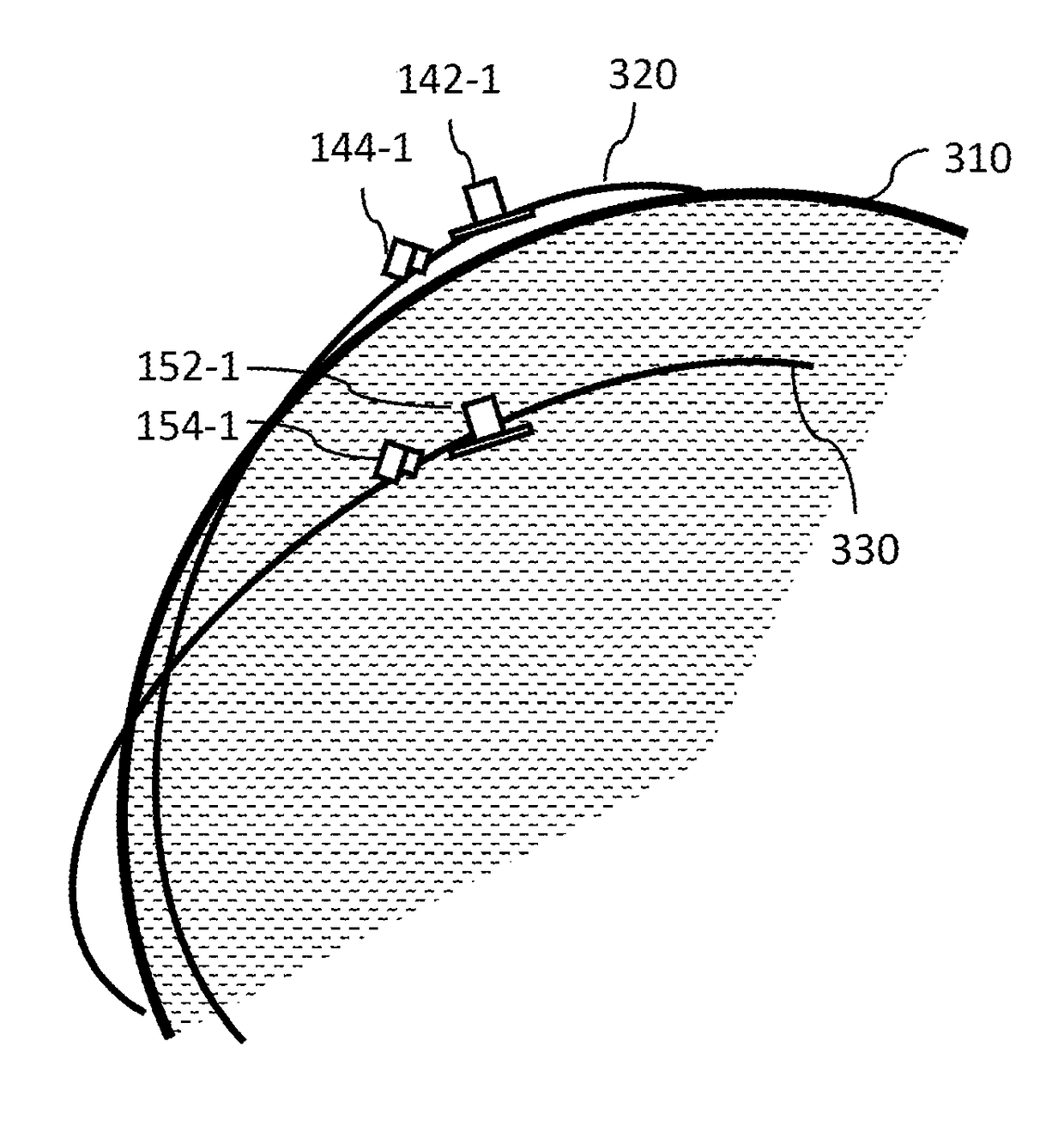
[0069]A mid-inclination orbit can provide more daily imaging opportunities for some latitudes especially at mid-latitudes, depending on the altitude of the satellite.
[0070]As FIG. 6 shows, a remote sensing system, such as remote sensing system 200 of FIG. 2, can be oper...

Problems solved by technology

Further, the particular shapes of the elements as drawn, are not necessarily intended to convey any information regar...

Method used


Image

  • Systems and methods for remote sensing of the earth from space
  • Systems and methods for remote sensing of the earth from space
  • Systems and methods for remote sensing of the earth from space

Examples


Embodiment Construction

[0023]Unless the context requires otherwise, throughout the specification and claims which follow, the word “comprise” and variations thereof, such as, “comprises” and “comprising” are to be construed in an open, inclusive sense, that is as “including, but not limited to.”

[0024]Reference throughout this specification to “one embodiment” or “an embodiment” means that a particular feature, structure or characteristic described in connection with the embodiment is included in at least one embodiment. Thus, the appearances of the phrases “in one embodiment” or “in an embodiment” in various places throughout this specification are not necessarily all referring to the same embodiment. Furthermore, the particular features, structures, or characteristics may be combined in any suitable manner in one or more embodiments.

[0025]As used in this specification and the appended claims, the singular forms “a,”“an,” and “the” include plural referents unless the content clearly dictates otherwise. It...


PUM


Abstract

A constellation of satellites may include a plurality of satellites in each of two or more different orbits. Satellites in a given orbit may operate in pairs, flying in tandem, one satellite leading, the other trailing closely behind, to be positioned to image the same target(s) of interest with substantially the same orientation (geographical coincident) at substantially the same time (temporally coincident). The first satellite may acquire SAR data, determine a location of a target of interest, assess cloud cover, and based on an extent of cloud cover, can acquire additional SAR data or cause the second satellite to capture optical imaging data (e.g., cross-cueing). Selection of orbits can provide a relatively high revisit rate may be obtained, allowing frequent opportunities to image given locations on a planet (e.g., Earth). One or more ground stations communicate with the constellation of satellites, and inter-satellite communications may be employed.

Description

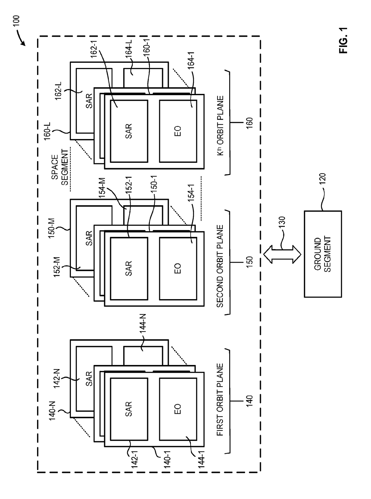
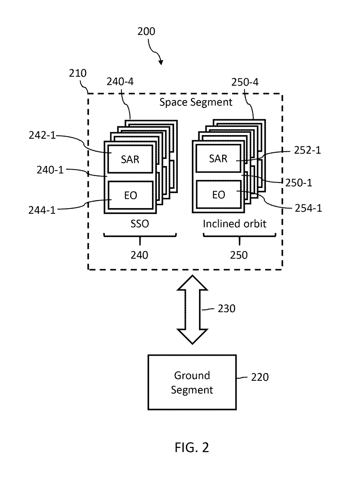
TECHNICAL FIELD[0001]The present disclosure relates generally to systems and methods for remote sensing of the Earth from space, and, more particularly, to constellations of synthetic aperture radar (SAR) and optical satellites.BACKGROUNDBrief Summary[0002]A constellation of satellites may include a plurality of satellites in each of two or more different orbits. Satellites in a given orbit may operate in pairs, flying in tandem, one satellite leading, the other trailing closely behind, to be positioned to image the same target(s) of interest with substantially the same orientation (geographical coincident) at substantially the same time (temporally coincident). The first satellite may acquire SAR data, determine a location of a target of interest, assess cloud cover, and based on an extent of cloud cover, can acquire additional SAR data or cause the second satellite to capture optical imaging data.[0003]A system for remote sensing of the Earth from space may be summarized as includ...

Claims


Application Information

Patent Timeline
IPC IPC(8): G01S13/90G01S13/86G01S19/13
CPCG01S13/90G01S13/867G01S19/13B64G1/242B64G1/1021B64G1/1085G01S13/9056B64G1/1035B64G1/1028
Inventor TYC, GEORGE
Owner URTHECAST CORP
Why Eureka
Try Eureka