Determining A Region Of Impact Of An Aircraft In The Event Of An Emergency
a technology of aircraft impact and emergency, applied in the field of aircraft impact, can solve the problems of general uncertainty of weather data and unknown extent of uncertainty, and achieve the effect of improving the aircraft impact forecas
- Summary
- Abstract
- Description
- Claims
- Application Information
AI Technical Summary
Benefits of technology
Problems solved by technology
Method used
Image
Examples
Embodiment Construction
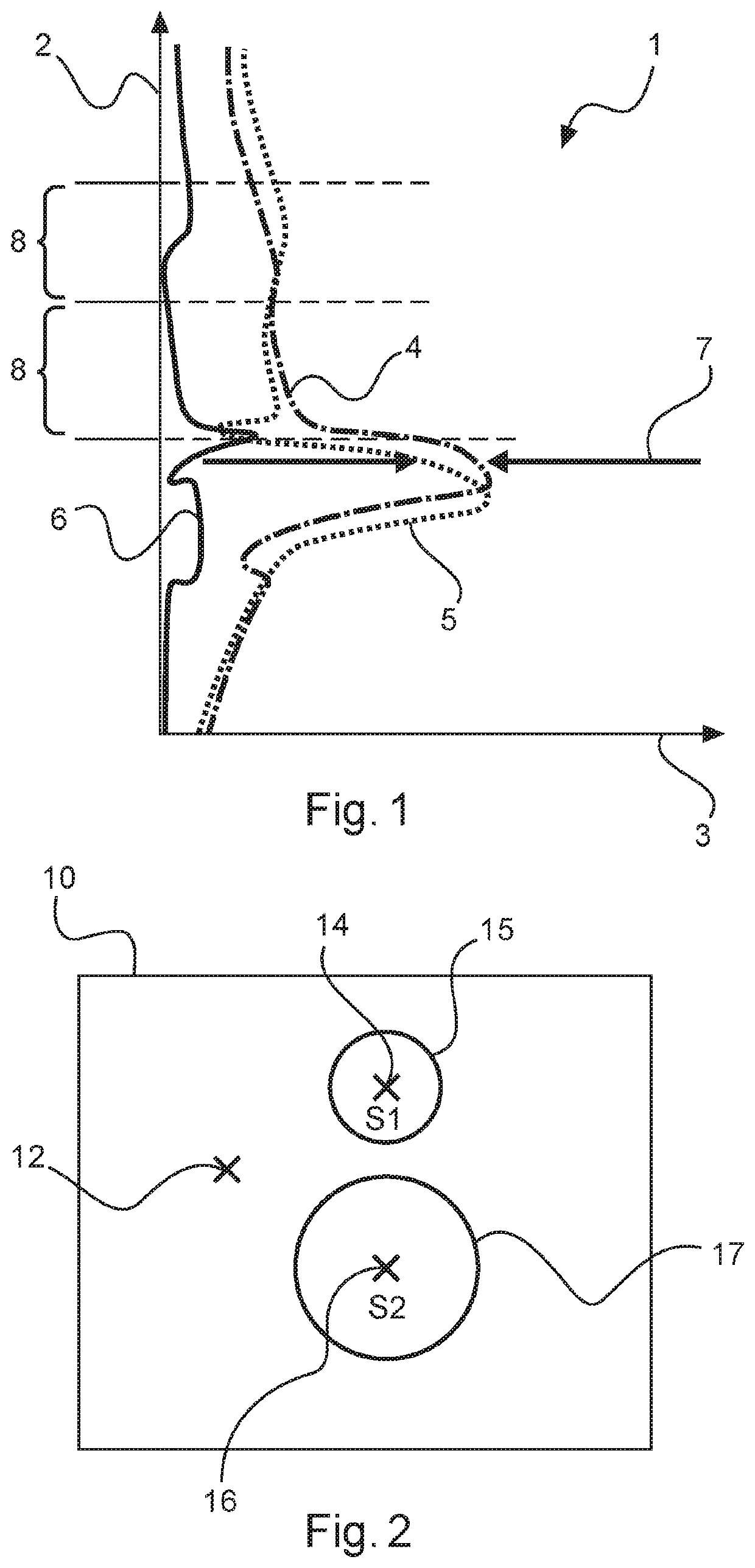
[0056]FIG. 1 illustrates an exemplary weather data diagram 1. The altitude above the surface of the Earth is plotted on the vertical axis 2 and the wind speed is plotted on the horizontal axis 3.
[0057]Such a weather data diagram 1 may be generated respectively for air movements in the north-south direction and in the east-west direction. In this case, the wind speed may assume positive or negative values. By way of example, positive values mean a wind movement towards the north or east whereas negative values mean a wind movement towards the south or west.
[0058]The altitude may be divided into multiple altitude positions 8 in order to be able to draw upon these altitude positions individually in order to determine the influence on a falling aircraft.
[0059]The line 4 that is illustrated as a dashed-dotted line corresponds to the retrieved weather information or the weather forecast for a specific point in time. The dotted line 5 corresponds to the actual weather situation as has been...
PUM
 Abstract
Description
Claims
Application Information
 - R&D
- Intellectual Property
- Life Sciences
- Materials
- Tech Scout
- Unparalleled Data Quality
- Higher Quality Content
- 60% Fewer Hallucinations
Browse by: Latest US Patents, China's latest patents, Technical Efficacy Thesaurus, Application Domain, Technology Topic, Popular Technical Reports.
© 2025 PatSnap. All rights reserved.Legal|Privacy policy|Modern Slavery Act Transparency Statement|Sitemap|About US| Contact US: help@patsnap.com


